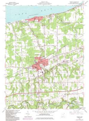
Geneva Topo Map Ohio
To zoom in, hover over the map of Geneva
USGS Topo Quad 41080g8 - 1:24,000 scale
| Topo Map Name: | Geneva |
| USGS Topo Quad ID: | 41080g8 |
| Print Size: | ca. 21 1/4" wide x 27" high |
| Southeast Coordinates: | 41.75° N latitude / 80.875° W longitude |
| Map Center Coordinates: | 41.8125° N latitude / 80.9375° W longitude |
| U.S. State: | OH |
| Filename: | o41080g8.jpg |
| Download Map JPG Image: | Geneva topo map 1:24,000 scale |
| Map Type: | Topographic |
| Topo Series: | 7.5´ |
| Map Scale: | 1:24,000 |
| Source of Map Images: | United States Geological Survey (USGS) |
| Alternate Map Versions: |
Geneva OH 1960, updated 1961 Download PDF Buy paper map Geneva OH 1960, updated 1970 Download PDF Buy paper map Geneva OH 1960, updated 1971 Download PDF Buy paper map Geneva OH 1960, updated 1985 Download PDF Buy paper map Geneva OH 1960, updated 1985 Download PDF Buy paper map Geneva OH 1994, updated 1997 Download PDF Buy paper map Geneva OH 2010 Download PDF Buy paper map Geneva OH 2013 Download PDF Buy paper map Geneva OH 2016 Download PDF Buy paper map |
1:24,000 Topo Quads surrounding Geneva
Ashtabula North |
North Kingsville |
|||
Perry |
Madison |
Geneva |
Ashtabula South |
Gageville |
Painesville |
Thompson |
East Trumbull |
Jefferson |
Dorset |
Chardon |
East Claridon |
Windsor |
Orwell |
Cherry Valley |
> Back to 41080e1 at 1:100,000 scale
> Back to 41080a1 at 1:250,000 scale
> Back to U.S. Topo Maps home
Geneva topo map: Gazetteer
Geneva: Airports
Germack Airport elevation 249m 816′Paines Airport elevation 204m 669′
Woerner Field elevation 195m 639′
Geneva: Bridges
Harpersville Bridge elevation 225m 738′Mechanicsville Bridge elevation 230m 754′
Geneva: Crossings
Interchange 218 elevation 249m 816′Geneva: Dams
Armington Lake Dam elevation 234m 767′Geneva Low Head Dam elevation 226m 741′
Geneva: Parks
Austinburg Township Park-Tote Road elevation 232m 761′Geneva-On-The-Lake State Park elevation 181m 593′
Kiwanis Park elevation 204m 669′
Geneva: Populated Places
Buckeye Beach elevation 184m 603′Elmwood elevation 199m 652′
Geneva elevation 205m 672′
Geneva-on-the-Lake elevation 183m 600′
Grandview Park elevation 183m 600′
Harpersfield elevation 259m 849′
Lakegrove Estates elevation 183m 600′
Mapleton Beach elevation 184m 603′
Mechanicsville elevation 238m 780′
Normandy Village Mobile Home Park elevation 206m 675′
Palmetto Beach elevation 183m 600′
Profeta's Mobile Home Park elevation 215m 705′
Saybrook-on-the-lake elevation 185m 606′
Whispering Willows Mobile Home Park elevation 261m 856′
Woodmere elevation 184m 603′
Geneva: Post Offices
Geneva Post Office elevation 206m 675′Geneva-on-the-Lake Post Office (historical) elevation 184m 603′
Harpersfield Post Office (historical) elevation 259m 849′
Mechanicsville Post Office (historical) elevation 237m 777′
Geneva: Reservoirs
Armington Lake elevation 234m 767′Geneva Low Head Reservoir elevation 226m 741′
Geneva Reservoir elevation 259m 849′
Geneva: Streams
Cowles Creek elevation 176m 577′Indian Creek elevation 174m 570′
Wheeler Creek elevation 174m 570′
Geneva digital topo map on disk
Buy this Geneva topo map showing relief, roads, GPS coordinates and other geographical features, as a high-resolution digital map file on DVD:


