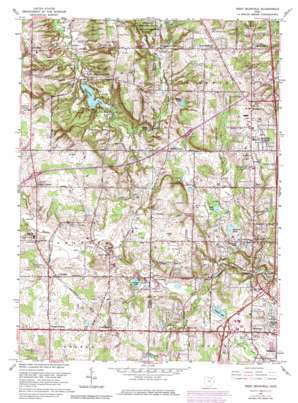
West Richfield Topo Map Ohio
To zoom in, hover over the map of West Richfield
USGS Topo Quad 41081b6 - 1:24,000 scale
| Topo Map Name: | West Richfield |
| USGS Topo Quad ID: | 41081b6 |
| Print Size: | ca. 21 1/4" wide x 27" high |
| Southeast Coordinates: | 41.125° N latitude / 81.625° W longitude |
| Map Center Coordinates: | 41.1875° N latitude / 81.6875° W longitude |
| U.S. State: | OH |
| Filename: | o41081b6.jpg |
| Download Map JPG Image: | West Richfield topo map 1:24,000 scale |
| Map Type: | Topographic |
| Topo Series: | 7.5´ |
| Map Scale: | 1:24,000 |
| Source of Map Images: | United States Geological Survey (USGS) |
| Alternate Map Versions: |
West Richfield OH 1953, updated 1955 Download PDF Buy paper map West Richfield OH 1963, updated 1964 Download PDF Buy paper map West Richfield OH 1963, updated 1968 Download PDF Buy paper map West Richfield OH 1963, updated 1980 Download PDF Buy paper map West Richfield OH 1963, updated 1980 Download PDF Buy paper map West Richfield OH 1963, updated 1980 Download PDF Buy paper map West Richfield OH 1994, updated 1997 Download PDF Buy paper map West Richfield OH 2010 Download PDF Buy paper map West Richfield OH 2013 Download PDF Buy paper map West Richfield OH 2016 Download PDF Buy paper map |
1:24,000 Topo Quads surrounding West Richfield
> Back to 41081a1 at 1:100,000 scale
> Back to 41080a1 at 1:250,000 scale
> Back to U.S. Topo Maps home
West Richfield topo map: Gazetteer
West Richfield: Airports
Schmeltzer Heliport elevation 302m 990′West Richfield: Canals
Granger Ditch elevation 317m 1040′West Richfield: Cliffs
Whipps Ledges elevation 350m 1148′Wordens Ledges elevation 345m 1131′
West Richfield: Crossings
Interchange 136 elevation 310m 1017′Interchange 138 elevation 303m 994′
Interchange 143 elevation 340m 1115′
Interchange 144 elevation 332m 1089′
Interchange 9 elevation 373m 1223′
West Richfield: Dams
Camp Crowell Dam elevation 328m 1076′Camp Hilaka Dam elevation 353m 1158′
Crystal Lake Dam elevation 306m 1003′
Granger Lake Dam elevation 311m 1020′
Hinckley Lake Dam elevation 279m 915′
Kirby Lake Dam elevation 327m 1072′
Ledge Lake Dam elevation 348m 1141′
Mirror Lake Dam elevation 358m 1174′
Pischieri Pond Dam elevation 290m 951′
Von Gunten Dam elevation 318m 1043′
West Richfield: Lakes
Bath Pond elevation 306m 1003′Lily Hill Lake elevation 302m 990′
Valley View Lake elevation 329m 1079′
West Richfield: Parks
Allardale County Park elevation 322m 1056′Bicentennial Park elevation 322m 1056′
Hinckley Reservation elevation 297m 974′
West Richfield: Populated Places
Bath elevation 342m 1122′Bath Center elevation 300m 984′
Broadview elevation 383m 1256′
Buzzard Roost elevation 298m 977′
Coddingville elevation 342m 1122′
Echo Lake Glen elevation 277m 908′
Ghent elevation 278m 912′
Granger elevation 334m 1095′
Hinckley elevation 334m 1095′
Montrose elevation 311m 1020′
Osborn Corners elevation 320m 1049′
Remsen Corners elevation 364m 1194′
Richfield elevation 351m 1151′
Richfield Heights elevation 364m 1194′
Stoney Hill elevation 330m 1082′
West Richfield elevation 389m 1276′
Youngs Corners elevation 348m 1141′
West Richfield: Post Offices
Bath Post Office elevation 342m 1122′Ghent Post Office (historical) elevation 278m 912′
Granger Post Office (historical) elevation 334m 1095′
Hinckley Post Office elevation 332m 1089′
Remson's Corners Post Office (historical) elevation 364m 1194′
Richfield Post Office elevation 348m 1141′
West Richfield: Reservoirs
Camp Crowell Lake elevation 328m 1076′Camp Hilaka Lake elevation 353m 1158′
Crystal Lake elevation 306m 1003′
Granger Lake elevation 311m 1020′
Greisin Pond elevation 296m 971′
Hinckley Lake elevation 279m 915′
Judges Lake elevation 298m 977′
Kirby Lake elevation 327m 1072′
Ledge Lake elevation 348m 1141′
Mirror Lake elevation 358m 1174′
Pischieri Pond elevation 290m 951′
Von Gunten Pond elevation 318m 1043′
West Richfield: Ridges
Hinckley Ridge elevation 391m 1282′West Richfield: Streams
Allard Creek elevation 308m 1010′North Fork Yellow Creek elevation 277m 908′
West Richfield: Summits
Reeds Hill elevation 347m 1138′West Richfield digital topo map on disk
Buy this West Richfield topo map showing relief, roads, GPS coordinates and other geographical features, as a high-resolution digital map file on DVD:


