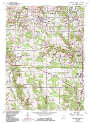
Broadview Heights Topo Map Ohio
To zoom in, hover over the map of Broadview Heights
USGS Topo Quad 41081c6 - 1:24,000 scale
| Topo Map Name: | Broadview Heights |
| USGS Topo Quad ID: | 41081c6 |
| Print Size: | ca. 21 1/4" wide x 27" high |
| Southeast Coordinates: | 41.25° N latitude / 81.625° W longitude |
| Map Center Coordinates: | 41.3125° N latitude / 81.6875° W longitude |
| U.S. State: | OH |
| Filename: | o41081c6.jpg |
| Download Map JPG Image: | Broadview Heights topo map 1:24,000 scale |
| Map Type: | Topographic |
| Topo Series: | 7.5´ |
| Map Scale: | 1:24,000 |
| Source of Map Images: | United States Geological Survey (USGS) |
| Alternate Map Versions: |
Broadview Heights OH 1953, updated 1955 Download PDF Buy paper map Broadview Heights OH 1953, updated 1961 Download PDF Buy paper map Broadview Heights OH 1963, updated 1964 Download PDF Buy paper map Broadview Heights OH 1963, updated 1971 Download PDF Buy paper map Broadview Heights OH 1963, updated 1979 Download PDF Buy paper map Broadview Heights OH 1963, updated 1979 Download PDF Buy paper map Broadview Heights OH 1963, updated 1984 Download PDF Buy paper map Broadview Heights OH 1994, updated 1997 Download PDF Buy paper map Broadview Heights OH 2010 Download PDF Buy paper map Broadview Heights OH 2013 Download PDF Buy paper map Broadview Heights OH 2016 Download PDF Buy paper map |
1:24,000 Topo Quads surrounding Broadview Heights
> Back to 41081a1 at 1:100,000 scale
> Back to 41080a1 at 1:250,000 scale
> Back to U.S. Topo Maps home
Broadview Heights topo map: Gazetteer
Broadview Heights: Airports
Shootz Field elevation 377m 1236′Broadview Heights: Crossings
Interchange 11 elevation 353m 1158′Interchange 145 elevation 312m 1023′
Interchange 149 elevation 308m 1010′
Interchange 153 elevation 290m 951′
Broadview Heights: Dams
Hayes Lake Dam elevation 277m 908′Broadview Heights: Parks
Furnace Run Metro Park elevation 317m 1040′Green Valley Park elevation 342m 1122′
Lucille Heasley Soccer Field elevation 375m 1230′
Memorial Park elevation 369m 1210′
Royalview Park elevation 279m 915′
Sandy Hook Park elevation 307m 1007′
Selwick Park elevation 281m 921′
Valleywood Park elevation 338m 1108′
Broadview Heights: Populated Places
Brecksville elevation 271m 889′Broadview Heights elevation 365m 1197′
East Center elevation 307m 1007′
Enterprise (historical) elevation 367m 1204′
Independence elevation 263m 862′
North Royalton elevation 366m 1200′
Pleasant Valley elevation 329m 1079′
Walling Corners elevation 366m 1200′
West Center elevation 390m 1279′
Broadview Heights: Post Offices
Brecksville Centre Post Office (historical) elevation 271m 889′Independence Post Office (historical) elevation 264m 866′
North Royalton Post Office (historical) elevation 366m 1200′
Broadview Heights: Reservoirs
Hayes Lake elevation 277m 908′Broadview Heights: Streams
Healey Creek elevation 256m 839′Broadview Heights digital topo map on disk
Buy this Broadview Heights topo map showing relief, roads, GPS coordinates and other geographical features, as a high-resolution digital map file on DVD:


