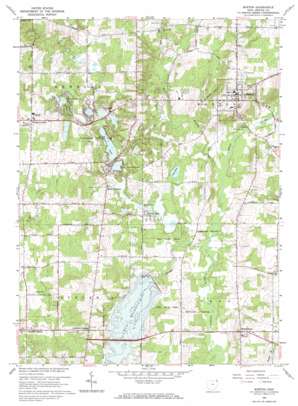
Burton Topo Map Ohio
To zoom in, hover over the map of Burton
USGS Topo Quad 41081d2 - 1:24,000 scale
| Topo Map Name: | Burton |
| USGS Topo Quad ID: | 41081d2 |
| Print Size: | ca. 21 1/4" wide x 27" high |
| Southeast Coordinates: | 41.375° N latitude / 81.125° W longitude |
| Map Center Coordinates: | 41.4375° N latitude / 81.1875° W longitude |
| U.S. State: | OH |
| Filename: | o41081d2.jpg |
| Download Map JPG Image: | Burton topo map 1:24,000 scale |
| Map Type: | Topographic |
| Topo Series: | 7.5´ |
| Map Scale: | 1:24,000 |
| Source of Map Images: | United States Geological Survey (USGS) |
| Alternate Map Versions: |
Burton OH 1953, updated 1955 Download PDF Buy paper map Burton OH 1953, updated 1965 Download PDF Buy paper map Burton OH 1966, updated 1968 Download PDF Buy paper map Burton OH 1966, updated 1968 Download PDF Buy paper map Burton OH 1994, updated 2000 Download PDF Buy paper map Burton OH 2010 Download PDF Buy paper map Burton OH 2013 Download PDF Buy paper map Burton OH 2016 Download PDF Buy paper map |
1:24,000 Topo Quads surrounding Burton
> Back to 41081a1 at 1:100,000 scale
> Back to 41080a1 at 1:250,000 scale
> Back to U.S. Topo Maps home
Burton topo map: Gazetteer
Burton: Airports
Brannon Field elevation 373m 1223′Bucks Airport elevation 373m 1223′
Burton: Dams
Bridge Creek Dam elevation 342m 1122′Burton: Lakes
Burton Lake elevation 337m 1105′Emerald Lake elevation 349m 1145′
Fern Lake elevation 340m 1115′
Kiwanis Lake elevation 353m 1158′
Lake Kelso elevation 339m 1112′
Little Punderson Lake elevation 345m 1131′
Pine Lake elevation 359m 1177′
Punderson Lake elevation 349m 1145′
Restful Lake elevation 352m 1154′
Snow Lake elevation 334m 1095′
Stump Lake elevation 350m 1148′
Burton: Parks
Auburn State Wildlife Area elevation 362m 1187′Burton County Wetlands elevation 345m 1131′
Burton Village Historic District elevation 404m 1325′
Punderson State Park elevation 358m 1174′
Russell County Park elevation 336m 1102′
Burton: Populated Places
Auburn Center elevation 376m 1233′Auburn Corners elevation 368m 1207′
Burton elevation 401m 1315′
Burton Lake elevation 338m 1108′
Deer Lake Mobile Park elevation 354m 1161′
Newbury Center elevation 380m 1246′
Popes Corners elevation 358m 1174′
South Newbury elevation 353m 1158′
Troy Oaks Homes elevation 360m 1181′
Welshfield elevation 376m 1233′
Burton: Post Offices
South Newbury Post Office (historical) elevation 354m 1161′Burton: Reservoirs
Akron City Reservoir elevation 340m 1115′La Due Reservoir elevation 342m 1122′
Burton: Streams
Bridge Creek elevation 342m 1122′East Branch Cuyahoga River elevation 333m 1092′
Fire Run elevation 341m 1118′
Hopsons Creek elevation 338m 1108′
Sawyer Brook elevation 333m 1092′
Sawyer Brook elevation 357m 1171′
West Branch Cuyahoga River elevation 333m 1092′
Burton: Summits
Welsh Hill elevation 369m 1210′Burton: Trails
Beach Trail elevation 349m 1145′Erie Trail elevation 353m 1158′
Iroquois Trail elevation 349m 1145′
Mohawk Trail elevation 360m 1181′
Mushers Trail elevation 370m 1213′
Burton digital topo map on disk
Buy this Burton topo map showing relief, roads, GPS coordinates and other geographical features, as a high-resolution digital map file on DVD:


