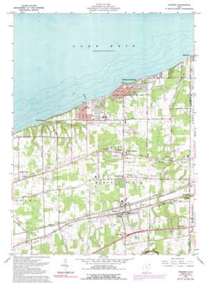
Madison Topo Map Ohio
To zoom in, hover over the map of Madison
USGS Topo Quad 41081g1 - 1:24,000 scale
| Topo Map Name: | Madison |
| USGS Topo Quad ID: | 41081g1 |
| Print Size: | ca. 21 1/4" wide x 27" high |
| Southeast Coordinates: | 41.75° N latitude / 81° W longitude |
| Map Center Coordinates: | 41.8125° N latitude / 81.0625° W longitude |
| U.S. State: | OH |
| Filename: | o41081g1.jpg |
| Download Map JPG Image: | Madison topo map 1:24,000 scale |
| Map Type: | Topographic |
| Topo Series: | 7.5´ |
| Map Scale: | 1:24,000 |
| Source of Map Images: | United States Geological Survey (USGS) |
| Alternate Map Versions: |
Madison OH 1960, updated 1962 Download PDF Buy paper map Madison OH 1960, updated 1971 Download PDF Buy paper map Madison OH 1960, updated 1985 Download PDF Buy paper map Madison OH 1960, updated 1991 Download PDF Buy paper map Madison OH 1994, updated 1997 Download PDF Buy paper map Madison OH 2010 Download PDF Buy paper map Madison OH 2013 Download PDF Buy paper map Madison OH 2016 Download PDF Buy paper map |
1:24,000 Topo Quads surrounding Madison
Ashtabula North |
||||
Perry |
Madison |
Geneva |
Ashtabula South |
|
Mentor |
Painesville |
Thompson |
East Trumbull |
Jefferson |
Chesterland |
Chardon |
East Claridon |
Windsor |
Orwell |
> Back to 41081e1 at 1:100,000 scale
> Back to 41080a1 at 1:250,000 scale
> Back to U.S. Topo Maps home
Madison topo map: Gazetteer
Madison: Airports
JTV Heliport elevation 190m 623′Woodworth Airport elevation 206m 675′
Madison: Crossings
Interchange 212 elevation 244m 800′Madison: Parks
Lake Shore Reservation Metropolitan Park elevation 191m 626′Madison Township Park elevation 180m 590′
Madison: Populated Places
Arcola Trailer Park elevation 200m 656′Driftwood elevation 178m 583′
Genung Corners elevation 211m 692′
James Place elevation 199m 652′
Madison elevation 222m 728′
Madison Beach elevation 181m 593′
Madison Dock (historical) elevation 177m 580′
Madison-on-the-Lake elevation 180m 590′
North Madison elevation 206m 675′
Redbird elevation 190m 623′
Sands Community elevation 206m 675′
Unionville elevation 226m 741′
Western Reserve Mobile Home Park elevation 182m 597′
Madison: Post Offices
Madison Post Office elevation 223m 731′North Madison Post Office (historical) elevation 205m 672′
Madison: Ridges
North Ridge elevation 202m 662′South Ridge elevation 218m 715′
Madison: Streams
Arcola Creek elevation 175m 574′Madison digital topo map on disk
Buy this Madison topo map showing relief, roads, GPS coordinates and other geographical features, as a high-resolution digital map file on DVD:


