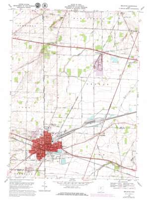
Bellevue Topo Map Ohio
To zoom in, hover over the map of Bellevue
USGS Topo Quad 41082c7 - 1:24,000 scale
| Topo Map Name: | Bellevue |
| USGS Topo Quad ID: | 41082c7 |
| Print Size: | ca. 21 1/4" wide x 27" high |
| Southeast Coordinates: | 41.25° N latitude / 82.75° W longitude |
| Map Center Coordinates: | 41.3125° N latitude / 82.8125° W longitude |
| U.S. State: | OH |
| Filename: | o41082c7.jpg |
| Download Map JPG Image: | Bellevue topo map 1:24,000 scale |
| Map Type: | Topographic |
| Topo Series: | 7.5´ |
| Map Scale: | 1:24,000 |
| Source of Map Images: | United States Geological Survey (USGS) |
| Alternate Map Versions: |
Bellevue OH 1959, updated 1960 Download PDF Buy paper map Bellevue OH 1969, updated 1971 Download PDF Buy paper map Bellevue OH 1969, updated 1979 Download PDF Buy paper map Bellevue OH 2010 Download PDF Buy paper map Bellevue OH 2013 Download PDF Buy paper map Bellevue OH 2016 Download PDF Buy paper map |
1:24,000 Topo Quads surrounding Bellevue
> Back to 41082a1 at 1:100,000 scale
> Back to 41082a1 at 1:250,000 scale
> Back to U.S. Topo Maps home
Bellevue topo map: Gazetteer
Bellevue: Airports
Missler-Bellevue Airport elevation 235m 770′Scagnetti Heliport elevation 223m 731′
Bellevue: Canals
Snyders Ditch elevation 218m 715′Bellevue: Dams
Bellevue Reservoir Number Three Dam elevation 231m 757′Bellevue Upground Reservoir Number Four Dam elevation 236m 774′
Bellevue Upground Reservoir Number One Dam elevation 232m 761′
Bellevue: Mines
Sandusky Quarry elevation 218m 715′Bellevue: Parks
Ellis Park elevation 232m 761′Harmon Field elevation 225m 738′
Mill Pond Park elevation 235m 770′
Bellevue: Populated Places
Bellevue elevation 229m 751′Lyme (historical) elevation 226m 741′
Mount Pleasant elevation 234m 767′
Parkertown elevation 219m 718′
Sand Hill elevation 217m 711′
Strongs Ridge elevation 234m 767′
Weyers elevation 206m 675′
Bellevue: Post Offices
Bellevue Post Office elevation 229m 751′Parkerton Post Office (historical) elevation 219m 718′
Sandhill Post Office (historical) elevation 217m 711′
Weyers Post Office (historical) elevation 206m 675′
Bellevue: Reservoirs
Bellevue Reservoir Number Four elevation 236m 774′Bellevue Reservoir Number One elevation 232m 761′
Bellevue Upground Reservoir Number Three elevation 231m 757′
Bellevue: Ridges
Strongs Ridge elevation 234m 767′Bellevue: Streams
Megginson Creek elevation 227m 744′Bellevue digital topo map on disk
Buy this Bellevue topo map showing relief, roads, GPS coordinates and other geographical features, as a high-resolution digital map file on DVD:


