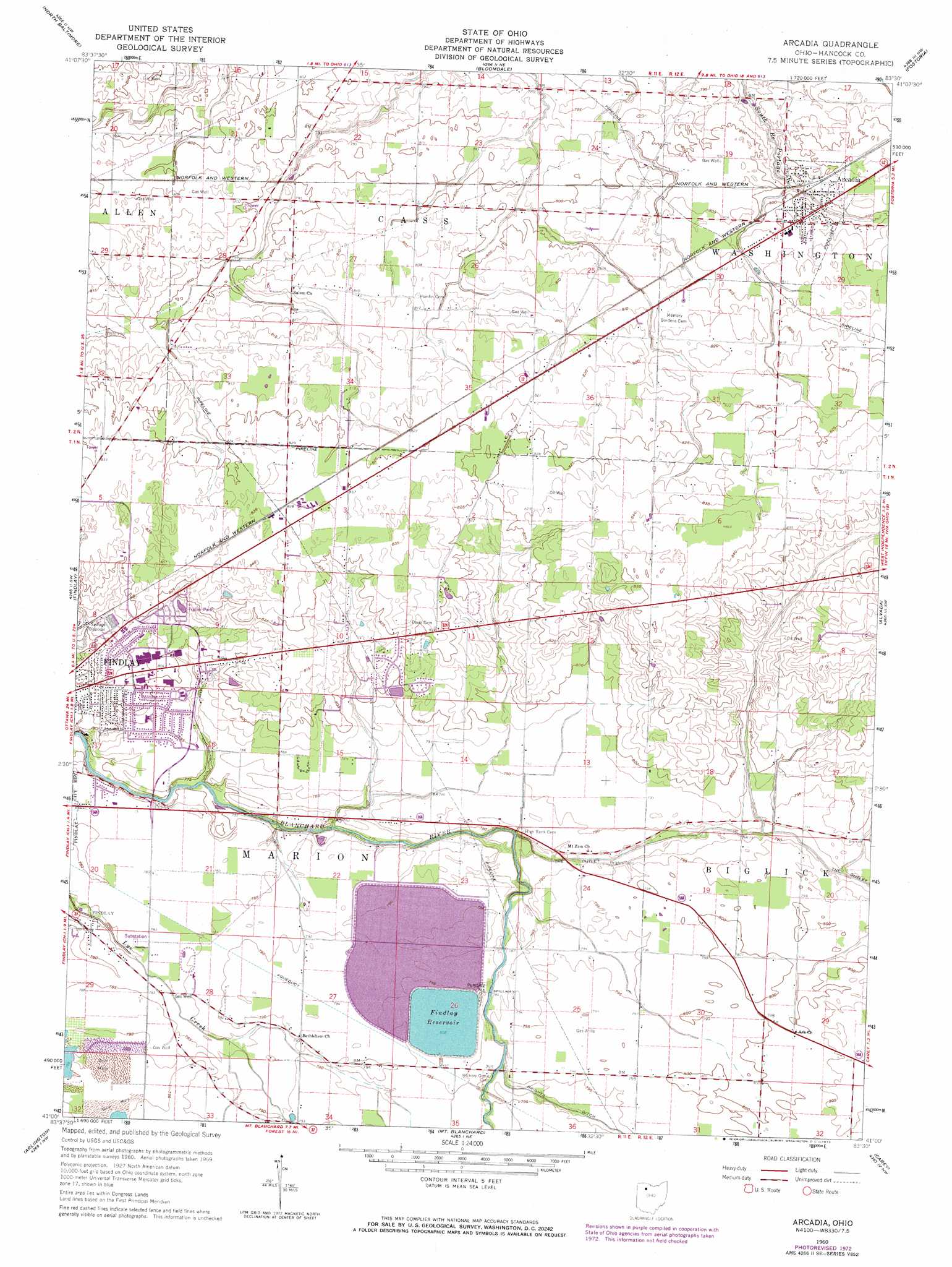
Arcadia Topo Map Ohio
To zoom in, hover over the map of Arcadia
USGS Topo Quad 41083a5 - 1:24,000 scale
| Topo Map Name: | Arcadia |
| USGS Topo Quad ID: | 41083a5 |
| Print Size: | ca. 21 1/4" wide x 27" high |
| Southeast Coordinates: | 41° N latitude / 83.5° W longitude |
| Map Center Coordinates: | 41.0625° N latitude / 83.5625° W longitude |
| U.S. State: | OH |
| Filename: | o41083a5.jpg |
| Download Map JPG Image: | Arcadia topo map 1:24,000 scale |
| Map Type: | Topographic |
| Topo Series: | 7.5´ |
| Map Scale: | 1:24,000 |
| Source of Map Images: | United States Geological Survey (USGS) |
| Alternate Map Versions: |
Arcadia OH 1960, updated 1962 Download PDF Buy paper map Arcadia OH 1960, updated 1973 Download PDF Buy paper map Arcadia OH 1960, updated 1973 Download PDF Buy paper map Arcadia OH 2010 Download PDF Buy paper map Arcadia OH 2013 Download PDF Buy paper map Arcadia OH 2016 Download PDF Buy paper map |
1:24,000 Topo Quads surrounding Arcadia
Weston |
Bowling Green South |
Jerry City |
Bradner |
Helena |
Hoytville |
North Baltimore |
Bloomdale |
Fostoria |
Bascom |
Mccomb |
Findlay |
Arcadia |
Alvada |
New Riegel |
Rawson |
Arlington |
Mount Blanchard |
Carey |
Mccutchenville |
Ada |
Dunkirk |
Forest |
Wharton |
Upper Sandusky |
> Back to 41083a1 at 1:100,000 scale
> Back to 41082a1 at 1:250,000 scale
> Back to U.S. Topo Maps home
Arcadia topo map: Gazetteer
Arcadia: Airports
Weaver Airport elevation 240m 787′Arcadia: Dams
Findlay Upground Reservoir Number One Dam elevation 242m 793′Findlay Upground Reservoir Number Two Dam elevation 242m 793′
Arcadia: Populated Places
Arcadia elevation 246m 807′Wineland (historical) elevation 242m 793′
Arcadia: Post Offices
Arcadia Post Office elevation 246m 807′Arcadia: Reservoirs
Findlay Reservoir elevation 244m 800′Findlay Upground Reservoir Number One elevation 242m 793′
Findlay Upground Reservoir Number Two elevation 242m 793′
Arcadia digital topo map on disk
Buy this Arcadia topo map showing relief, roads, GPS coordinates and other geographical features, as a high-resolution digital map file on DVD:
 map DVD")