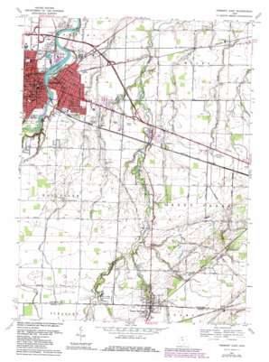
Fremont East Topo Map Ohio
To zoom in, hover over the map of Fremont East
USGS Topo Quad 41083c1 - 1:24,000 scale
| Topo Map Name: | Fremont East |
| USGS Topo Quad ID: | 41083c1 |
| Print Size: | ca. 21 1/4" wide x 27" high |
| Southeast Coordinates: | 41.25° N latitude / 83° W longitude |
| Map Center Coordinates: | 41.3125° N latitude / 83.0625° W longitude |
| U.S. State: | OH |
| Filename: | o41083c1.jpg |
| Download Map JPG Image: | Fremont East topo map 1:24,000 scale |
| Map Type: | Topographic |
| Topo Series: | 7.5´ |
| Map Scale: | 1:24,000 |
| Source of Map Images: | United States Geological Survey (USGS) |
| Alternate Map Versions: |
Fremont East OH 1958, updated 1960 Download PDF Buy paper map Fremont East OH 1969, updated 1971 Download PDF Buy paper map Fremont East OH 1969, updated 1980 Download PDF Buy paper map Fremont East OH 2010 Download PDF Buy paper map Fremont East OH 2013 Download PDF Buy paper map Fremont East OH 2016 Download PDF Buy paper map |
1:24,000 Topo Quads surrounding Fremont East
> Back to 41083a1 at 1:100,000 scale
> Back to 41082a1 at 1:250,000 scale
> Back to U.S. Topo Maps home
Fremont East topo map: Gazetteer
Fremont East: Airports
Jenkins Airport elevation 198m 649′Southcreek Airport elevation 202m 662′
Fremont East: Canals
Ferguson Ditch elevation 191m 626′Fremont East: Islands
Bradys Island elevation 175m 574′Fremont East: Parks
Countryside Park elevation 187m 613′East Side Park elevation 190m 623′
Green Springs State Nursery elevation 206m 675′
Harmon Field elevation 190m 623′
Michael Murray Wildlife Area elevation 215m 705′
Roger Young Memorial Park elevation 183m 600′
Stephenson Park elevation 189m 620′
Triangle Park elevation 192m 629′
Whirlpool Park elevation 201m 659′
Fremont East: Populated Places
Erlin elevation 185m 606′Fremont elevation 191m 626′
Green Creek elevation 192m 629′
Green Springs elevation 216m 708′
Indian Springs elevation 210m 688′
Oil Station elevation 223m 731′
Fremont East: Post Offices
Erlin Post Office (historical) elevation 184m 603′Fremont Post Office elevation 180m 590′
Green Springs Post Office elevation 216m 708′
Fremont East: Springs
Saint Francis Springs elevation 203m 666′Fremont East: Streams
Flag Run elevation 195m 639′Little Bark Creek elevation 185m 606′
Minnow Creek elevation 176m 577′
Fremont East digital topo map on disk
Buy this Fremont East topo map showing relief, roads, GPS coordinates and other geographical features, as a high-resolution digital map file on DVD:


