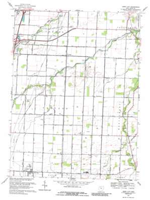
Jerry City Topo Map Ohio
To zoom in, hover over the map of Jerry City
USGS Topo Quad 41083c5 - 1:24,000 scale
| Topo Map Name: | Jerry City |
| USGS Topo Quad ID: | 41083c5 |
| Print Size: | ca. 21 1/4" wide x 27" high |
| Southeast Coordinates: | 41.25° N latitude / 83.5° W longitude |
| Map Center Coordinates: | 41.3125° N latitude / 83.5625° W longitude |
| U.S. State: | OH |
| Filename: | o41083c5.jpg |
| Download Map JPG Image: | Jerry City topo map 1:24,000 scale |
| Map Type: | Topographic |
| Topo Series: | 7.5´ |
| Map Scale: | 1:24,000 |
| Source of Map Images: | United States Geological Survey (USGS) |
| Alternate Map Versions: |
Jerry City OH 1958, updated 1960 Download PDF Buy paper map Jerry City OH 1958, updated 1964 Download PDF Buy paper map Jerry City OH 1969, updated 1971 Download PDF Buy paper map Jerry City OH 1969, updated 1986 Download PDF Buy paper map Jerry City OH 2010 Download PDF Buy paper map Jerry City OH 2013 Download PDF Buy paper map Jerry City OH 2016 Download PDF Buy paper map |
1:24,000 Topo Quads surrounding Jerry City
> Back to 41083a1 at 1:100,000 scale
> Back to 41082a1 at 1:250,000 scale
> Back to U.S. Topo Maps home
Jerry City topo map: Gazetteer
Jerry City: Airports
Aring Field elevation 204m 669′Shelton Airport elevation 204m 669′
Jerry City: Canals
Cessna Ditch elevation 206m 675′Eckert Ditch elevation 207m 679′
Rhodes Ditch elevation 202m 662′
Jerry City: Crossings
Interchange 179 elevation 207m 679′Interchange 181 elevation 206m 675′
Jerry City: Parks
Carter Park elevation 209m 685′Wood County Historical Center elevation 204m 669′
Jerry City: Populated Places
Cloverdale elevation 206m 675′Jerry City elevation 212m 695′
New Rochester elevation 203m 666′
Six Points elevation 207m 679′
Jerry City: Post Offices
Jerry City Post Office elevation 212m 695′Jerry City: Streams
Bull Creek elevation 203m 666′Cuckle Creek elevation 202m 662′
East Branch Portage River elevation 207m 679′
East Branch South Branch Portage River elevation 207m 679′
Middle Branch Portage River elevation 199m 652′
South Branch Portage River elevation 199m 652′
Jerry City digital topo map on disk
Buy this Jerry City topo map showing relief, roads, GPS coordinates and other geographical features, as a high-resolution digital map file on DVD:


