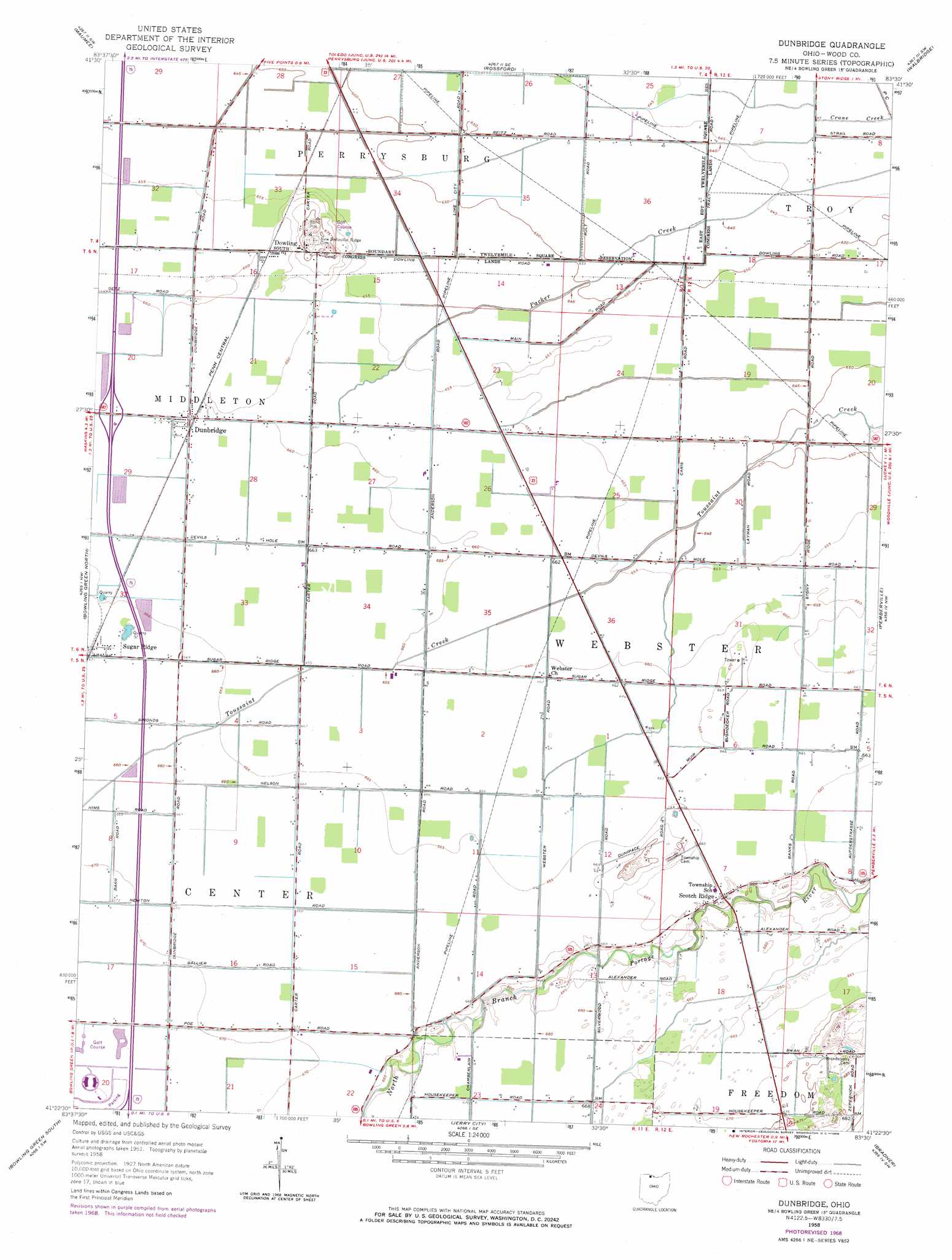
Dunbridge Topo Map Ohio
To zoom in, hover over the map of Dunbridge
USGS Topo Quad 41083d5 - 1:24,000 scale
| Topo Map Name: | Dunbridge |
| USGS Topo Quad ID: | 41083d5 |
| Print Size: | ca. 21 1/4" wide x 27" high |
| Southeast Coordinates: | 41.375° N latitude / 83.5° W longitude |
| Map Center Coordinates: | 41.4375° N latitude / 83.5625° W longitude |
| U.S. State: | OH |
| Filename: | o41083d5.jpg |
| Download Map JPG Image: | Dunbridge topo map 1:24,000 scale |
| Map Type: | Topographic |
| Topo Series: | 7.5´ |
| Map Scale: | 1:24,000 |
| Source of Map Images: | United States Geological Survey (USGS) |
| Alternate Map Versions: |
Dunbridge OH 1958, updated 1960 Download PDF Buy paper map Dunbridge OH 1958, updated 1968 Download PDF Buy paper map Dunbridge OH 1994, updated 1998 Download PDF Buy paper map Dunbridge OH 2010 Download PDF Buy paper map Dunbridge OH 2013 Download PDF Buy paper map Dunbridge OH 2016 Download PDF Buy paper map |
1:24,000 Topo Quads surrounding Dunbridge
Berkey |
Sylvania |
Toledo |
Oregon |
Reno Beach |
Whitehouse |
Maumee |
Rossford |
Walbridge |
Genoa |
Grand Rapids |
Bowling Green North |
Dunbridge |
Pemberville |
Elmore |
Weston |
Bowling Green South |
Jerry City |
Bradner |
Helena |
Hoytville |
North Baltimore |
Bloomdale |
Fostoria |
Bascom |
> Back to 41083a1 at 1:100,000 scale
> Back to 41082a1 at 1:250,000 scale
> Back to U.S. Topo Maps home
Dunbridge topo map: Gazetteer
Dunbridge: Airports
Drake Airport elevation 201m 659′Ranchport Airport elevation 196m 643′
Dunbridge: Areas
Devils Hole Prairie elevation 199m 652′Dunbridge: Crossings
Interchange 187 elevation 201m 659′Dunbridge: Parks
Perry Field elevation 205m 672′Whittaker Track elevation 205m 672′
Dunbridge: Populated Places
Dowling elevation 204m 669′Dunbridge elevation 202m 662′
Fenton (historical) elevation 199m 652′
Perrysburg Estates Mobile Home Park elevation 197m 646′
Scotch Ridge elevation 201m 659′
Sugar Ridge elevation 202m 662′
Village Green Mobile Home Park elevation 196m 643′
Dunbridge: Post Offices
Dunbridge Post Office elevation 202m 662′Dunbridge digital topo map on disk
Buy this Dunbridge topo map showing relief, roads, GPS coordinates and other geographical features, as a high-resolution digital map file on DVD:
 map DVD")