Oak Harbor Topo Map Ohio
To zoom in, hover over the map of Oak Harbor
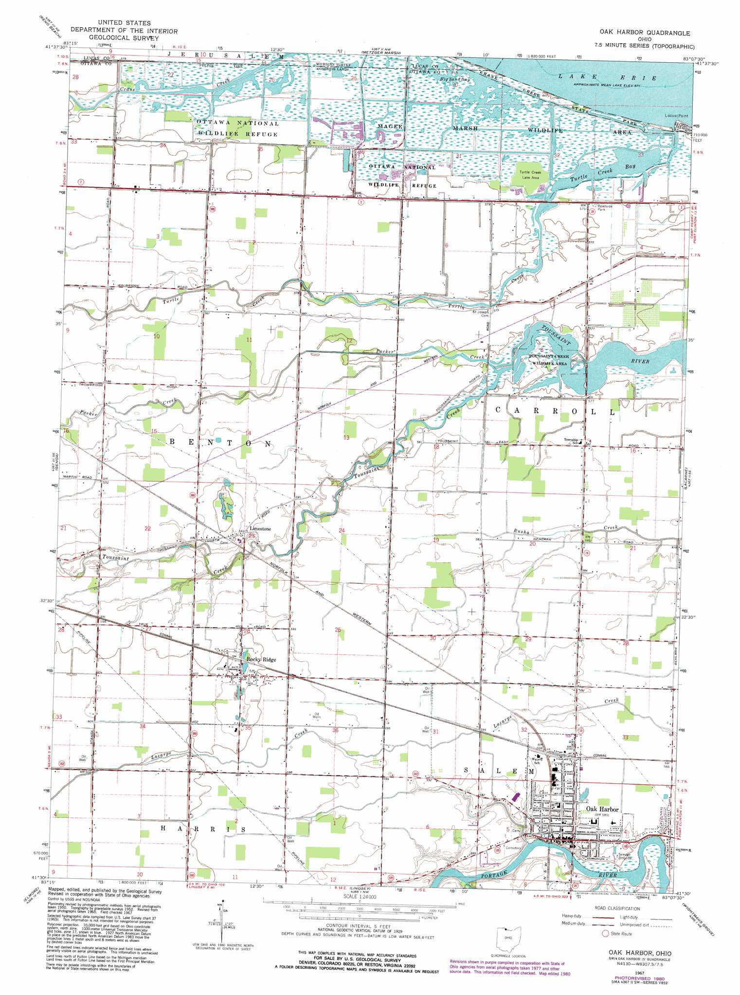
USGS Topo Quad 41083e2 - 1:24,000 scale
| Topo Map Name: | Oak Harbor |
| USGS Topo Quad ID: | 41083e2 |
| Print Size: | ca. 21 1/4" wide x 27" high |
| Southeast Coordinates: | 41.5° N latitude / 83.125° W longitude |
| Map Center Coordinates: | 41.5625° N latitude / 83.1875° W longitude |
| U.S. State: | OH |
| Filename: | o41083e2.jpg |
| Download Map JPG Image: | Oak Harbor topo map 1:24,000 scale |
| Map Type: | Topographic |
| Topo Series: | 7.5´ |
| Map Scale: | 1:24,000 |
| Source of Map Images: | United States Geological Survey (USGS) |
| Alternate Map Versions: |
Oak Harbor OH 1952, updated 1953 Download PDF Buy paper map Oak Harbor OH 1967, updated 1968 Download PDF Buy paper map Oak Harbor OH 1967, updated 1981 Download PDF Buy paper map Oak Harbor OH 2010 Download PDF Buy paper map Oak Harbor OH 2013 Download PDF Buy paper map Oak Harbor OH 2016 Download PDF Buy paper map |
1:24,000 Topo Quads surrounding Oak Harbor
Erie |
||||
Oregon |
Reno Beach |
Metzger Marsh |
||
Walbridge |
Genoa |
Oak Harbor |
Lacarne |
Port Clinton |
Pemberville |
Elmore |
Lindsey |
Wightmans Grove |
Vickery |
Bradner |
Helena |
Fremont West |
Fremont East |
Clyde |
> Back to 41083e1 at 1:100,000 scale
> Back to 41082a1 at 1:250,000 scale
> Back to U.S. Topo Maps home
Oak Harbor topo map: Gazetteer
Oak Harbor: Bays
Big Sand Bay elevation 175m 574′Turtle Creek Bay elevation 175m 574′
Oak Harbor: Capes
Locust Point elevation 175m 574′Oak Harbor: Mines
Rocky Ridge Quarry elevation 183m 600′Oak Harbor: Parks
Crane Creek State Park elevation 174m 570′Magee Marsh Wildlife Area elevation 174m 570′
Ottawa National Wildlife Refuge elevation 175m 574′
Toussaint Creek Wildlife Area elevation 175m 574′
Turtle Creek Lake Area elevation 175m 574′
Oak Harbor: Populated Places
Limestone elevation 180m 590′Maple Grove (historical) elevation 175m 574′
Oak Harbor elevation 177m 580′
Rocky Ridge elevation 185m 606′
Oak Harbor: Post Offices
Limestone Post Office (historical) elevation 180m 590′Oak Harbor Post Office elevation 178m 583′
Rockyridge Post Office elevation 184m 603′
Oak Harbor: Streams
Packer Creek elevation 175m 574′Toussaint Creek elevation 175m 574′
Turtle Creek elevation 175m 574′
Wolf Creek elevation 175m 574′
Oak Harbor: Swamps
Continental Marsh elevation 175m 574′Eisenhour Marsh elevation 175m 574′
France Marsh elevation 175m 574′
Hunter Marsh elevation 175m 574′
Magee Marsh elevation 175m 574′
Ritter Marsh elevation 175m 574′
Oak Harbor digital topo map on disk
Buy this Oak Harbor topo map showing relief, roads, GPS coordinates and other geographical features, as a high-resolution digital map file on DVD:
 map DVD")