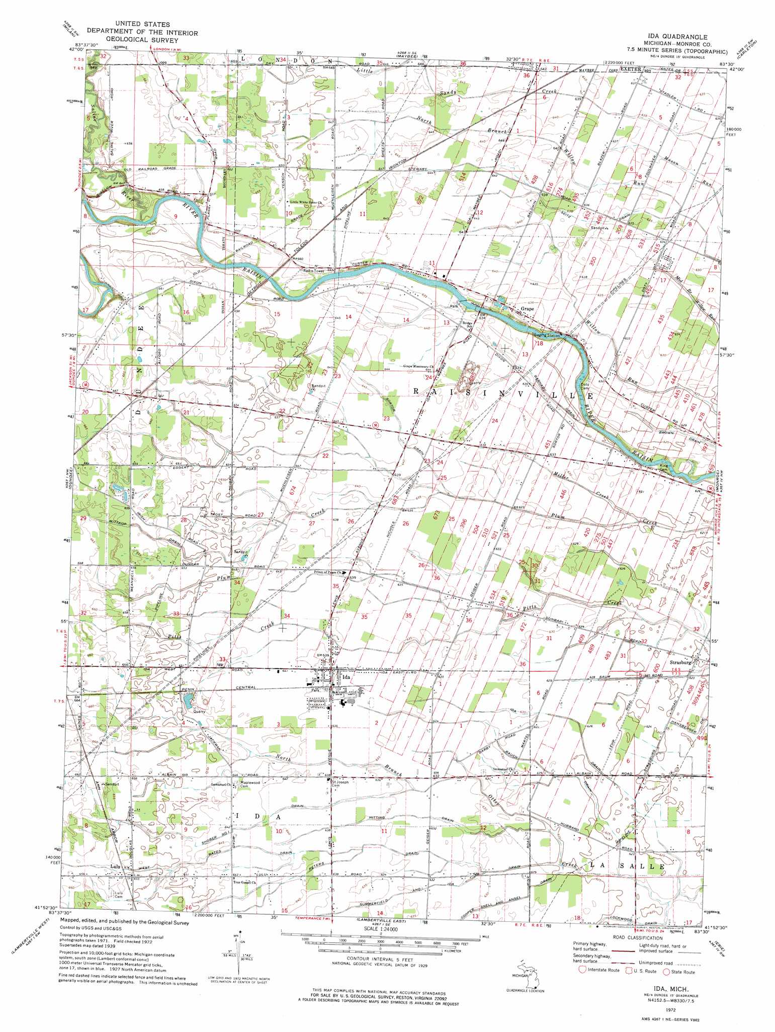
Ida Topo Map Michigan
To zoom in, hover over the map of Ida
USGS Topo Quad 41083h5 - 1:24,000 scale
| Topo Map Name: | Ida |
| USGS Topo Quad ID: | 41083h5 |
| Print Size: | ca. 21 1/4" wide x 27" high |
| Southeast Coordinates: | 41.875° N latitude / 83.5° W longitude |
| Map Center Coordinates: | 41.9375° N latitude / 83.5625° W longitude |
| U.S. State: | MI |
| Filename: | o41083h5.jpg |
| Download Map JPG Image: | Ida topo map 1:24,000 scale |
| Map Type: | Topographic |
| Topo Series: | 7.5´ |
| Map Scale: | 1:24,000 |
| Source of Map Images: | United States Geological Survey (USGS) |
| Alternate Map Versions: |
Ida MI 1940 Download PDF Buy paper map Ida MI 1972, updated 1975 Download PDF Buy paper map Ida MI 2011 Download PDF Buy paper map Ida MI 2014 Download PDF Buy paper map Ida MI 2016 Download PDF Buy paper map |
1:24,000 Topo Quads surrounding Ida
Saline |
Ypsilanti West |
Ypsilanti East |
Belleville |
Flat Rock Ne |
Macon |
Milan |
Maybee |
Carleton |
Flat Rock |
Deerfield |
Dundee |
Ida |
Monroe |
Stony Point |
Blissfield |
Lambertville West |
Lambertville East |
Erie |
|
Berkey |
Sylvania |
Toledo |
Oregon |
Reno Beach |
> Back to 41083e1 at 1:100,000 scale
> Back to 41082a1 at 1:250,000 scale
> Back to U.S. Topo Maps home
Ida topo map: Gazetteer
Ida: Parks
Peter Seite Tavern and Stagecoach Inn Historical Marker elevation 194m 636′Ida: Populated Places
Grape elevation 194m 636′Ida elevation 195m 639′
Lulu elevation 200m 656′
Strasburg elevation 190m 623′
Ida: Post Offices
Federman Post Office (historical) elevation 202m 662′Grape Post Office (historical) elevation 194m 636′
Ida Post Office elevation 195m 639′
Lulu Post Office (historical) elevation 199m 652′
Raisinville Post Office (historical) elevation 195m 639′
Strasburg Post Office (historical) elevation 190m 623′
Ida: Streams
Barnaby Drain elevation 187m 613′Cooper Snell and Ansel Drain elevation 189m 620′
Hitting Drain elevation 190m 623′
Ida Drain elevation 187m 613′
Lockwood Drain elevation 189m 620′
Macon Creek elevation 196m 643′
Miller Creek elevation 190m 623′
Peters Drain elevation 190m 623′
Rauch Drain elevation 189m 620′
Saline River elevation 192m 629′
Seitz Drain elevation 192m 629′
Shober Number One Drain elevation 192m 629′
Sortor Drain elevation 191m 626′
Summerfield and Ida Drain elevation 189m 620′
West Bates Drain elevation 193m 633′
Wittkop Drain elevation 194m 636′
Ida digital topo map on disk
Buy this Ida topo map showing relief, roads, GPS coordinates and other geographical features, as a high-resolution digital map file on DVD:
 map DVD")