New Bavaria Topo Map Ohio
To zoom in, hover over the map of New Bavaria
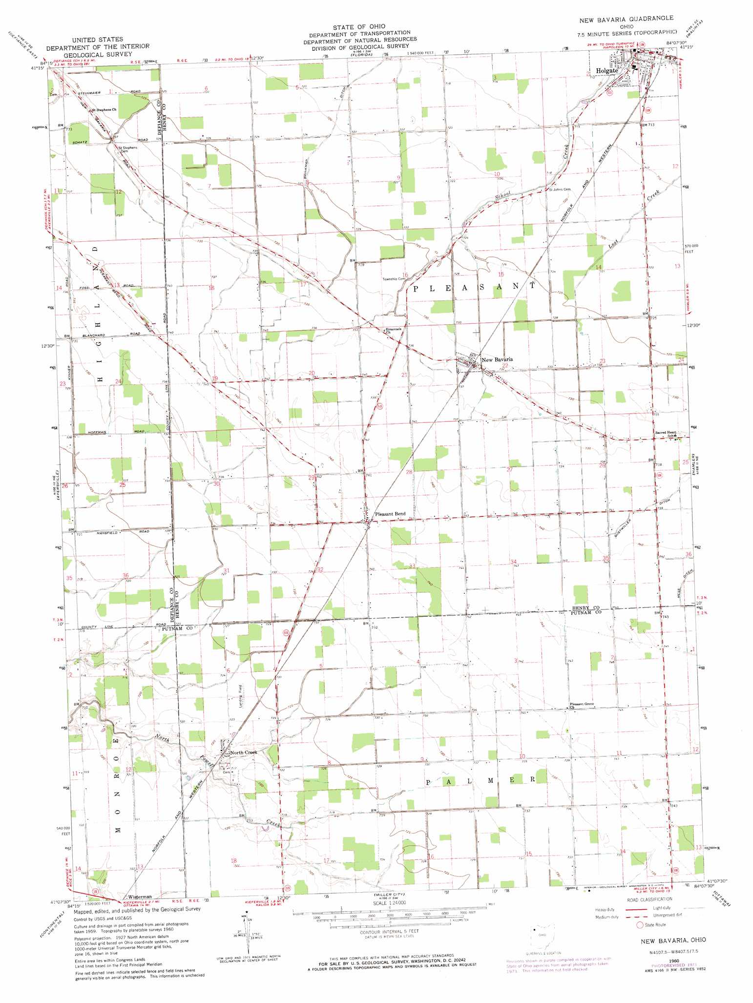
USGS Topo Quad 41084b2 - 1:24,000 scale
| Topo Map Name: | New Bavaria |
| USGS Topo Quad ID: | 41084b2 |
| Print Size: | ca. 21 1/4" wide x 27" high |
| Southeast Coordinates: | 41.125° N latitude / 84.125° W longitude |
| Map Center Coordinates: | 41.1875° N latitude / 84.1875° W longitude |
| U.S. State: | OH |
| Filename: | o41084b2.jpg |
| Download Map JPG Image: | New Bavaria topo map 1:24,000 scale |
| Map Type: | Topographic |
| Topo Series: | 7.5´ |
| Map Scale: | 1:24,000 |
| Source of Map Images: | United States Geological Survey (USGS) |
| Alternate Map Versions: |
New Bavaria OH 1960, updated 1961 Download PDF Buy paper map New Bavaria OH 1960, updated 1971 Download PDF Buy paper map New Bavaria OH 1960, updated 1974 Download PDF Buy paper map New Bavaria OH 2010 Download PDF Buy paper map New Bavaria OH 2013 Download PDF Buy paper map New Bavaria OH 2016 Download PDF Buy paper map |
1:24,000 Topo Quads surrounding New Bavaria
Evansport |
Ridgeville Corners |
Napoleon West |
Napoleon East |
Colton |
Defiance West |
Defiance East |
Florida |
Malinta |
Mcclure |
Junction |
Ayersville |
New Bavaria |
Hamler |
Deshler |
Oakwood |
Continental |
Miller City |
Ottawa |
Leipsic |
Wetsel |
Ottoville |
Kalida |
Columbus Grove |
Bluffton |
> Back to 41084a1 at 1:100,000 scale
> Back to 41084a1 at 1:250,000 scale
> Back to U.S. Topo Maps home
New Bavaria topo map: Gazetteer
New Bavaria: Airports
Hiltner Airport elevation 220m 721′New Bavaria: Populated Places
Holgate elevation 217m 711′New Bavaria elevation 224m 734′
North Creek elevation 219m 718′
Pleasant Bend elevation 225m 738′
New Bavaria: Post Offices
Holgate Post Office elevation 215m 705′New Bavaria Post Office elevation 224m 734′
North Creek Post Office (historical) elevation 218m 715′
Pleasantbend Post Office (historical) elevation 225m 738′
New Bavaria digital topo map on disk
Buy this New Bavaria topo map showing relief, roads, GPS coordinates and other geographical features, as a high-resolution digital map file on DVD:
Northern Illinois, Northern Indiana & Southwestern Michigan
Buy digital topo maps: Northern Illinois, Northern Indiana & Southwestern Michigan