Florida Topo Map Ohio
To zoom in, hover over the map of Florida
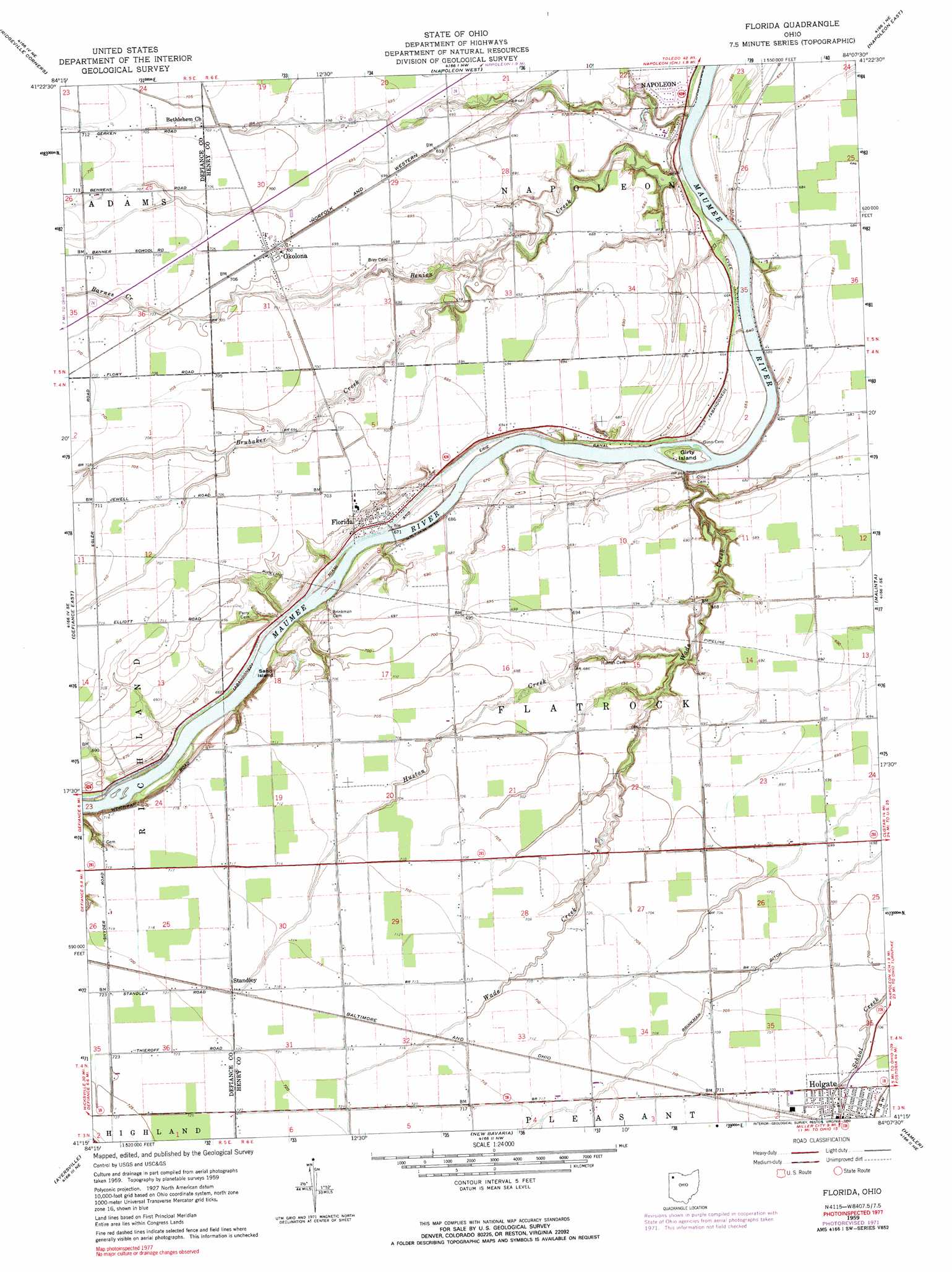
USGS Topo Quad 41084c2 - 1:24,000 scale
| Topo Map Name: | Florida |
| USGS Topo Quad ID: | 41084c2 |
| Print Size: | ca. 21 1/4" wide x 27" high |
| Southeast Coordinates: | 41.25° N latitude / 84.125° W longitude |
| Map Center Coordinates: | 41.3125° N latitude / 84.1875° W longitude |
| U.S. State: | OH |
| Filename: | o41084c2.jpg |
| Download Map JPG Image: | Florida topo map 1:24,000 scale |
| Map Type: | Topographic |
| Topo Series: | 7.5´ |
| Map Scale: | 1:24,000 |
| Source of Map Images: | United States Geological Survey (USGS) |
| Alternate Map Versions: |
Florida OH 1959, updated 1961 Download PDF Buy paper map Florida OH 1959, updated 1972 Download PDF Buy paper map Florida OH 1959, updated 1990 Download PDF Buy paper map Florida OH 2010 Download PDF Buy paper map Florida OH 2013 Download PDF Buy paper map Florida OH 2016 Download PDF Buy paper map |
1:24,000 Topo Quads surrounding Florida
West Unity |
Archbold |
Wauseon |
Delta |
Swanton |
Evansport |
Ridgeville Corners |
Napoleon West |
Napoleon East |
Colton |
Defiance West |
Defiance East |
Florida |
Malinta |
Mcclure |
Junction |
Ayersville |
New Bavaria |
Hamler |
Deshler |
Oakwood |
Continental |
Miller City |
Ottawa |
Leipsic |
> Back to 41084a1 at 1:100,000 scale
> Back to 41084a1 at 1:250,000 scale
> Back to U.S. Topo Maps home
Florida topo map: Gazetteer
Florida: Airports
Christys Airport elevation 210m 688′Florida: Canals
Brinkman Ditch elevation 213m 698′Miami and Erie Canal elevation 201m 659′
Florida: Islands
Girty Island elevation 199m 652′Sand Island elevation 197m 646′
Florida: Populated Places
Florida elevation 205m 672′Okolona elevation 214m 702′
Standley elevation 219m 718′
Florida: Post Offices
Florida Post Office (historical) elevation 205m 672′Okolona Post Office elevation 214m 702′
Florida: Streams
Barnes Creek elevation 212m 695′Benien Creek elevation 199m 652′
Brubaker Creek elevation 207m 679′
Huston Creek elevation 203m 666′
Wade Creek elevation 199m 652′
Florida digital topo map on disk
Buy this Florida topo map showing relief, roads, GPS coordinates and other geographical features, as a high-resolution digital map file on DVD:
Northern Illinois, Northern Indiana & Southwestern Michigan
Buy digital topo maps: Northern Illinois, Northern Indiana & Southwestern Michigan