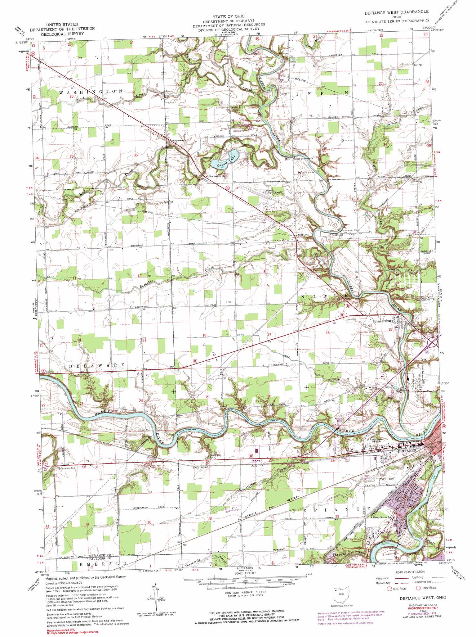
Defiance West Topo Map Ohio
To zoom in, hover over the map of Defiance West
USGS Topo Quad 41084c4 - 1:24,000 scale
| Topo Map Name: | Defiance West |
| USGS Topo Quad ID: | 41084c4 |
| Print Size: | ca. 21 1/4" wide x 27" high |
| Southeast Coordinates: | 41.25° N latitude / 84.375° W longitude |
| Map Center Coordinates: | 41.3125° N latitude / 84.4375° W longitude |
| U.S. State: | OH |
| Filename: | o41084c4.jpg |
| Download Map JPG Image: | Defiance West topo map 1:24,000 scale |
| Map Type: | Topographic |
| Topo Series: | 7.5´ |
| Map Scale: | 1:24,000 |
| Source of Map Images: | United States Geological Survey (USGS) |
| Alternate Map Versions: |
Defiance West OH 1960, updated 1961 Download PDF Buy paper map Defiance West OH 1960, updated 1972 Download PDF Buy paper map Defiance West OH 1960, updated 1990 Download PDF Buy paper map Defiance West OH 2010 Download PDF Buy paper map Defiance West OH 2013 Download PDF Buy paper map Defiance West OH 2016 Download PDF Buy paper map |
1:24,000 Topo Quads surrounding Defiance West
Blakeslee |
Montpelier |
West Unity |
Archbold |
Wauseon |
Edgerton |
Bryan |
Evansport |
Ridgeville Corners |
Napoleon West |
Mark Center |
Sherwood |
Defiance West |
Defiance East |
Florida |
Antwerp |
Paulding |
Junction |
Ayersville |
New Bavaria |
Payne |
Latty |
Oakwood |
Continental |
Miller City |
> Back to 41084a1 at 1:100,000 scale
> Back to 41084a1 at 1:250,000 scale
> Back to U.S. Topo Maps home
Defiance West topo map: Gazetteer
Defiance West: Airports
Defiance Memorial Airport elevation 215m 705′Defiance West: Canals
Dowe Ditch elevation 213m 698′Stevens Ditch elevation 211m 692′
Defiance West: Dams
Camp Lakota Boy Scout Lake Dam elevation 204m 669′Oxbow Lake Dam elevation 215m 705′
Defiance West: Parks
Bronson Park elevation 208m 682′Legion Field elevation 213m 698′
Oxbow Lake State Wildlife Area elevation 209m 685′
Tecumseh Park elevation 210m 688′
Defiance West: Populated Places
Ashwood (historical) elevation 218m 715′Brunersburg elevation 210m 688′
Defiance West: Post Offices
Ashwood Post Office (historical) elevation 218m 715′Brunersburg Post Office (historical) elevation 211m 692′
Defiance West: Reservoirs
Camp Lakota Boy Scout Lake elevation 204m 669′Oxbow Lake elevation 215m 705′
Defiance West: Streams
Black Creek elevation 206m 675′Buckskin Creek elevation 202m 662′
Lick Creek elevation 206m 675′
Mud Creek elevation 204m 669′
Powell Creek elevation 203m 666′
Threemile Creek elevation 202m 662′
Tiffin River elevation 203m 666′
Webb Run elevation 202m 662′
Defiance West digital topo map on disk
Buy this Defiance West topo map showing relief, roads, GPS coordinates and other geographical features, as a high-resolution digital map file on DVD:
Northern Illinois, Northern Indiana & Southwestern Michigan
Buy digital topo maps: Northern Illinois, Northern Indiana & Southwestern Michigan