Napoleon West Topo Map Ohio
To zoom in, hover over the map of Napoleon West
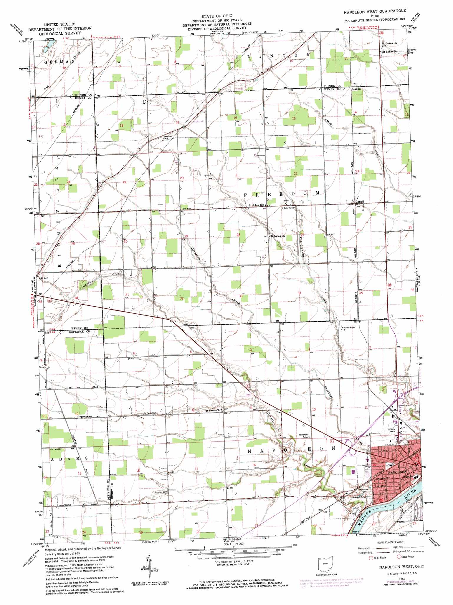
USGS Topo Quad 41084d2 - 1:24,000 scale
| Topo Map Name: | Napoleon West |
| USGS Topo Quad ID: | 41084d2 |
| Print Size: | ca. 21 1/4" wide x 27" high |
| Southeast Coordinates: | 41.375° N latitude / 84.125° W longitude |
| Map Center Coordinates: | 41.4375° N latitude / 84.1875° W longitude |
| U.S. State: | OH |
| Filename: | o41084d2.jpg |
| Download Map JPG Image: | Napoleon West topo map 1:24,000 scale |
| Map Type: | Topographic |
| Topo Series: | 7.5´ |
| Map Scale: | 1:24,000 |
| Source of Map Images: | United States Geological Survey (USGS) |
| Alternate Map Versions: |
Napoleon West OH 1959, updated 1961 Download PDF Buy paper map Napoleon West OH 1959, updated 1972 Download PDF Buy paper map Napoleon West OH 2010 Download PDF Buy paper map Napoleon West OH 2013 Download PDF Buy paper map Napoleon West OH 2016 Download PDF Buy paper map |
1:24,000 Topo Quads surrounding Napoleon West
Alvordton |
Fayette |
Morenci |
Lyons |
Assumption |
West Unity |
Archbold |
Wauseon |
Delta |
Swanton |
Evansport |
Ridgeville Corners |
Napoleon West |
Napoleon East |
Colton |
Defiance West |
Defiance East |
Florida |
Malinta |
Mcclure |
Junction |
Ayersville |
New Bavaria |
Hamler |
Deshler |
> Back to 41084a1 at 1:100,000 scale
> Back to 41084a1 at 1:250,000 scale
> Back to U.S. Topo Maps home
Napoleon West topo map: Gazetteer
Napoleon West: Populated Places
Bostelmans Corners elevation 211m 692′Gerald elevation 215m 705′
Lueneburg elevation 216m 708′
Naomi elevation 218m 715′
Napoleon elevation 207m 679′
Napoleon West: Post Offices
Gerald Post Office (historical) elevation 215m 705′Naomi Post Office (historical) elevation 218m 715′
Napoleon Post Office elevation 208m 682′
Napoleon West: Streams
Garrett Creek elevation 196m 643′Napoleon West digital topo map on disk
Buy this Napoleon West topo map showing relief, roads, GPS coordinates and other geographical features, as a high-resolution digital map file on DVD:
Northern Illinois, Northern Indiana & Southwestern Michigan
Buy digital topo maps: Northern Illinois, Northern Indiana & Southwestern Michigan