Edgerton Topo Map Ohio
To zoom in, hover over the map of Edgerton
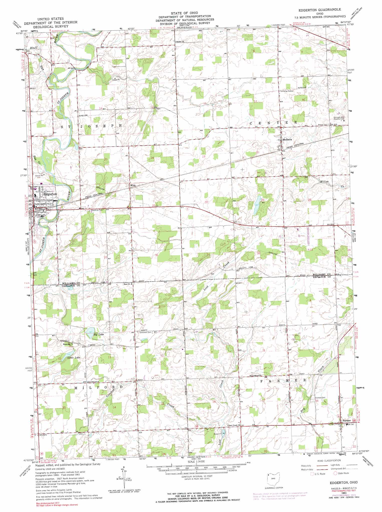
USGS Topo Quad 41084d6 - 1:24,000 scale
| Topo Map Name: | Edgerton |
| USGS Topo Quad ID: | 41084d6 |
| Print Size: | ca. 21 1/4" wide x 27" high |
| Southeast Coordinates: | 41.375° N latitude / 84.625° W longitude |
| Map Center Coordinates: | 41.4375° N latitude / 84.6875° W longitude |
| U.S. State: | OH |
| Filename: | o41084d6.jpg |
| Download Map JPG Image: | Edgerton topo map 1:24,000 scale |
| Map Type: | Topographic |
| Topo Series: | 7.5´ |
| Map Scale: | 1:24,000 |
| Source of Map Images: | United States Geological Survey (USGS) |
| Alternate Map Versions: |
Edgerton OH 1961, updated 1962 Download PDF Buy paper map Edgerton OH 1961, updated 1974 Download PDF Buy paper map Edgerton OH 1961, updated 1990 Download PDF Buy paper map Edgerton OH 2010 Download PDF Buy paper map Edgerton OH 2013 Download PDF Buy paper map Edgerton OH 2016 Download PDF Buy paper map |
1:24,000 Topo Quads surrounding Edgerton
Angola East |
Clear Lake |
Nettle Lake |
Pioneer |
Alvordton |
Hamilton |
Edon |
Blakeslee |
Montpelier |
West Unity |
Butler West |
Butler East |
Edgerton |
Bryan |
Evansport |
Saint Joe |
Hicksville |
Mark Center |
Sherwood |
Defiance West |
Grabill |
Woodburn North |
Antwerp |
Paulding |
Junction |
> Back to 41084a1 at 1:100,000 scale
> Back to 41084a1 at 1:250,000 scale
> Back to U.S. Topo Maps home
Edgerton topo map: Gazetteer
Edgerton: Bridges
Denmark Bridge elevation 255m 836′Edgerton: Lakes
Big Lake elevation 253m 830′Little Lake elevation 256m 839′
Edgerton: Populated Places
Denmark (historical) elevation 255m 836′Edgerton elevation 256m 839′
Farmer elevation 228m 748′
Melbern elevation 259m 849′
Mina elevation 261m 856′
Valley Springs Addition elevation 259m 849′
Edgerton: Post Offices
Farmer Post Office elevation 228m 748′Edgerton: Streams
Bluff Run elevation 250m 820′Crooked Creek elevation 237m 777′
Fish Creek elevation 249m 816′
Edgerton digital topo map on disk
Buy this Edgerton topo map showing relief, roads, GPS coordinates and other geographical features, as a high-resolution digital map file on DVD:
Northern Illinois, Northern Indiana & Southwestern Michigan
Buy digital topo maps: Northern Illinois, Northern Indiana & Southwestern Michigan