Camden Topo Map Michigan
To zoom in, hover over the map of Camden
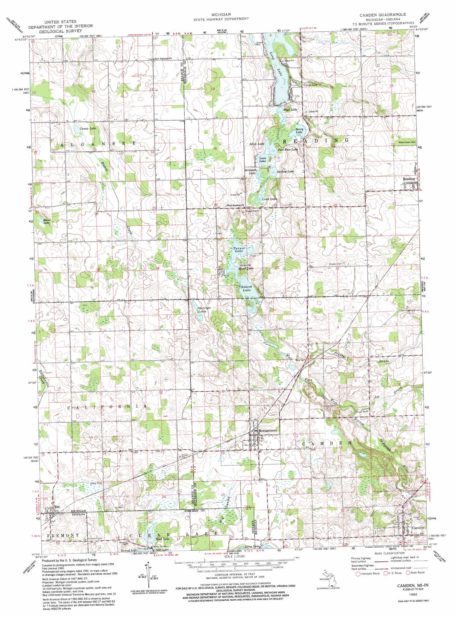
USGS Topo Quad 41084g7 - 1:24,000 scale
| Topo Map Name: | Camden |
| USGS Topo Quad ID: | 41084g7 |
| Print Size: | ca. 21 1/4" wide x 27" high |
| Southeast Coordinates: | 41.75° N latitude / 84.75° W longitude |
| Map Center Coordinates: | 41.8125° N latitude / 84.8125° W longitude |
| U.S. States: | MI, IN |
| Filename: | o41084g7.jpg |
| Download Map JPG Image: | Camden topo map 1:24,000 scale |
| Map Type: | Topographic |
| Topo Series: | 7.5´ |
| Map Scale: | 1:24,000 |
| Source of Map Images: | United States Geological Survey (USGS) |
| Alternate Map Versions: |
Camden MI 1960, updated 1961 Download PDF Buy paper map Camden MI 1960, updated 1978 Download PDF Buy paper map Camden MI 1992, updated 1995 Download PDF Buy paper map Camden MI 2011 Download PDF Buy paper map Camden MI 2014 Download PDF Buy paper map Camden MI 2016 Download PDF Buy paper map |
1:24,000 Topo Quads surrounding Camden
Burlington |
Tekonsha |
Litchfield |
Mosherville |
Hanover |
Coldwater West |
Coldwater East |
Allen |
Hillsdale |
North Adams |
Kinderhook |
California |
Camden |
Reading |
Frontier |
Angola West |
Angola East |
Clear Lake |
Nettle Lake |
Pioneer |
Ashley |
Hamilton |
Edon |
Blakeslee |
Montpelier |
> Back to 41084e1 at 1:100,000 scale
> Back to 41084a1 at 1:250,000 scale
> Back to U.S. Topo Maps home
Camden topo map: Gazetteer
Camden: Lakes
Allen Lake elevation 311m 1020′Beckwith Lake elevation 313m 1026′
Berry Lake elevation 311m 1020′
Bovee Lake elevation 316m 1036′
Camp Lake elevation 311m 1020′
Cartwright Lakes elevation 317m 1040′
Lime Lake elevation 313m 1026′
Long Lake elevation 310m 1017′
Loon Lake elevation 311m 1020′
Mead Lake elevation 309m 1013′
Mud Lake elevation 311m 1020′
Mud Lake elevation 315m 1033′
Paw Paw Lake elevation 311m 1020′
Rebeck Lake elevation 309m 1013′
Round Lake elevation 317m 1040′
Suckey Lake elevation 313m 1026′
Turner Lake elevation 309m 1013′
Camden: Parks
Barre Field elevation 363m 1190′Camden Community Field elevation 321m 1053′
Camden: Populated Places
Camden elevation 311m 1020′Montgomery elevation 320m 1049′
Ray elevation 329m 1079′
Camden: Post Offices
Camden Post Office elevation 311m 1020′Montgomery Post Office elevation 320m 1049′
Camden: Streams
Joe Drain elevation 302m 990′Prouty Drain elevation 305m 1000′
Camden: Swamps
Big Swamp elevation 315m 1033′Big Swamp elevation 315m 1033′
Camden digital topo map on disk
Buy this Camden topo map showing relief, roads, GPS coordinates and other geographical features, as a high-resolution digital map file on DVD:
Northern Illinois, Northern Indiana & Southwestern Michigan
Buy digital topo maps: Northern Illinois, Northern Indiana & Southwestern Michigan