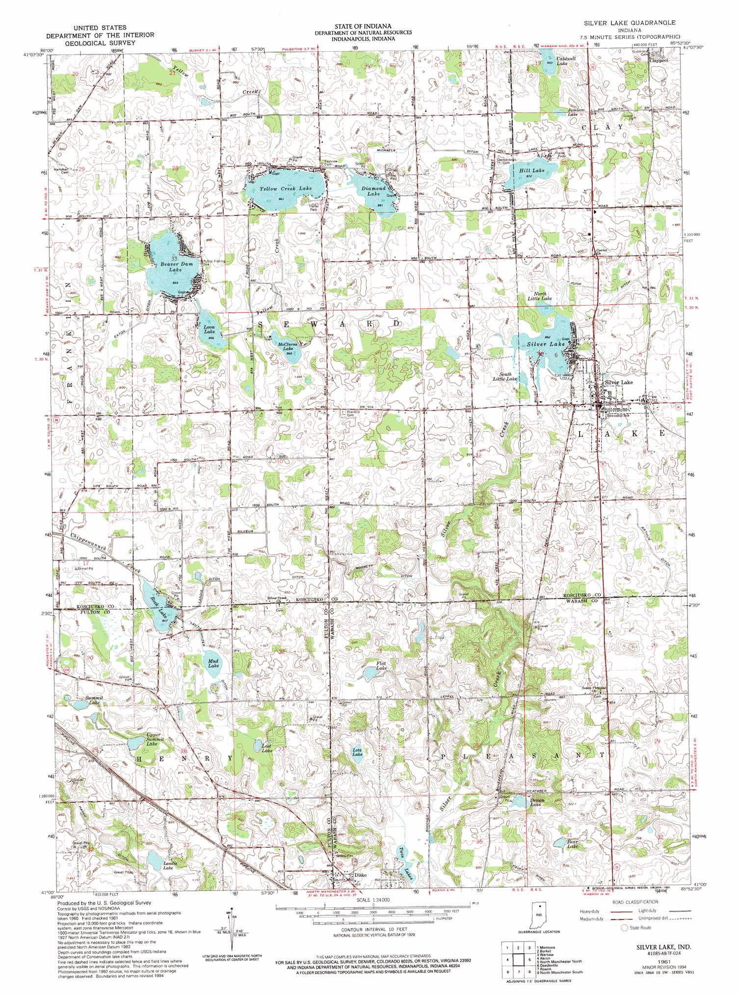
Silver Lake Topo Map Indiana
To zoom in, hover over the map of Silver Lake
USGS Topo Quad 41085a8 - 1:24,000 scale
| Topo Map Name: | Silver Lake |
| USGS Topo Quad ID: | 41085a8 |
| Print Size: | ca. 21 1/4" wide x 27" high |
| Southeast Coordinates: | 41° N latitude / 85.875° W longitude |
| Map Center Coordinates: | 41.0625° N latitude / 85.9375° W longitude |
| U.S. State: | IN |
| Filename: | o41085a8.jpg |
| Download Map JPG Image: | Silver Lake topo map 1:24,000 scale |
| Map Type: | Topographic |
| Topo Series: | 7.5´ |
| Map Scale: | 1:24,000 |
| Source of Map Images: | United States Geological Survey (USGS) |
| Alternate Map Versions: |
Silver Lake IN 1961, updated 1963 Download PDF Buy paper map Silver Lake IN 1961, updated 1994 Download PDF Buy paper map Silver Lake IN 2010 Download PDF Buy paper map Silver Lake IN 2013 Download PDF Buy paper map Silver Lake IN 2016 Download PDF Buy paper map |
1:24,000 Topo Quads surrounding Silver Lake
Inwood |
Bourbon |
Atwood |
Leesburg |
North Webster |
Argos |
Mentone |
Burket |
Warsaw |
Pierceton |
Rochester |
Akron |
Silver Lake |
North Manchester North |
South Whitley West |
Macy |
Deedsville |
Roann |
North Manchester South |
Servia |
Twelve Mile |
Peru |
Richvalley |
Wabash |
Lagro |
> Back to 41085a1 at 1:100,000 scale
> Back to 41084a1 at 1:250,000 scale
> Back to U.S. Topo Maps home
Silver Lake topo map: Gazetteer
Silver Lake: Canals
Arthur Ditch elevation 267m 875′Eaton Ditch elevation 266m 872′
Funk Ditch elevation 271m 889′
Harsh Ditch elevation 246m 807′
Kroft Ditch elevation 241m 790′
Landis Ditch elevation 259m 849′
Lautzenhizer Ditch elevation 262m 859′
Michaels Ditch elevation 265m 869′
Morrett Ditch elevation 261m 856′
Silveus Ditch elevation 258m 846′
Silver Lake: Lakes
Bear Lake elevation 246m 807′Beaver Dam Lake elevation 264m 866′
Brown Lake elevation 242m 793′
Diamond Lake elevation 263m 862′
Flat Lake elevation 259m 849′
Hill Lake elevation 265m 869′
Jamison Lake elevation 270m 885′
Landis Lake elevation 238m 780′
Loon Lake elevation 264m 866′
Lost Lake elevation 262m 859′
Lotz Lake elevation 239m 784′
McClures Lake elevation 265m 869′
Mud Lake elevation 261m 856′
North Little Lake elevation 263m 862′
Rock Lake elevation 259m 849′
Silver Lake elevation 263m 862′
South Little Lake elevation 263m 862′
Summit Lake elevation 260m 853′
Twin Lakes elevation 234m 767′
Upper Summit Lake elevation 260m 853′
Yellow Creek Lake elevation 263m 862′
Silver Lake: Populated Places
Disko elevation 263m 862′Silver Lake elevation 276m 905′
Silver Lake digital topo map on disk
Buy this Silver Lake topo map showing relief, roads, GPS coordinates and other geographical features, as a high-resolution digital map file on DVD:
Northern Illinois, Northern Indiana & Southwestern Michigan
Buy digital topo maps: Northern Illinois, Northern Indiana & Southwestern Michigan