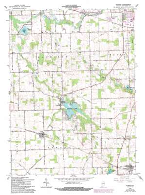
Burket Topo Map Indiana
To zoom in, hover over the map of Burket
USGS Topo Quad 41085b8 - 1:24,000 scale
| Topo Map Name: | Burket |
| USGS Topo Quad ID: | 41085b8 |
| Print Size: | ca. 21 1/4" wide x 27" high |
| Southeast Coordinates: | 41.125° N latitude / 85.875° W longitude |
| Map Center Coordinates: | 41.1875° N latitude / 85.9375° W longitude |
| U.S. State: | IN |
| Filename: | o41085b8.jpg |
| Download Map JPG Image: | Burket topo map 1:24,000 scale |
| Map Type: | Topographic |
| Topo Series: | 7.5´ |
| Map Scale: | 1:24,000 |
| Source of Map Images: | United States Geological Survey (USGS) |
| Alternate Map Versions: |
Burket IN 1961, updated 1963 Download PDF Buy paper map Burket IN 1961, updated 1982 Download PDF Buy paper map Burket IN 1961, updated 1994 Download PDF Buy paper map Burket IN 2010 Download PDF Buy paper map Burket IN 2013 Download PDF Buy paper map Burket IN 2016 Download PDF Buy paper map |
1:24,000 Topo Quads surrounding Burket
> Back to 41085a1 at 1:100,000 scale
> Back to 41084a1 at 1:250,000 scale
> Back to U.S. Topo Maps home
Burket topo map: Gazetteer
Burket: Canals
Adams Ditch elevation 255m 836′Bierce Ditch elevation 248m 813′
Boggs Ditch elevation 256m 839′
Cretcher Ditch elevation 245m 803′
Kuhn Ditch elevation 258m 846′
Magee Ditch elevation 256m 839′
Marsh Ditch elevation 248m 813′
Merrit Ditch elevation 254m 833′
Pyle Ditch elevation 245m 803′
Ring Ditch elevation 254m 833′
Robbins Ditch elevation 261m 856′
Sellers Ditch elevation 249m 816′
Sloan Ditch elevation 253m 830′
Ulsch Ditch elevation 262m 859′
Williamson Ditch elevation 255m 836′
Burket: Dams
Palestine Lake Dam elevation 251m 823′Burket: Lakes
Caldwell Lake elevation 264m 866′Crystal Lake elevation 242m 793′
Goose Lake elevation 264m 866′
Sickle Lake elevation 260m 853′
Burket: Populated Places
Burket elevation 263m 862′Claypool elevation 271m 889′
Palestine elevation 255m 836′
Burket: Reservoirs
Palestine Lake elevation 251m 823′Burket: Streams
Trail Creek elevation 240m 787′Walnut Creek elevation 247m 810′
Yellow Creek elevation 260m 853′
Burket digital topo map on disk
Buy this Burket topo map showing relief, roads, GPS coordinates and other geographical features, as a high-resolution digital map file on DVD:
Northern Illinois, Northern Indiana & Southwestern Michigan
Buy digital topo maps: Northern Illinois, Northern Indiana & Southwestern Michigan


