Albion Topo Map Indiana
To zoom in, hover over the map of Albion
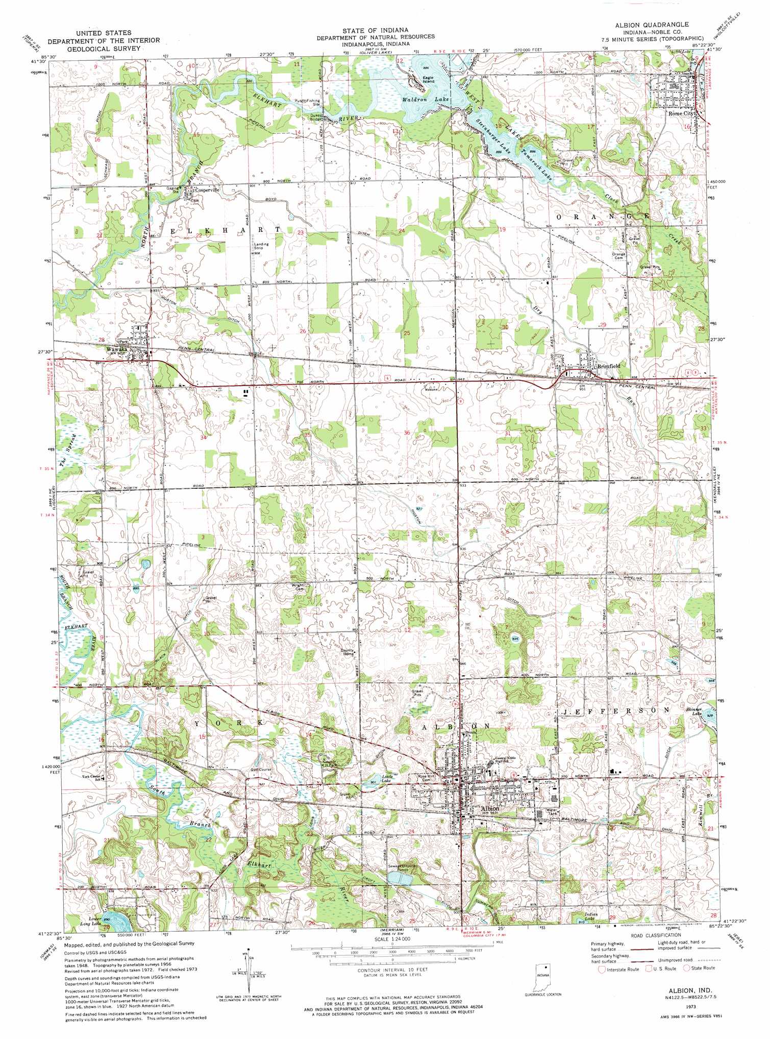
USGS Topo Quad 41085d4 - 1:24,000 scale
| Topo Map Name: | Albion |
| USGS Topo Quad ID: | 41085d4 |
| Print Size: | ca. 21 1/4" wide x 27" high |
| Southeast Coordinates: | 41.375° N latitude / 85.375° W longitude |
| Map Center Coordinates: | 41.4375° N latitude / 85.4375° W longitude |
| U.S. State: | IN |
| Filename: | o41085d4.jpg |
| Download Map JPG Image: | Albion topo map 1:24,000 scale |
| Map Type: | Topographic |
| Topo Series: | 7.5´ |
| Map Scale: | 1:24,000 |
| Source of Map Images: | United States Geological Survey (USGS) |
| Alternate Map Versions: |
Albion IN 1956, updated 1958 Download PDF Buy paper map Albion IN 1956, updated 1958 Download PDF Buy paper map Albion IN 1973, updated 1974 Download PDF Buy paper map Albion IN 2010 Download PDF Buy paper map Albion IN 2013 Download PDF Buy paper map Albion IN 2016 Download PDF Buy paper map |
1:24,000 Topo Quads surrounding Albion
Middlebury |
Shipshewana |
Lagrange |
Mongo |
Orland |
Millersburg |
Topeka |
Oliver Lake |
Wolcottville |
Stroh |
Lake Wawasee |
Ligonier |
Albion |
Kendallville |
Corunna |
North Webster |
Ormas |
Merriam |
Ege |
Garrett |
Pierceton |
Lorane |
Columbia City |
Churubusco |
Huntertown |
> Back to 41085a1 at 1:100,000 scale
> Back to 41084a1 at 1:250,000 scale
> Back to U.S. Topo Maps home
Albion topo map: Gazetteer
Albion: Bridges
Dukes Bridge elevation 270m 885′Albion: Canals
Black Ditch elevation 272m 892′Boyd Ditch elevation 277m 908′
Croft Ditch elevation 288m 944′
Huston Ditch elevation 273m 895′
Long Ditch elevation 270m 885′
Schwab Ditch elevation 273m 895′
Albion: Islands
Eagle Island elevation 270m 885′Albion: Lakes
Indian Lake elevation 277m 908′Little Lake elevation 277m 908′
Lower Long Lake elevation 272m 892′
Spring Lake elevation 271m 889′
Steinbarger Lake elevation 269m 882′
Tamarack Lake elevation 270m 885′
Waldron Lake elevation 270m 885′
West Lakes elevation 270m 885′
Albion: Populated Places
Albion elevation 291m 954′Brimfield elevation 289m 948′
Cosperville elevation 274m 898′
Rome City elevation 285m 935′
Wawaka elevation 274m 898′
Albion: Streams
Clock Creek elevation 270m 885′Dry Run elevation 270m 885′
Albion digital topo map on disk
Buy this Albion topo map showing relief, roads, GPS coordinates and other geographical features, as a high-resolution digital map file on DVD:
Northern Illinois, Northern Indiana & Southwestern Michigan
Buy digital topo maps: Northern Illinois, Northern Indiana & Southwestern Michigan