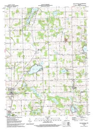
Wolcottville Topo Map Indiana
To zoom in, hover over the map of Wolcottville
USGS Topo Quad 41085e3 - 1:24,000 scale
| Topo Map Name: | Wolcottville |
| USGS Topo Quad ID: | 41085e3 |
| Print Size: | ca. 21 1/4" wide x 27" high |
| Southeast Coordinates: | 41.5° N latitude / 85.25° W longitude |
| Map Center Coordinates: | 41.5625° N latitude / 85.3125° W longitude |
| U.S. State: | IN |
| Filename: | o41085e3.jpg |
| Download Map JPG Image: | Wolcottville topo map 1:24,000 scale |
| Map Type: | Topographic |
| Topo Series: | 7.5´ |
| Map Scale: | 1:24,000 |
| Source of Map Images: | United States Geological Survey (USGS) |
| Alternate Map Versions: |
Wolcottville IN 1947 Download PDF Buy paper map Wolcottville IN 1959, updated 1960 Download PDF Buy paper map Wolcottville IN 1959, updated 1960 Download PDF Buy paper map Wolcottville IN 1959, updated 1987 Download PDF Buy paper map Wolcottville IN 1992, updated 1993 Download PDF Buy paper map Wolcottville IN 2010 Download PDF Buy paper map Wolcottville IN 2013 Download PDF Buy paper map Wolcottville IN 2016 Download PDF Buy paper map |
1:24,000 Topo Quads surrounding Wolcottville
> Back to 41085e1 at 1:100,000 scale
> Back to 41084a1 at 1:250,000 scale
> Back to U.S. Topo Maps home
Wolcottville topo map: Gazetteer
Wolcottville: Lakes
Adams Lake elevation 289m 948′Axel Lake elevation 285m 935′
Blackman Lake elevation 295m 967′
Case Lake elevation 295m 967′
Cree Lake elevation 287m 941′
Eve Lake elevation 290m 951′
Fish Lake elevation 285m 935′
Fites Lake elevation 288m 944′
Grannis Lake elevation 284m 931′
Mud Lake elevation 285m 935′
Nauvoo Lake elevation 285m 935′
Needham Lake elevation 284m 931′
Newman Lake elevation 287m 941′
Roger Lake (historical) elevation 286m 938′
Royer Lake elevation 286m 938′
Tamarack Lake elevation 287m 941′
Wolcottville: Populated Places
South Milford elevation 297m 974′Wolcottville elevation 287m 941′
Woodruff elevation 296m 971′
Wolcottville: Springs
Kneipp Springs elevation 286m 938′Wolcottville: Swamps
Grass Lake elevation 291m 954′Wolcottville digital topo map on disk
Buy this Wolcottville topo map showing relief, roads, GPS coordinates and other geographical features, as a high-resolution digital map file on DVD:
Northern Illinois, Northern Indiana & Southwestern Michigan
Buy digital topo maps: Northern Illinois, Northern Indiana & Southwestern Michigan


