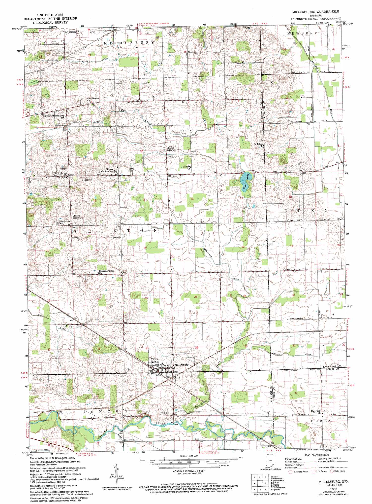
Millersburg Topo Map Indiana
To zoom in, hover over the map of Millersburg
USGS Topo Quad 41085e6 - 1:24,000 scale
| Topo Map Name: | Millersburg |
| USGS Topo Quad ID: | 41085e6 |
| Print Size: | ca. 21 1/4" wide x 27" high |
| Southeast Coordinates: | 41.5° N latitude / 85.625° W longitude |
| Map Center Coordinates: | 41.5625° N latitude / 85.6875° W longitude |
| U.S. State: | IN |
| Filename: | o41085e6.jpg |
| Download Map JPG Image: | Millersburg topo map 1:24,000 scale |
| Map Type: | Topographic |
| Topo Series: | 7.5´ |
| Map Scale: | 1:24,000 |
| Source of Map Images: | United States Geological Survey (USGS) |
| Alternate Map Versions: |
Millersburg IN 1959, updated 1961 Download PDF Buy paper map Millersburg IN 1959, updated 1961 Download PDF Buy paper map Millersburg IN 1959, updated 1961 Download PDF Buy paper map Millersburg IN 1959, updated 1994 Download PDF Buy paper map Millersburg IN 2010 Download PDF Buy paper map Millersburg IN 2013 Download PDF Buy paper map Millersburg IN 2016 Download PDF Buy paper map |
1:24,000 Topo Quads surrounding Millersburg
Adamsville |
Mottville |
Constantine |
Klinger Lake |
Sturgis |
Elkhart |
Bristol |
Middlebury |
Shipshewana |
Lagrange |
Foraker |
Goshen |
Millersburg |
Topeka |
Oliver Lake |
Nappanee East |
Milford |
Lake Wawasee |
Ligonier |
Albion |
Atwood |
Leesburg |
North Webster |
Ormas |
Merriam |
> Back to 41085e1 at 1:100,000 scale
> Back to 41084a1 at 1:250,000 scale
> Back to U.S. Topo Maps home
Millersburg topo map: Gazetteer
Millersburg: Canals
Dry Run Ditch elevation 254m 833′McAllister Ditch elevation 270m 885′
Phillips Ditch elevation 270m 885′
Rowe-Eden Ditch elevation 261m 856′
Millersburg: Lakes
Fish Lake elevation 276m 905′Millersburg: Populated Places
Millersburg elevation 270m 885′Stony Creek elevation 269m 882′
Millersburg: Streams
Stony Creek elevation 265m 869′Millersburg digital topo map on disk
Buy this Millersburg topo map showing relief, roads, GPS coordinates and other geographical features, as a high-resolution digital map file on DVD:
Northern Illinois, Northern Indiana & Southwestern Michigan
Buy digital topo maps: Northern Illinois, Northern Indiana & Southwestern Michigan