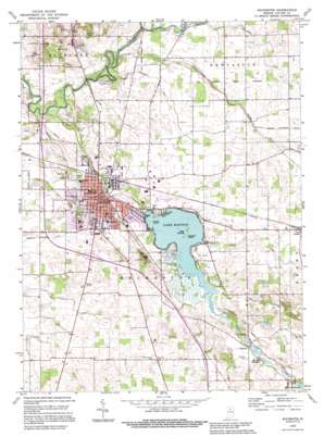
Rochester Topo Map Indiana
To zoom in, hover over the map of Rochester
USGS Topo Quad 41086a2 - 1:24,000 scale
| Topo Map Name: | Rochester |
| USGS Topo Quad ID: | 41086a2 |
| Print Size: | ca. 21 1/4" wide x 27" high |
| Southeast Coordinates: | 41° N latitude / 86.125° W longitude |
| Map Center Coordinates: | 41.0625° N latitude / 86.1875° W longitude |
| U.S. State: | IN |
| Filename: | o41086a2.jpg |
| Download Map JPG Image: | Rochester topo map 1:24,000 scale |
| Map Type: | Topographic |
| Topo Series: | 7.5´ |
| Map Scale: | 1:24,000 |
| Source of Map Images: | United States Geological Survey (USGS) |
| Alternate Map Versions: |
Rochester IN 1962, updated 1964 Download PDF Buy paper map Rochester IN 1962, updated 1981 Download PDF Buy paper map Rochester IN 1992, updated 1995 Download PDF Buy paper map Rochester IN 2010 Download PDF Buy paper map Rochester IN 2013 Download PDF Buy paper map Rochester IN 2016 Download PDF Buy paper map |
1:24,000 Topo Quads surrounding Rochester
> Back to 41086a1 at 1:100,000 scale
> Back to 41086a1 at 1:250,000 scale
> Back to U.S. Topo Maps home
Rochester topo map: Gazetteer
Rochester: Airports
Fulton County Airport elevation 240m 787′Rochester: Canals
Blair Ditch elevation 235m 770′Mastellar Ditch elevation 244m 800′
McMahan Ditch elevation 236m 774′
Minnow Ditch elevation 230m 754′
Neff Ditch elevation 235m 770′
Smith Ditch elevation 242m 793′
Whitenberger Eiler Ditch elevation 239m 784′
Rochester: Dams
Millark Millpond Dam elevation 246m 807′Mount Zion Millpond Dam elevation 242m 793′
Rochester: Islands
Big Island elevation 238m 780′Coney Island elevation 239m 784′
Treasure Island elevation 238m 780′
Rochester: Lakes
Colonial Pond elevation 238m 780′Lake Manitou elevation 238m 780′
Rochester: Parks
Menominee Public Fishing Area elevation 229m 751′Rochester: Populated Places
Athens elevation 247m 810′Big Hill elevation 273m 895′
Mount Zion elevation 247m 810′
Rochester elevation 238m 780′
Rochester: Post Offices
Rochester Post Office elevation 238m 780′Rochester: Reservoirs
Millark Millpond elevation 246m 807′Mount Zion Millpond elevation 242m 793′
Rochester: Streams
Chippewanuck Creek elevation 228m 748′Mill Creek elevation 227m 744′
Rain Creek elevation 238m 780′
Rochester digital topo map on disk
Buy this Rochester topo map showing relief, roads, GPS coordinates and other geographical features, as a high-resolution digital map file on DVD:
Northern Illinois, Northern Indiana & Southwestern Michigan
Buy digital topo maps: Northern Illinois, Northern Indiana & Southwestern Michigan


