Plymouth Topo Map Indiana
To zoom in, hover over the map of Plymouth
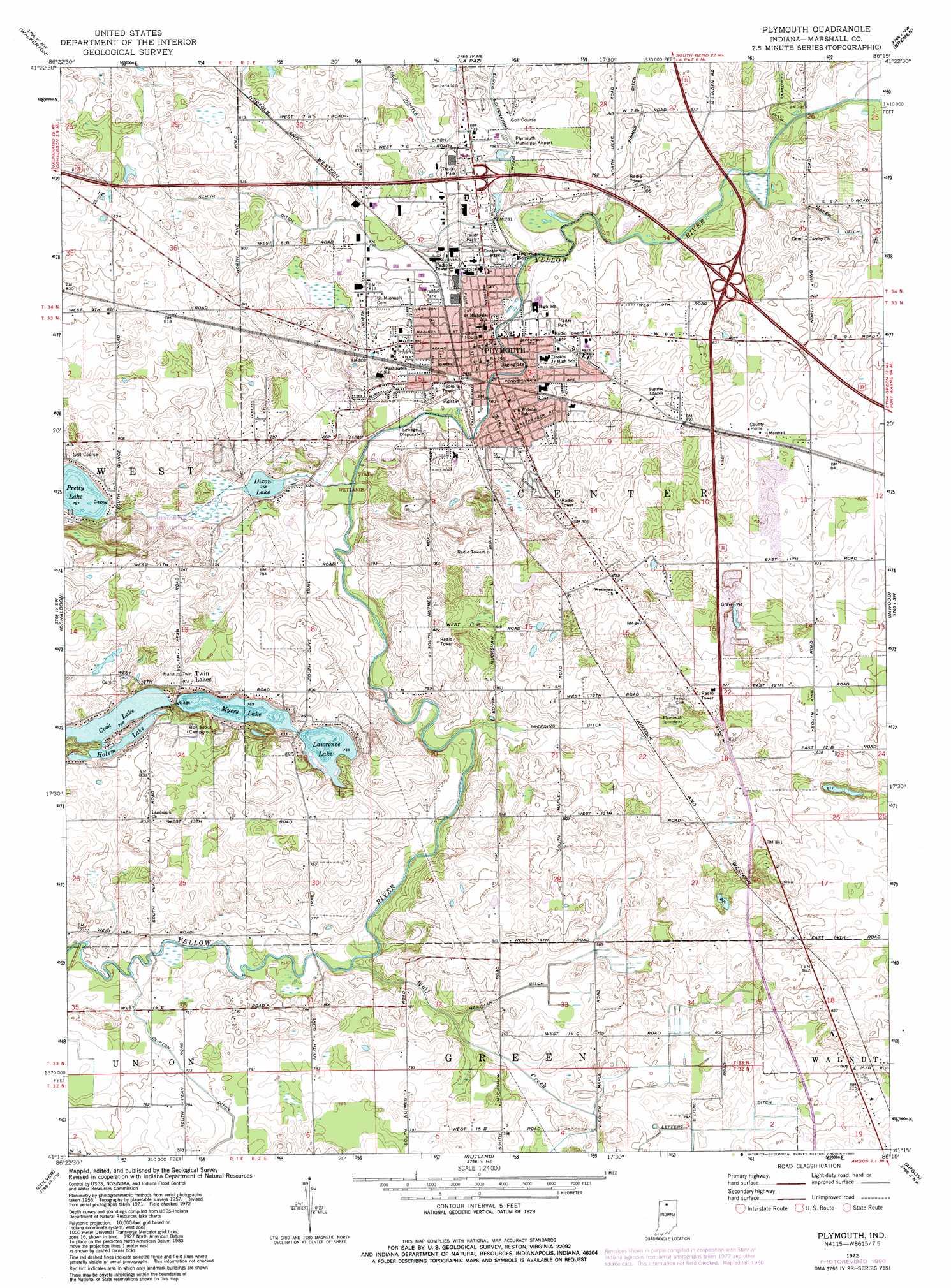
USGS Topo Quad 41086c3 - 1:24,000 scale
| Topo Map Name: | Plymouth |
| USGS Topo Quad ID: | 41086c3 |
| Print Size: | ca. 21 1/4" wide x 27" high |
| Southeast Coordinates: | 41.25° N latitude / 86.25° W longitude |
| Map Center Coordinates: | 41.3125° N latitude / 86.3125° W longitude |
| U.S. State: | IN |
| Filename: | o41086c3.jpg |
| Download Map JPG Image: | Plymouth topo map 1:24,000 scale |
| Map Type: | Topographic |
| Topo Series: | 7.5´ |
| Map Scale: | 1:24,000 |
| Source of Map Images: | United States Geological Survey (USGS) |
| Alternate Map Versions: |
Plymouth IN 1957, updated 1959 Download PDF Buy paper map Plymouth IN 1972, updated 1974 Download PDF Buy paper map Plymouth IN 1972, updated 1980 Download PDF Buy paper map Plymouth IN 2010 Download PDF Buy paper map Plymouth IN 2013 Download PDF Buy paper map Plymouth IN 2016 Download PDF Buy paper map |
1:24,000 Topo Quads surrounding Plymouth
Stillwell |
North Liberty |
Lakeville |
Wyatt |
Wakarusa |
Hamlet |
Walkerton |
La Paz |
Bremen |
Nappanee West |
Knox East |
Donaldson |
Plymouth |
Inwood |
Bourbon |
Bass Lake |
Culver |
Rutland |
Argos |
Mentone |
Winamac |
Kewanna |
Pershing |
Rochester |
Akron |
> Back to 41086a1 at 1:100,000 scale
> Back to 41086a1 at 1:250,000 scale
> Back to U.S. Topo Maps home
Plymouth topo map: Gazetteer
Plymouth: Airports
Plymouth Municipal Airport elevation 241m 790′Plymouth: Canals
Breeding Ditch elevation 238m 780′Carothers Ditch elevation 237m 777′
Ernest Rightley Ditch elevation 244m 800′
Greer Ditch elevation 243m 797′
Hartman Ditch elevation 237m 777′
Leffert Ditch elevation 238m 780′
Schuh Ditch elevation 246m 807′
Zimmer Ditch elevation 243m 797′
Plymouth: Lakes
Cook Lake elevation 235m 770′Dixon Lake elevation 237m 777′
Holem Lake elevation 235m 770′
Lawrence Lake elevation 234m 767′
Myers Lake elevation 235m 770′
Pretty Lake elevation 240m 787′
Plymouth: Parks
Centennial Park elevation 243m 797′Menominee State Wetlands elevation 240m 787′
Plymouth: Populated Places
Plymouth elevation 243m 797′Twin Lakes elevation 248m 813′
Plymouth: Streams
Wolf Creek elevation 230m 754′Plymouth digital topo map on disk
Buy this Plymouth topo map showing relief, roads, GPS coordinates and other geographical features, as a high-resolution digital map file on DVD:
Northern Illinois, Northern Indiana & Southwestern Michigan
Buy digital topo maps: Northern Illinois, Northern Indiana & Southwestern Michigan