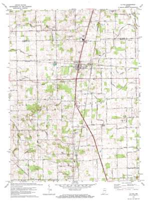
La Paz Topo Map Indiana
To zoom in, hover over the map of La Paz
USGS Topo Quad 41086d3 - 1:24,000 scale
| Topo Map Name: | La Paz |
| USGS Topo Quad ID: | 41086d3 |
| Print Size: | ca. 21 1/4" wide x 27" high |
| Southeast Coordinates: | 41.375° N latitude / 86.25° W longitude |
| Map Center Coordinates: | 41.4375° N latitude / 86.3125° W longitude |
| U.S. State: | IN |
| Filename: | o41086d3.jpg |
| Download Map JPG Image: | La Paz topo map 1:24,000 scale |
| Map Type: | Topographic |
| Topo Series: | 7.5´ |
| Map Scale: | 1:24,000 |
| Source of Map Images: | United States Geological Survey (USGS) |
| Alternate Map Versions: |
La Paz IN 1958, updated 1960 Download PDF Buy paper map La Paz IN 1972, updated 1974 Download PDF Buy paper map La Paz IN 1972, updated 1974 Download PDF Buy paper map La Paz IN 2010 Download PDF Buy paper map La Paz IN 2013 Download PDF Buy paper map La Paz IN 2016 Download PDF Buy paper map |
1:24,000 Topo Quads surrounding La Paz
> Back to 41086a1 at 1:100,000 scale
> Back to 41086a1 at 1:250,000 scale
> Back to U.S. Topo Maps home
La Paz topo map: Gazetteer
La Paz: Canals
Elmer Seltenright Ditch elevation 247m 810′Emma Mishler Ditch elevation 244m 800′
Harris Arm elevation 250m 820′
Jesse McKesson Ditch elevation 236m 774′
Lehman Ditch elevation 254m 833′
Mangun Arm elevation 256m 839′
Martin Ditch elevation 253m 830′
Oliver Heckaman Ditch elevation 255m 836′
William Forsythe Ditch elevation 254m 833′
La Paz: Populated Places
Harris elevation 254m 833′La Paz elevation 262m 859′
La Paz Junction elevation 259m 849′
Linkville elevation 253m 830′
La Paz: Streams
Pine Creek elevation 261m 856′La Paz digital topo map on disk
Buy this La Paz topo map showing relief, roads, GPS coordinates and other geographical features, as a high-resolution digital map file on DVD:
Northern Illinois, Northern Indiana & Southwestern Michigan
Buy digital topo maps: Northern Illinois, Northern Indiana & Southwestern Michigan


