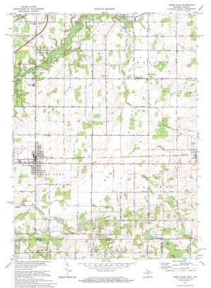
Three Oaks Topo Map Michigan
To zoom in, hover over the map of Three Oaks
USGS Topo Quad 41086g5 - 1:24,000 scale
| Topo Map Name: | Three Oaks |
| USGS Topo Quad ID: | 41086g5 |
| Print Size: | ca. 21 1/4" wide x 27" high |
| Southeast Coordinates: | 41.75° N latitude / 86.5° W longitude |
| Map Center Coordinates: | 41.8125° N latitude / 86.5625° W longitude |
| U.S. States: | MI, IN |
| Filename: | o41086g5.jpg |
| Download Map JPG Image: | Three Oaks topo map 1:24,000 scale |
| Map Type: | Topographic |
| Topo Series: | 7.5´ |
| Map Scale: | 1:24,000 |
| Source of Map Images: | United States Geological Survey (USGS) |
| Alternate Map Versions: |
Three Oaks MI 1970, updated 1973 Download PDF Buy paper map Three Oaks MI 2011 Download PDF Buy paper map Three Oaks MI 2014 Download PDF Buy paper map Three Oaks MI 2016 Download PDF Buy paper map |
1:24,000 Topo Quads surrounding Three Oaks
> Back to 41086e1 at 1:100,000 scale
> Back to 41086a1 at 1:250,000 scale
> Back to U.S. Topo Maps home
Three Oaks topo map: Gazetteer
Three Oaks: Lakes
Davidson Lake elevation 222m 728′Davidson Lake elevation 235m 770′
Klutes Lakes elevation 196m 643′
Lake Louise elevation 192m 629′
Three Oaks: Parks
Harbert Community Park elevation 188m 616′The Dewey Cannon Historical Marker elevation 213m 698′
Warren Woods State Park elevation 191m 626′
Watkins Memorial Park elevation 209m 685′
Three Oaks: Populated Places
Avery elevation 207m 679′Oakview Estates Mobile Home Park elevation 202m 662′
Three Oaks elevation 211m 692′
Three Oaks: Post Offices
Three Oaks Post Office elevation 212m 695′Three Oaks: Streams
Beaverdam Creek elevation 198m 649′Blue Jay Creek elevation 194m 636′
Dowling Creek elevation 197m 646′
East Branch Galien River elevation 185m 606′
Three Oaks: Valleys
Elm Valley elevation 196m 643′Three Oaks digital topo map on disk
Buy this Three Oaks topo map showing relief, roads, GPS coordinates and other geographical features, as a high-resolution digital map file on DVD:
Northern Illinois, Northern Indiana & Southwestern Michigan
Buy digital topo maps: Northern Illinois, Northern Indiana & Southwestern Michigan


