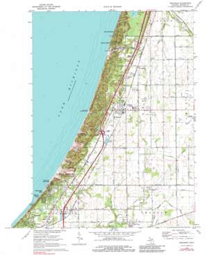
Bridgman Topo Map Michigan
To zoom in, hover over the map of Bridgman
USGS Topo Quad 41086h5 - 1:24,000 scale
| Topo Map Name: | Bridgman |
| USGS Topo Quad ID: | 41086h5 |
| Print Size: | ca. 21 1/4" wide x 27" high |
| Southeast Coordinates: | 41.875° N latitude / 86.5° W longitude |
| Map Center Coordinates: | 41.9375° N latitude / 86.5625° W longitude |
| U.S. State: | MI |
| Filename: | o41086h5.jpg |
| Download Map JPG Image: | Bridgman topo map 1:24,000 scale |
| Map Type: | Topographic |
| Topo Series: | 7.5´ |
| Map Scale: | 1:24,000 |
| Source of Map Images: | United States Geological Survey (USGS) |
| Alternate Map Versions: |
Bridgman MI 1970, updated 1973 Download PDF Buy paper map Bridgman MI 1970, updated 1984 Download PDF Buy paper map Bridgman MI 2011 Download PDF Buy paper map Bridgman MI 2014 Download PDF Buy paper map Bridgman MI 2016 Download PDF Buy paper map |
1:24,000 Topo Quads surrounding Bridgman
> Back to 41086e1 at 1:100,000 scale
> Back to 41086a1 at 1:250,000 scale
> Back to U.S. Topo Maps home
Bridgman topo map: Gazetteer
Bridgman: Airports
Bridgman Community Air Park elevation 205m 672′Del Hickcox Airport elevation 192m 629′
Hickcox Landing Strip elevation 193m 633′
Myers Airport elevation 216m 708′
Bridgman: Canals
Becker Drain elevation 205m 672′Painterville Drain elevation 177m 580′
Shuler Drain elevation 194m 636′
Thorton Valley Drain elevation 193m 633′
Bridgman: Crossings
Interchange 12 elevation 195m 639′Interchange 16 elevation 218m 715′
Bridgman: Lakes
Lake Anne elevation 195m 639′Bridgman: Parks
Lake Township Park elevation 212m 695′Warren Dunes State Park elevation 224m 734′
Weko Beach Recreational Area elevation 204m 669′
Bridgman: Populated Places
Bethany Beach elevation 195m 639′Bridgman elevation 207m 679′
Jerico elevation 203m 666′
Livingston elevation 205m 672′
New Troy elevation 199m 652′
Rosemary Beach elevation 199m 652′
Sawyer elevation 201m 659′
Shorewood Hills elevation 193m 633′
Tower Hill Shorelands elevation 184m 603′
Warren Dunes Estates Mobile Home Park elevation 205m 672′
Waverland Beach elevation 182m 597′
Bridgman: Post Offices
Bridgman Post Office elevation 207m 679′Livingston Post Office (historical) elevation 205m 672′
New Troy Post Office elevation 199m 652′
Sawyer Post Office elevation 199m 652′
Bridgman: Streams
Kirktown Creek elevation 185m 606′Bridgman: Summits
Great Warren Dune elevation 225m 738′Mount Edward elevation 242m 793′
Mount Fuller elevation 227m 744′
Mount Randall elevation 235m 770′
Pikes Peak elevation 229m 751′
Tower Hill elevation 233m 764′
Bridgman digital topo map on disk
Buy this Bridgman topo map showing relief, roads, GPS coordinates and other geographical features, as a high-resolution digital map file on DVD:
Northern Illinois, Northern Indiana & Southwestern Michigan
Buy digital topo maps: Northern Illinois, Northern Indiana & Southwestern Michigan


