Gifford Topo Map Indiana
To zoom in, hover over the map of Gifford
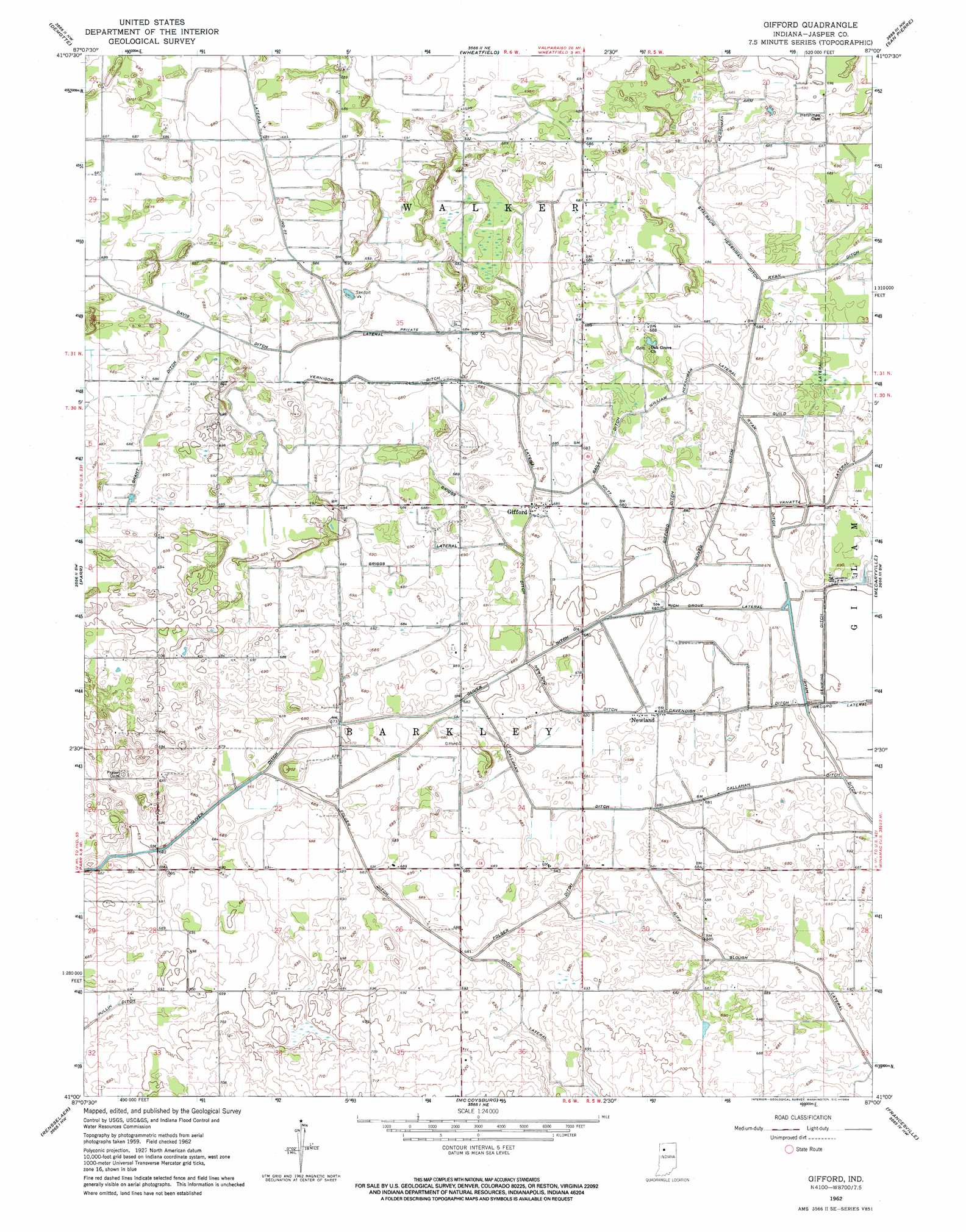
USGS Topo Quad 41087a1 - 1:24,000 scale
| Topo Map Name: | Gifford |
| USGS Topo Quad ID: | 41087a1 |
| Print Size: | ca. 21 1/4" wide x 27" high |
| Southeast Coordinates: | 41° N latitude / 87° W longitude |
| Map Center Coordinates: | 41.0625° N latitude / 87.0625° W longitude |
| U.S. State: | IN |
| Filename: | o41087a1.jpg |
| Download Map JPG Image: | Gifford topo map 1:24,000 scale |
| Map Type: | Topographic |
| Topo Series: | 7.5´ |
| Map Scale: | 1:24,000 |
| Source of Map Images: | United States Geological Survey (USGS) |
| Alternate Map Versions: |
Gifford IN 1962, updated 1964 Download PDF Buy paper map Gifford IN 2010 Download PDF Buy paper map Gifford IN 2013 Download PDF Buy paper map Gifford IN 2016 Download PDF Buy paper map |
1:24,000 Topo Quads surrounding Gifford
Leroy |
Hebron |
Kouts |
La Crosse |
English Lake |
Shelby |
Demotte |
Wheatfield |
San Pierre |
North Judson |
Fair Oaks |
Parr |
Gifford |
Medaryville |
North Judson Se |
Mount Ayr |
Rensselaer |
Mccoysburg |
Francesville |
Monon Ne |
Goodland |
Remington |
Wolcott |
Monon |
Monticello North |
> Back to 41087a1 at 1:100,000 scale
> Back to 41086a1 at 1:250,000 scale
> Back to U.S. Topo Maps home
Gifford topo map: Gazetteer
Gifford: Canals
Bailey Ditch elevation 207m 679′Callahan Ditch elevation 207m 679′
Cavendish Ditch elevation 206m 675′
Folger Ditch elevation 209m 685′
Gehring Ditch elevation 207m 679′
Gifford Ditch elevation 208m 682′
Grant Ditch elevation 210m 688′
Griggs Ditch elevation 209m 685′
Griggs Lateral elevation 210m 688′
Guild Lateral elevation 209m 685′
Hershman Arm elevation 209m 685′
Lateral Number Seventy-seven elevation 207m 679′
Moody Lateral elevation 208m 682′
Newland Ditch elevation 205m 672′
Oliver Ditch elevation 209m 685′
Rich Grove Lateral elevation 205m 672′
Ryan Ditch elevation 208m 682′
Stalbaum Hershman Ditch elevation 208m 682′
Vernigor Ditch elevation 206m 675′
William Hershman Lateral elevation 209m 685′
Wynkoop Ditch elevation 207m 679′
Gifford: Populated Places
Gifford elevation 209m 685′Laura elevation 209m 685′
Lewiston elevation 208m 682′
Newland elevation 208m 682′
Gifford digital topo map on disk
Buy this Gifford topo map showing relief, roads, GPS coordinates and other geographical features, as a high-resolution digital map file on DVD:
Northern Illinois, Northern Indiana & Southwestern Michigan
Buy digital topo maps: Northern Illinois, Northern Indiana & Southwestern Michigan