Kouts Topo Map Indiana
To zoom in, hover over the map of Kouts
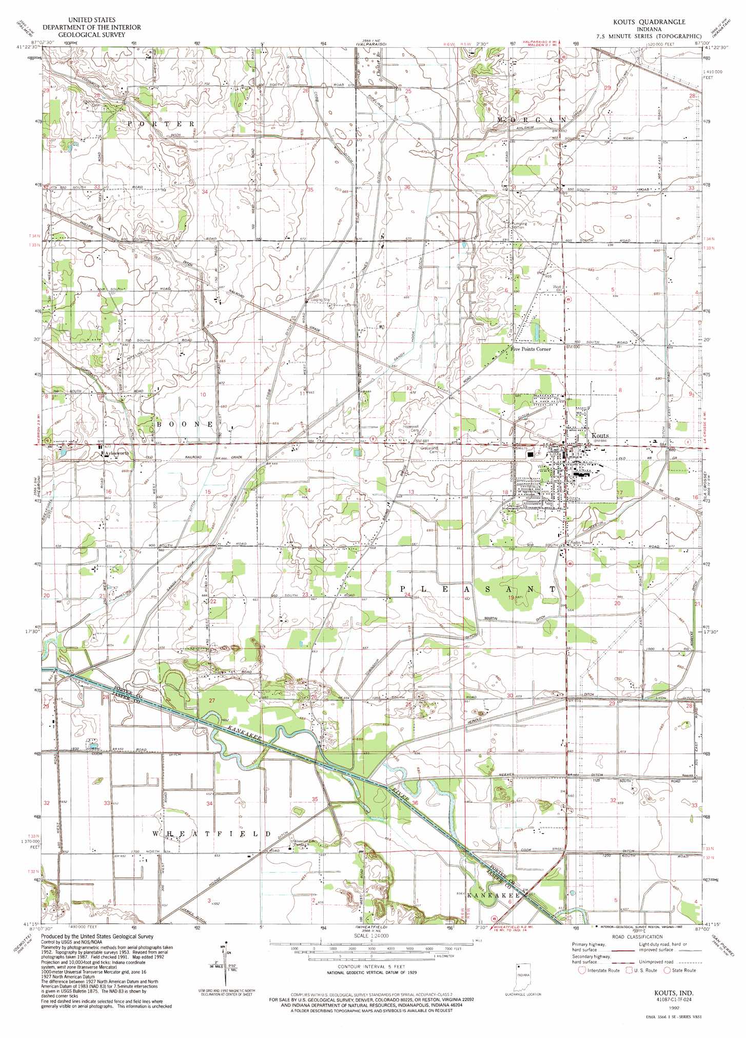
USGS Topo Quad 41087c1 - 1:24,000 scale
| Topo Map Name: | Kouts |
| USGS Topo Quad ID: | 41087c1 |
| Print Size: | ca. 21 1/4" wide x 27" high |
| Southeast Coordinates: | 41.25° N latitude / 87° W longitude |
| Map Center Coordinates: | 41.3125° N latitude / 87.0625° W longitude |
| U.S. State: | IN |
| Filename: | o41087c1.jpg |
| Download Map JPG Image: | Kouts topo map 1:24,000 scale |
| Map Type: | Topographic |
| Topo Series: | 7.5´ |
| Map Scale: | 1:24,000 |
| Source of Map Images: | United States Geological Survey (USGS) |
| Alternate Map Versions: |
Kouts IN 1953, updated 1955 Download PDF Buy paper map Kouts IN 1969, updated 1971 Download PDF Buy paper map Kouts IN 1969, updated 1989 Download PDF Buy paper map Kouts IN 1992, updated 1992 Download PDF Buy paper map Kouts IN 2010 Download PDF Buy paper map Kouts IN 2013 Download PDF Buy paper map Kouts IN 2016 Download PDF Buy paper map |
1:24,000 Topo Quads surrounding Kouts
Gary |
Portage |
Chesterton |
Westville |
Laporte West |
Crown Point |
Palmer |
Valparaiso |
Wanatah |
Hanna |
Leroy |
Hebron |
Kouts |
La Crosse |
English Lake |
Shelby |
Demotte |
Wheatfield |
San Pierre |
North Judson |
Fair Oaks |
Parr |
Gifford |
Medaryville |
North Judson Se |
> Back to 41087a1 at 1:100,000 scale
> Back to 41086a1 at 1:250,000 scale
> Back to U.S. Topo Maps home
Kouts topo map: Gazetteer
Kouts: Canals
Breyfogel Ditch elevation 200m 656′Crooked Creek elevation 199m 652′
James Ditch elevation 198m 649′
Jones Ditch elevation 203m 666′
Martin Ditch elevation 206m 675′
Phillips Ditch elevation 202m 662′
Pleasant Township Ditch elevation 200m 656′
Sandy Hook Ditch elevation 201m 659′
Kouts: Populated Places
Aylesworth elevation 206m 675′Five Points Corner elevation 210m 688′
Kouts elevation 208m 682′
Kouts: Streams
Chester Branch elevation 205m 672′Kouts digital topo map on disk
Buy this Kouts topo map showing relief, roads, GPS coordinates and other geographical features, as a high-resolution digital map file on DVD:
Northern Illinois, Northern Indiana & Southwestern Michigan
Buy digital topo maps: Northern Illinois, Northern Indiana & Southwestern Michigan