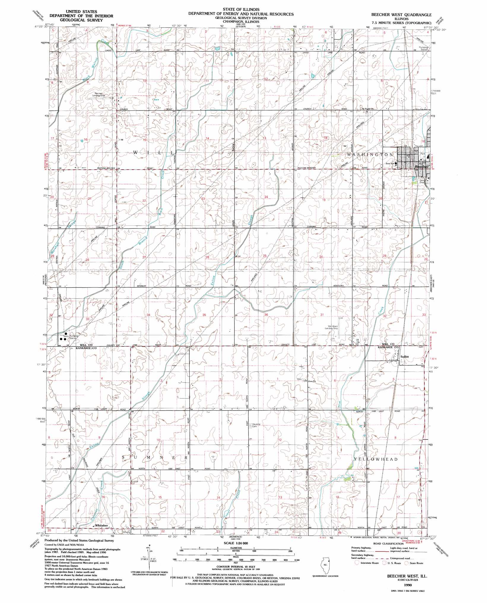
Beecher West Topo Map Illinois
To zoom in, hover over the map of Beecher West
USGS Topo Quad 41087c6 - 1:24,000 scale
| Topo Map Name: | Beecher West |
| USGS Topo Quad ID: | 41087c6 |
| Print Size: | ca. 21 1/4" wide x 27" high |
| Southeast Coordinates: | 41.25° N latitude / 87.625° W longitude |
| Map Center Coordinates: | 41.3125° N latitude / 87.6875° W longitude |
| U.S. State: | IL |
| Filename: | o41087c6.jpg |
| Download Map JPG Image: | Beecher West topo map 1:24,000 scale |
| Map Type: | Topographic |
| Topo Series: | 7.5´ |
| Map Scale: | 1:24,000 |
| Source of Map Images: | United States Geological Survey (USGS) |
| Alternate Map Versions: |
Beecher West IL 1953, updated 1955 Download PDF Buy paper map Beecher West IL 1953, updated 1974 Download PDF Buy paper map Beecher West IL 1990, updated 1991 Download PDF Buy paper map Beecher West IL 2012 Download PDF Buy paper map Beecher West IL 2015 Download PDF Buy paper map |
1:24,000 Topo Quads surrounding Beecher West
Mokena |
Tinley Park |
Harvey |
Calumet City |
Highland |
Manhattan |
Frankfort |
Steger |
Dyer |
Saint John |
Wilton Center |
Peotone |
Beecher West |
Beecher East |
Lowell |
Bourbonnais |
Bradley |
Momence |
Illiana Heights |
Schneider |
West Kankakee |
Kankakee |
Saint Anne |
Leesville |
Enos |
> Back to 41087a1 at 1:100,000 scale
> Back to 41086a1 at 1:250,000 scale
> Back to U.S. Topo Maps home
Beecher West topo map: Gazetteer
Beecher West: Airports
Norman Airport elevation 232m 761′Norman Landing Strip elevation 217m 711′
Van Alven Landing Strip elevation 217m 711′
Von Alvens Airview Airport elevation 214m 702′
Beecher West: Parks
Depot Park elevation 220m 721′Lions Park elevation 219m 718′
Sippel Memorial Field elevation 215m 705′
Water Tower Park elevation 225m 738′
Womens Welfare Park elevation 222m 728′
Beecher West: Populated Places
Judson (historical) elevation 214m 702′Sollitt elevation 217m 711′
Whitaker elevation 212m 695′
Beecher West: Post Offices
Beecher Post Office elevation 216m 708′Beecher West digital topo map on disk
Buy this Beecher West topo map showing relief, roads, GPS coordinates and other geographical features, as a high-resolution digital map file on DVD:
Northern Illinois, Northern Indiana & Southwestern Michigan
Buy digital topo maps: Northern Illinois, Northern Indiana & Southwestern Michigan