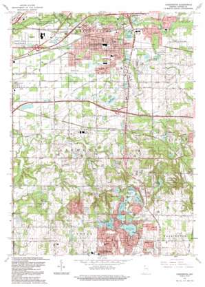
Chesterton Topo Map Indiana
To zoom in, hover over the map of Chesterton
USGS Topo Quad 41087e1 - 1:24,000 scale
| Topo Map Name: | Chesterton |
| USGS Topo Quad ID: | 41087e1 |
| Print Size: | ca. 21 1/4" wide x 27" high |
| Southeast Coordinates: | 41.5° N latitude / 87° W longitude |
| Map Center Coordinates: | 41.5625° N latitude / 87.0625° W longitude |
| U.S. State: | IN |
| Filename: | o41087e1.jpg |
| Download Map JPG Image: | Chesterton topo map 1:24,000 scale |
| Map Type: | Topographic |
| Topo Series: | 7.5´ |
| Map Scale: | 1:24,000 |
| Source of Map Images: | United States Geological Survey (USGS) |
| Alternate Map Versions: |
Chestertown IN 1953, updated 1955 Download PDF Buy paper map Chesterton IN 1962, updated 1964 Download PDF Buy paper map Chesterton IN 1962, updated 1969 Download PDF Buy paper map Chesterton IN 1962, updated 1980 Download PDF Buy paper map Chesterton IN 1962, updated 1987 Download PDF Buy paper map Chesterton IN 1991, updated 1992 Download PDF Buy paper map Chesterton IN 2010 Download PDF Buy paper map Chesterton IN 2013 Download PDF Buy paper map Chesterton IN 2016 Download PDF Buy paper map |
1:24,000 Topo Quads surrounding Chesterton
> Back to 41087e1 at 1:100,000 scale
> Back to 41086a1 at 1:250,000 scale
> Back to U.S. Topo Maps home
Chesterton topo map: Gazetteer
Chesterton: Canals
Gustafson Ditch elevation 192m 629′Johnson Ditch elevation 205m 672′
Pope-O'Conner Ditch elevation 194m 636′
Shooter Ditch elevation 204m 669′
Swanson Lamporte Ditch elevation 195m 639′
Chesterton: Crossings
Interchange 3 elevation 206m 675′Chesterton: Dams
Loomis Lake Dam elevation 250m 820′Traekabas Mill Dam elevation 213m 698′
Chesterton: Lakes
Billington Lake elevation 193m 633′Bulls-Eye Lake elevation 252m 826′
Canada Lake elevation 242m 793′
Carlson Pond elevation 236m 774′
Chestnut Lakes elevation 199m 652′
Chubb Lake elevation 190m 623′
Deep Lake elevation 243m 797′
Flint Lake elevation 242m 793′
Lake Charles elevation 192m 629′
Lake Florence elevation 195m 639′
Long Lake elevation 242m 793′
Morgan Lake elevation 193m 633′
Moss Lake elevation 245m 803′
Mud Lake elevation 243m 797′
Mud Lake elevation 193m 633′
Pratt Lake elevation 191m 626′
Round Lake elevation 243m 797′
Spectacle Lake elevation 248m 813′
Wauhob Lake elevation 242m 793′
Chesterton: Parks
Bicentennial Park elevation 259m 849′Camp Farr elevation 218m 715′
Chesterton Park elevation 196m 643′
Coffee Creek Park elevation 191m 626′
Dogwood Park elevation 195m 639′
Hawthorne Park elevation 190m 623′
Indian Springs Park elevation 194m 636′
Lakewood Park elevation 193m 633′
Moraine Nature Preserve elevation 259m 849′
Rodgers-Lakewood Park elevation 252m 826′
Thomds Centennial Park elevation 197m 646′
Chesterton: Populated Places
Babcock elevation 195m 639′Blackhawk Beach elevation 250m 820′
Brummitt Acres elevation 196m 643′
Burlington Beach elevation 250m 820′
Chesterton elevation 195m 639′
Crocker elevation 192m 629′
Edgewater elevation 246m 807′
Forest Oaks elevation 197m 646′
Graham Woods elevation 193m 633′
Haglund elevation 193m 633′
Hillcrest elevation 254m 833′
Lake View elevation 248m 813′
Liberty Farm Mobile Home Park elevation 235m 770′
Long Lake Island elevation 252m 826′
Meadowbrook elevation 194m 636′
Morgan Park elevation 196m 643′
Northwood Park elevation 252m 826′
Porter elevation 195m 639′
Rainbow Mobile Home Park elevation 195m 639′
Roble Woods elevation 252m 826′
Suman elevation 226m 741′
Tratebas Mill elevation 215m 705′
Wake Robin Fields elevation 195m 639′
Western Acres elevation 195m 639′
Whispering Sands Mobile Home Court elevation 203m 666′
Woodville elevation 217m 711′
Chesterton: Post Offices
Chesterton Post Office elevation 197m 646′Chesterton: Reservoirs
Loomis Lake elevation 254m 833′Mink Lake elevation 245m 803′
Chesterton: Springs
Butternut Springs elevation 212m 695′Chesterton: Streams
Coffee Creek elevation 187m 613′Damon Run elevation 186m 610′
Peterson Ditch elevation 195m 639′
Sand Creek elevation 187m 613′
Chesterton: Swamps
Moore Swamp elevation 240m 787′Chesterton digital topo map on disk
Buy this Chesterton topo map showing relief, roads, GPS coordinates and other geographical features, as a high-resolution digital map file on DVD:
Northern Illinois, Northern Indiana & Southwestern Michigan
Buy digital topo maps: Northern Illinois, Northern Indiana & Southwestern Michigan


