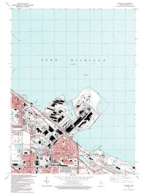
Whiting Topo Map Indiana
To zoom in, hover over the map of Whiting
USGS Topo Quad 41087f4 - 1:24,000 scale
| Topo Map Name: | Whiting |
| USGS Topo Quad ID: | 41087f4 |
| Print Size: | ca. 21 1/4" wide x 27" high |
| Southeast Coordinates: | 41.625° N latitude / 87.375° W longitude |
| Map Center Coordinates: | 41.6875° N latitude / 87.4375° W longitude |
| U.S. State: | IN |
| Filename: | o41087f4.jpg |
| Download Map JPG Image: | Whiting topo map 1:24,000 scale |
| Map Type: | Topographic |
| Topo Series: | 7.5´ |
| Map Scale: | 1:24,000 |
| Source of Map Images: | United States Geological Survey (USGS) |
| Alternate Map Versions: |
Whiting IN 1953, updated 1955 Download PDF Buy paper map Whiting IN 1960, updated 1962 Download PDF Buy paper map Whiting IN 1968, updated 1970 Download PDF Buy paper map Whiting IN 1968, updated 1981 Download PDF Buy paper map Whiting IN 1991, updated 1992 Download PDF Buy paper map Whiting IN 1998, updated 2001 Download PDF Buy paper map Whiting IN 2010 Download PDF Buy paper map Whiting IN 2013 Download PDF Buy paper map Whiting IN 2016 Download PDF Buy paper map |
1:24,000 Topo Quads surrounding Whiting
Chicago Loop |
||||
Englewood |
Jackson Park |
|||
Blue Island |
Lake Calumet |
Whiting |
Ogden Dunes |
|
Harvey |
Calumet City |
Highland |
Gary |
Portage |
Steger |
Dyer |
Saint John |
Crown Point |
Palmer |
> Back to 41087e1 at 1:100,000 scale
> Back to 41086a1 at 1:250,000 scale
> Back to U.S. Topo Maps home
Whiting topo map: Gazetteer
Whiting: Bars
Indiana Shoals elevation 175m 574′Whiting: Canals
Indiana Harbor Canal elevation 175m 574′Lake George Canal elevation 175m 574′
Whiting: Harbors
Buffington Harbor elevation 175m 574′Indiana Harbor elevation 175m 574′
The Forks elevation 175m 574′
Whiting: Parks
Block Field elevation 179m 587′Callahan Park elevation 180m 590′
City Hall Park elevation 178m 583′
Edward Valve Park elevation 178m 583′
Good Shepherd Episcopal Church elevation 178m 583′
Indiana Harbor Catholic Elementary School elevation 180m 590′
Irving Park elevation 183m 600′
Jeorse Park elevation 181m 593′
Mark Town Park elevation 180m 590′
Marktown Historic District elevation 180m 590′
Nunez Park elevation 181m 593′
Riley Park elevation 179m 587′
Sunnyside Park elevation 181m 593′
Tod Park elevation 178m 583′
Washington Park elevation 180m 590′
Whiting Park elevation 179m 587′
Whiting: Populated Places
Buffington elevation 180m 590′Clarke Junction elevation 180m 590′
East Chicago elevation 180m 590′
Indiana Harbor elevation 180m 590′
Whiting elevation 179m 587′
Whiting: Post Offices
Chicago Avenue Station East Chicago Post Office elevation 178m 583′East Chicago Main Post Office elevation 179m 587′
Harbor Station East Chicago Post Office elevation 180m 590′
Whiting Post Office elevation 179m 587′
Whiting digital topo map on disk
Buy this Whiting topo map showing relief, roads, GPS coordinates and other geographical features, as a high-resolution digital map file on DVD:
Northern Illinois, Northern Indiana & Southwestern Michigan
Buy digital topo maps: Northern Illinois, Northern Indiana & Southwestern Michigan


