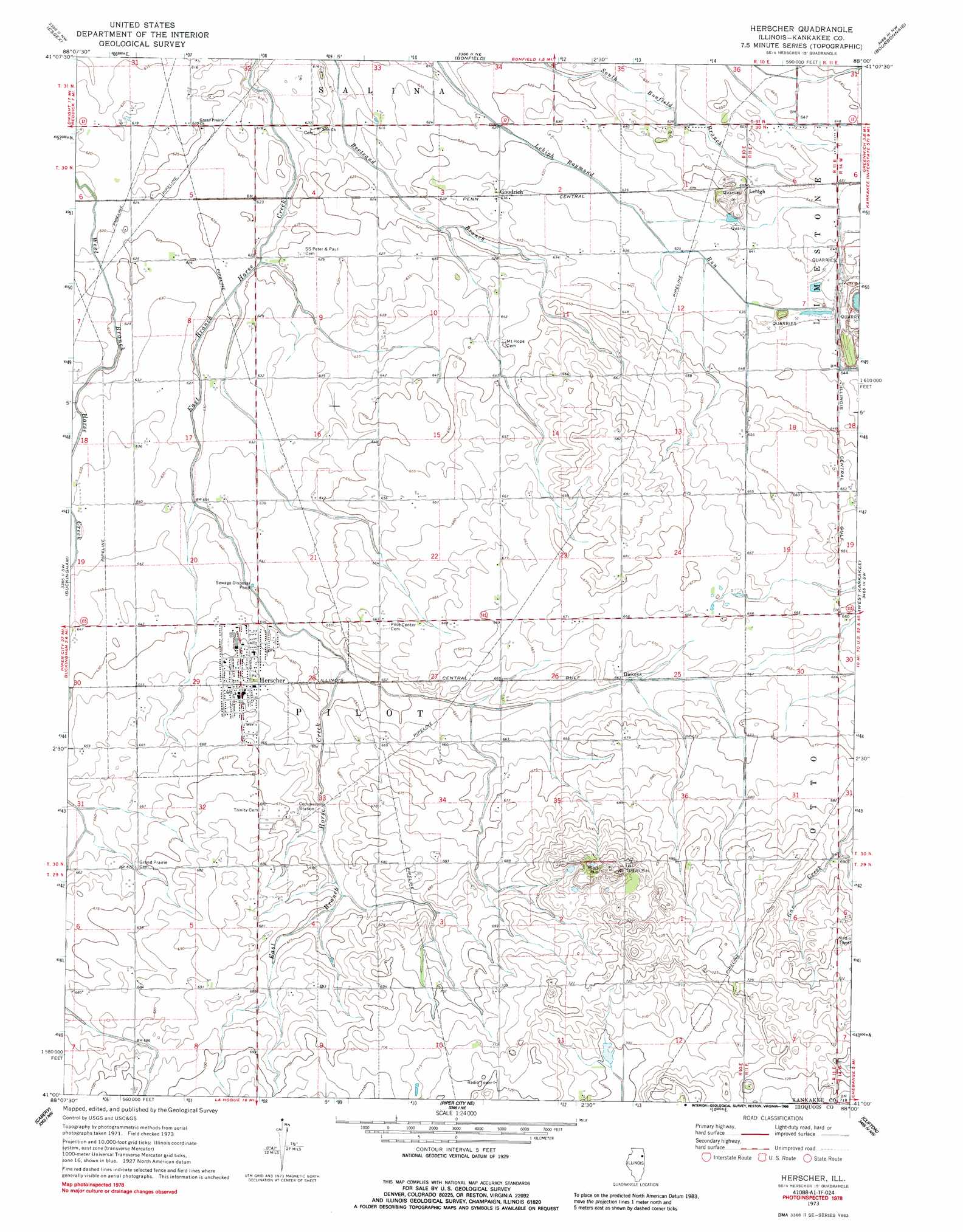
Herscher Topo Map Illinois
To zoom in, hover over the map of Herscher
USGS Topo Quad 41088a1 - 1:24,000 scale
| Topo Map Name: | Herscher |
| USGS Topo Quad ID: | 41088a1 |
| Print Size: | ca. 21 1/4" wide x 27" high |
| Southeast Coordinates: | 41° N latitude / 88° W longitude |
| Map Center Coordinates: | 41.0625° N latitude / 88.0625° W longitude |
| U.S. State: | IL |
| Filename: | o41088a1.jpg |
| Download Map JPG Image: | Herscher topo map 1:24,000 scale |
| Map Type: | Topographic |
| Topo Series: | 7.5´ |
| Map Scale: | 1:24,000 |
| Source of Map Images: | United States Geological Survey (USGS) |
| Alternate Map Versions: |
Herscher IL 1973, updated 1975 Download PDF Buy paper map Herscher IL 1973, updated 1988 Download PDF Buy paper map Herscher IL 2012 Download PDF Buy paper map Herscher IL 2015 Download PDF Buy paper map |
1:24,000 Topo Quads surrounding Herscher
Coal City |
Wilmington |
Symerton |
Wilton Center |
Peotone |
Gardner |
Essex |
Bonfield |
Bourbonnais |
Bradley |
Campus |
Buckingham |
Herscher |
West Kankakee |
Kankakee |
Cullom |
Cabery |
Piper City Ne |
Clifton |
L'Erable |
Chatsworth North |
Piper City |
La Hogue |
Gilman |
Crescent |
> Back to 41088a1 at 1:100,000 scale
> Back to 41088a1 at 1:250,000 scale
> Back to U.S. Topo Maps home
Herscher topo map: Gazetteer
Herscher: Populated Places
Dickeys elevation 203m 666′Goodrich elevation 194m 636′
Herscher elevation 201m 659′
Lehigh elevation 198m 649′
Pilot Center (historical) elevation 202m 662′
Herscher: Summits
Pilot Hill elevation 229m 751′Herscher digital topo map on disk
Buy this Herscher topo map showing relief, roads, GPS coordinates and other geographical features, as a high-resolution digital map file on DVD:
Northern Illinois, Northern Indiana & Southwestern Michigan
Buy digital topo maps: Northern Illinois, Northern Indiana & Southwestern Michigan