Essex Topo Map Illinois
To zoom in, hover over the map of Essex
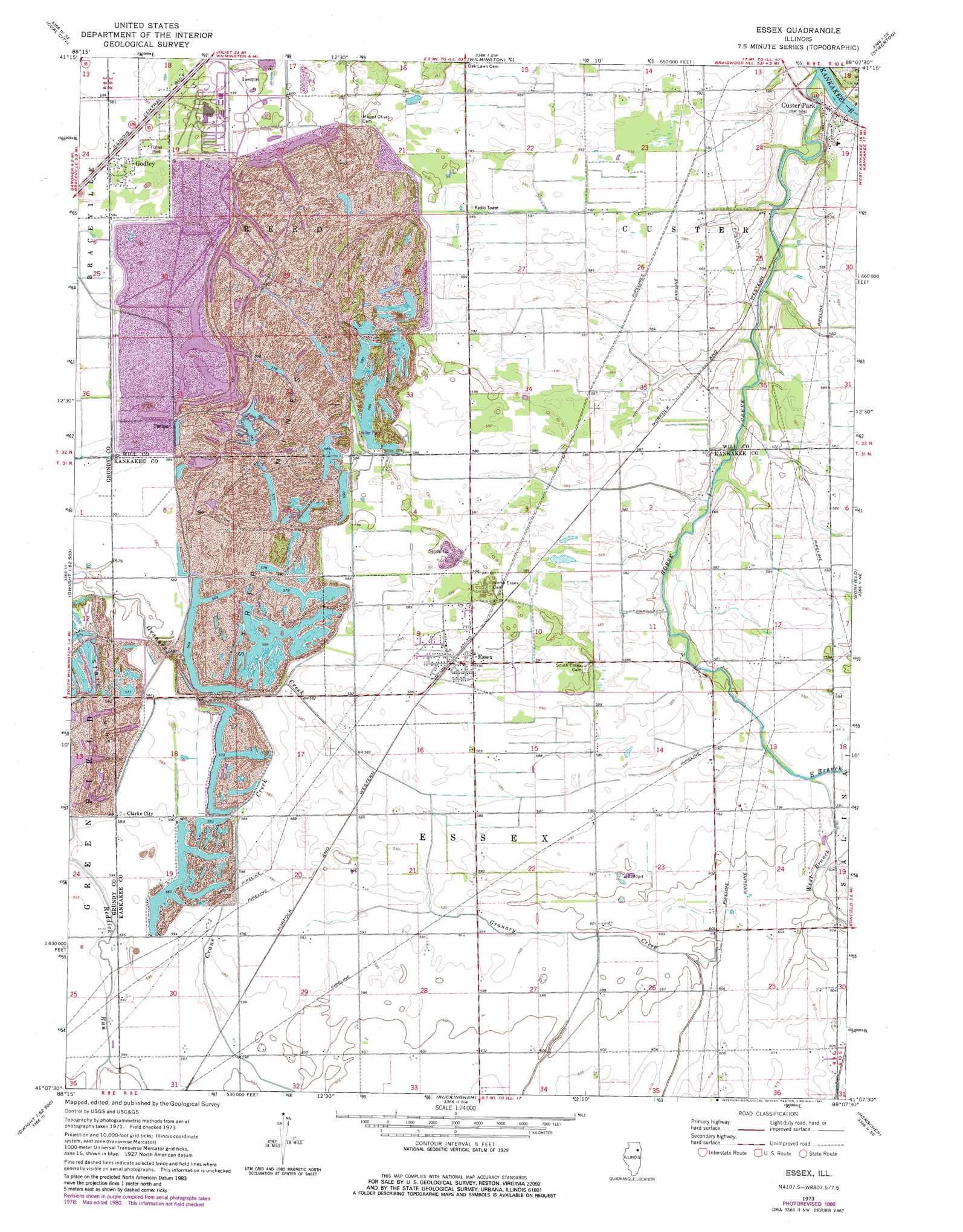
USGS Topo Quad 41088b2 - 1:24,000 scale
| Topo Map Name: | Essex |
| USGS Topo Quad ID: | 41088b2 |
| Print Size: | ca. 21 1/4" wide x 27" high |
| Southeast Coordinates: | 41.125° N latitude / 88.125° W longitude |
| Map Center Coordinates: | 41.1875° N latitude / 88.1875° W longitude |
| U.S. State: | IL |
| Filename: | o41088b2.jpg |
| Download Map JPG Image: | Essex topo map 1:24,000 scale |
| Map Type: | Topographic |
| Topo Series: | 7.5´ |
| Map Scale: | 1:24,000 |
| Source of Map Images: | United States Geological Survey (USGS) |
| Alternate Map Versions: |
Essex IL 1973, updated 1975 Download PDF Buy paper map Essex IL 1973, updated 1981 Download PDF Buy paper map Essex IL 2012 Download PDF Buy paper map Essex IL 2015 Download PDF Buy paper map |
1:24,000 Topo Quads surrounding Essex
Lisbon |
Minooka |
Channahon |
Elwood |
Manhattan |
Morris |
Coal City |
Wilmington |
Symerton |
Wilton Center |
Mazon |
Gardner |
Essex |
Bonfield |
Bourbonnais |
Dwight |
Campus |
Buckingham |
Herscher |
West Kankakee |
Saunemin |
Cullom |
Cabery |
Piper City Ne |
Clifton |
> Back to 41088a1 at 1:100,000 scale
> Back to 41088a1 at 1:250,000 scale
> Back to U.S. Topo Maps home
Essex topo map: Gazetteer
Essex: Airports
Braidwood National Park Service Heliport elevation 183m 600′Lagrange Airport elevation 179m 587′
Rashs Acres Airport elevation 181m 593′
Essex: Dams
Braidwood Station Cooling Pond Dam elevation 191m 626′Essex: Mines
A Mine elevation 181m 593′Clark City Mine elevation 180m 590′
Grand Prairie Mine elevation 182m 597′
Joliet And Aurora Number 1 Mine elevation 183m 600′
K Mine elevation 178m 583′
M Mine elevation 179m 587′
Pit 11 Northern Mine elevation 183m 600′
Pit 12 Northern Mine elevation 175m 574′
Pit 13 Northern Mine elevation 183m 600′
Pit 14 Northern Mine elevation 180m 590′
Pit 15 Northern Mine elevation 192m 629′
Rixson Mine elevation 183m 600′
Wilmington Number 2 Mine elevation 183m 600′
Wilmington Number 6 Mine elevation 177m 580′
Essex: Populated Places
Clarke City elevation 180m 590′Custer Park elevation 171m 561′
Essex elevation 180m 590′
Godley elevation 179m 587′
Torino elevation 177m 580′
Essex: Reservoirs
Braidwood Power Plant Cooling Pond elevation 191m 626′Essex: Streams
Crane Creek elevation 175m 574′East Branch Horse Creek elevation 178m 583′
Horse Creek elevation 164m 538′
West Branch Horse Creek elevation 178m 583′
Essex digital topo map on disk
Buy this Essex topo map showing relief, roads, GPS coordinates and other geographical features, as a high-resolution digital map file on DVD:
Northern Illinois, Northern Indiana & Southwestern Michigan
Buy digital topo maps: Northern Illinois, Northern Indiana & Southwestern Michigan