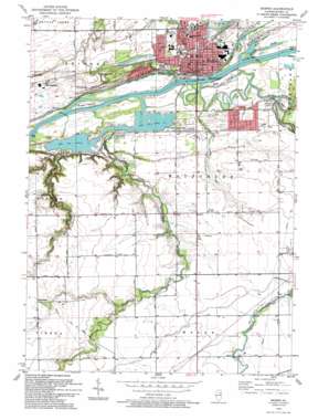
Morris Topo Map Illinois
To zoom in, hover over the map of Morris
USGS Topo Quad 41088c4 - 1:24,000 scale
| Topo Map Name: | Morris |
| USGS Topo Quad ID: | 41088c4 |
| Print Size: | ca. 21 1/4" wide x 27" high |
| Southeast Coordinates: | 41.25° N latitude / 88.375° W longitude |
| Map Center Coordinates: | 41.3125° N latitude / 88.4375° W longitude |
| U.S. State: | IL |
| Filename: | o41088c4.jpg |
| Download Map JPG Image: | Morris topo map 1:24,000 scale |
| Map Type: | Topographic |
| Topo Series: | 7.5´ |
| Map Scale: | 1:24,000 |
| Source of Map Images: | United States Geological Survey (USGS) |
| Alternate Map Versions: |
Morris IL 1953, updated 1955 Download PDF Buy paper map Morris IL 1953, updated 1974 Download PDF Buy paper map Morris IL 1953, updated 1981 Download PDF Buy paper map Morris IL 1993, updated 1994 Download PDF Buy paper map Morris IL 2012 Download PDF Buy paper map Morris IL 2015 Download PDF Buy paper map |
1:24,000 Topo Quads surrounding Morris
> Back to 41088a1 at 1:100,000 scale
> Back to 41088a1 at 1:250,000 scale
> Back to U.S. Topo Maps home
Morris topo map: Gazetteer
Morris: Airports
Morris Hospital Heliport elevation 156m 511′Morris: Bridges
Pine Bluff Bridge elevation 148m 485′Morris: Canals
Nettle Creek Aqueduct elevation 149m 488′Morris: Guts
Peacock Slough elevation 149m 488′Morris: Islands
Peacocks Island elevation 150m 492′Sugar Island elevation 151m 495′
Morris: Parks
Chapin Park elevation 158m 518′Gebhard Woods State Park elevation 151m 495′
Goold Park elevation 158m 518′
William Stratton State Access Area elevation 153m 501′
Morris: Populated Places
Bradley Subdivision elevation 158m 518′Claypool elevation 156m 511′
Claypool Woods elevation 156m 511′
Gaslight Village elevation 155m 508′
Heatherfield elevation 165m 541′
Lori-Sue Subdivision elevation 160m 524′
Morris elevation 157m 515′
Paytonville elevation 157m 515′
Pebble Beach elevation 159m 521′
Pine Grove elevation 160m 524′
Pine Meadow Estates elevation 156m 511′
Richards Park elevation 159m 521′
Stockdale elevation 159m 521′
Van Peterson Subdivision elevation 160m 524′
Wauponsee elevation 189m 620′
Willow Ridge elevation 157m 515′
Morris: Post Offices
Morris Post Office elevation 158m 518′Morris: Streams
Bills Run elevation 149m 488′East Fork Nettle Creek elevation 150m 492′
Mazon River elevation 149m 488′
Mud Slough elevation 150m 492′
Nettle Creek elevation 149m 488′
Spring Run elevation 150m 492′
Waupecan Creek elevation 149m 488′
Morris digital topo map on disk
Buy this Morris topo map showing relief, roads, GPS coordinates and other geographical features, as a high-resolution digital map file on DVD:
Northern Illinois, Northern Indiana & Southwestern Michigan
Buy digital topo maps: Northern Illinois, Northern Indiana & Southwestern Michigan


