Wedron Topo Map Illinois
To zoom in, hover over the map of Wedron
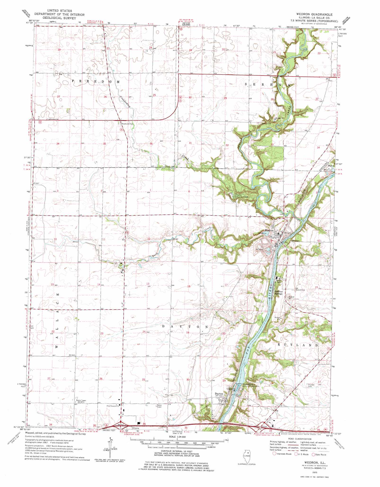
USGS Topo Quad 41088d7 - 1:24,000 scale
| Topo Map Name: | Wedron |
| USGS Topo Quad ID: | 41088d7 |
| Print Size: | ca. 21 1/4" wide x 27" high |
| Southeast Coordinates: | 41.375° N latitude / 88.75° W longitude |
| Map Center Coordinates: | 41.4375° N latitude / 88.8125° W longitude |
| U.S. State: | IL |
| Filename: | o41088d7.jpg |
| Download Map JPG Image: | Wedron topo map 1:24,000 scale |
| Map Type: | Topographic |
| Topo Series: | 7.5´ |
| Map Scale: | 1:24,000 |
| Source of Map Images: | United States Geological Survey (USGS) |
| Alternate Map Versions: |
Wedron IL 1970, updated 1978 Download PDF Buy paper map Wedron IL 2012 Download PDF Buy paper map Wedron IL 2015 Download PDF Buy paper map |
1:24,000 Topo Quads surrounding Wedron
Compton |
Paw Paw |
Shabbona Grove |
Somonauk |
Plano |
Mendota East |
Earlville |
Leland |
Sheridan |
Newark |
Troy Grove |
Prairie Center |
Wedron |
Serena |
Stavanger |
La Salle |
Starved Rock |
Ottawa |
Marseilles |
Seneca |
Tonica |
Leonore |
Streator North |
Ransom |
Kinsman |
> Back to 41088a1 at 1:100,000 scale
> Back to 41088a1 at 1:250,000 scale
> Back to U.S. Topo Maps home
Wedron topo map: Gazetteer
Wedron: Crossings
Interchange 90 elevation 191m 626′Interchange 93 elevation 185m 606′
Wedron: Dams
Dayton Dam elevation 147m 482′Wedron: Parks
Lower Fox River - Blakes Landing Nature Preserve elevation 183m 600′Wedron: Populated Places
Blakes elevation 186m 610′Dayton elevation 172m 564′
Sulphur Springs elevation 157m 515′
Wedron elevation 165m 541′
Wedron: Post Offices
Wedron Post Office elevation 163m 534′Wedron: Streams
Buck Creek elevation 151m 495′Crookedleg Creek elevation 155m 508′
Indian Creek elevation 152m 498′
Wedron digital topo map on disk
Buy this Wedron topo map showing relief, roads, GPS coordinates and other geographical features, as a high-resolution digital map file on DVD:
Northern Illinois, Northern Indiana & Southwestern Michigan
Buy digital topo maps: Northern Illinois, Northern Indiana & Southwestern Michigan