Sheridan Topo Map Illinois
To zoom in, hover over the map of Sheridan
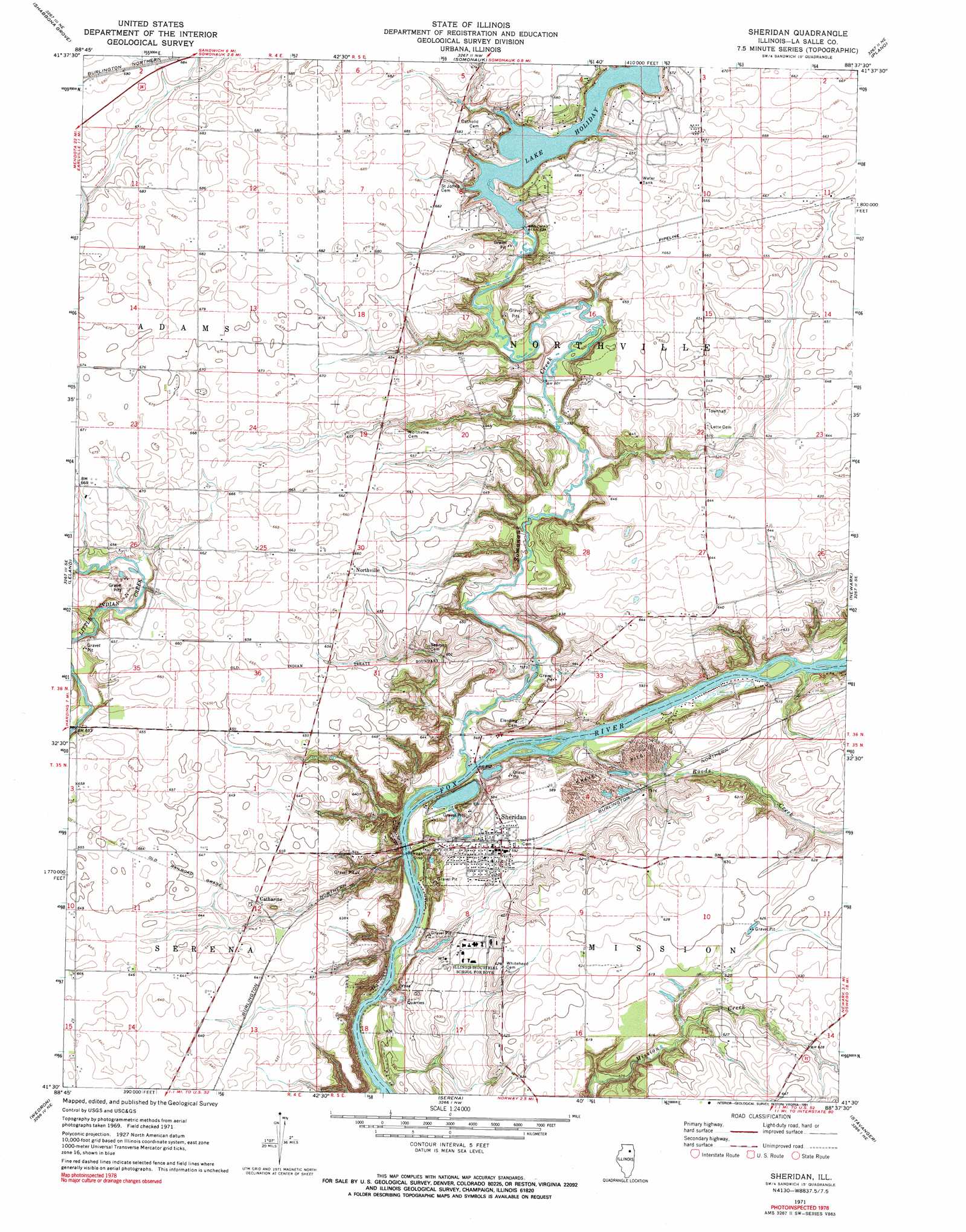
USGS Topo Quad 41088e6 - 1:24,000 scale
| Topo Map Name: | Sheridan |
| USGS Topo Quad ID: | 41088e6 |
| Print Size: | ca. 21 1/4" wide x 27" high |
| Southeast Coordinates: | 41.5° N latitude / 88.625° W longitude |
| Map Center Coordinates: | 41.5625° N latitude / 88.6875° W longitude |
| U.S. State: | IL |
| Filename: | o41088e6.jpg |
| Download Map JPG Image: | Sheridan topo map 1:24,000 scale |
| Map Type: | Topographic |
| Topo Series: | 7.5´ |
| Map Scale: | 1:24,000 |
| Source of Map Images: | United States Geological Survey (USGS) |
| Alternate Map Versions: |
Sheridan IL 1971, updated 1973 Download PDF Buy paper map Sheridan IL 1971, updated 1991 Download PDF Buy paper map Sheridan IL 2012 Download PDF Buy paper map Sheridan IL 2015 Download PDF Buy paper map |
1:24,000 Topo Quads surrounding Sheridan
Lee |
Waterman |
Hinckley |
Big Rock |
Sugar Grove |
Paw Paw |
Shabbona Grove |
Somonauk |
Plano |
Yorkville |
Earlville |
Leland |
Sheridan |
Newark |
Plattville |
Prairie Center |
Wedron |
Serena |
Stavanger |
Lisbon |
Starved Rock |
Ottawa |
Marseilles |
Seneca |
Morris |
> Back to 41088e1 at 1:100,000 scale
> Back to 41088a1 at 1:250,000 scale
> Back to U.S. Topo Maps home
Sheridan topo map: Gazetteer
Sheridan: Airports
Cwian Field elevation 180m 590′Dick Burns Farm Airport elevation 200m 656′
Harrington Farms Airport elevation 196m 643′
Johnson Airport elevation 203m 666′
Sheridan: Dams
Lake Holiday Dam elevation 193m 633′Sheridan: Mines
Bowers Pit elevation 170m 557′Troup Quarry elevation 164m 538′
Sheridan: Parks
Glen Park elevation 197m 646′Sheridan: Populated Places
Catharine elevation 196m 643′Northville elevation 200m 656′
Sheridan elevation 181m 593′
Sheridan: Reservoirs
Lake Holiday elevation 193m 633′Sheridan: Streams
Roods Creek elevation 162m 531′Somonauk Creek elevation 162m 531′
Sheridan digital topo map on disk
Buy this Sheridan topo map showing relief, roads, GPS coordinates and other geographical features, as a high-resolution digital map file on DVD:
Northern Illinois, Northern Indiana & Southwestern Michigan
Buy digital topo maps: Northern Illinois, Northern Indiana & Southwestern Michigan