Leland Topo Map Illinois
To zoom in, hover over the map of Leland
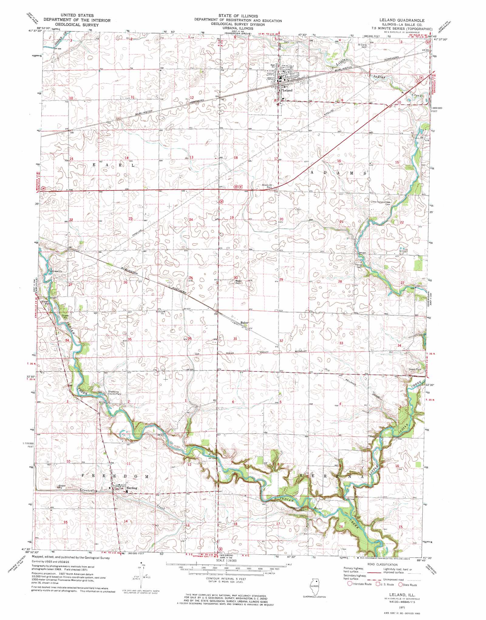
USGS Topo Quad 41088e7 - 1:24,000 scale
| Topo Map Name: | Leland |
| USGS Topo Quad ID: | 41088e7 |
| Print Size: | ca. 21 1/4" wide x 27" high |
| Southeast Coordinates: | 41.5° N latitude / 88.75° W longitude |
| Map Center Coordinates: | 41.5625° N latitude / 88.8125° W longitude |
| U.S. State: | IL |
| Filename: | o41088e7.jpg |
| Download Map JPG Image: | Leland topo map 1:24,000 scale |
| Map Type: | Topographic |
| Topo Series: | 7.5´ |
| Map Scale: | 1:24,000 |
| Source of Map Images: | United States Geological Survey (USGS) |
| Alternate Map Versions: |
Leland IL 1971, updated 1972 Download PDF Buy paper map Leland IL 1971, updated 1973 Download PDF Buy paper map Leland IL 2012 Download PDF Buy paper map Leland IL 2015 Download PDF Buy paper map |
1:24,000 Topo Quads surrounding Leland
Steward |
Lee |
Waterman |
Hinckley |
Big Rock |
Compton |
Paw Paw |
Shabbona Grove |
Somonauk |
Plano |
Mendota East |
Earlville |
Leland |
Sheridan |
Newark |
Troy Grove |
Prairie Center |
Wedron |
Serena |
Stavanger |
La Salle |
Starved Rock |
Ottawa |
Marseilles |
Seneca |
> Back to 41088e1 at 1:100,000 scale
> Back to 41088a1 at 1:250,000 scale
> Back to U.S. Topo Maps home
Leland topo map: Gazetteer
Leland: Airports
Cody Port RLA Airport elevation 202m 662′Leland: Parks
Shabbona County Park elevation 203m 666′Leland: Populated Places
Baker elevation 205m 672′Harding elevation 199m 652′
Leland elevation 212m 695′
Munson (historical) elevation 204m 669′
Leland: Streams
Little Indian Creek elevation 178m 583′Leland digital topo map on disk
Buy this Leland topo map showing relief, roads, GPS coordinates and other geographical features, as a high-resolution digital map file on DVD:
Northern Illinois, Northern Indiana & Southwestern Michigan
Buy digital topo maps: Northern Illinois, Northern Indiana & Southwestern Michigan