Waterman Topo Map Illinois
To zoom in, hover over the map of Waterman
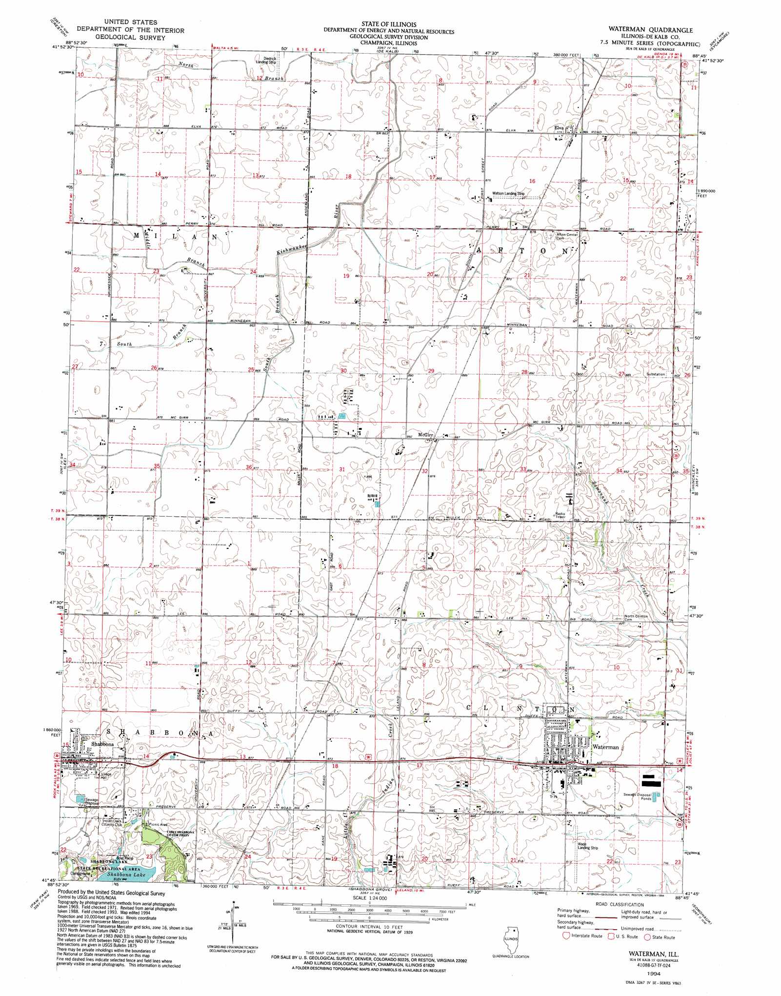
USGS Topo Quad 41088g7 - 1:24,000 scale
| Topo Map Name: | Waterman |
| USGS Topo Quad ID: | 41088g7 |
| Print Size: | ca. 21 1/4" wide x 27" high |
| Southeast Coordinates: | 41.75° N latitude / 88.75° W longitude |
| Map Center Coordinates: | 41.8125° N latitude / 88.8125° W longitude |
| U.S. State: | IL |
| Filename: | o41088g7.jpg |
| Download Map JPG Image: | Waterman topo map 1:24,000 scale |
| Map Type: | Topographic |
| Topo Series: | 7.5´ |
| Map Scale: | 1:24,000 |
| Source of Map Images: | United States Geological Survey (USGS) |
| Alternate Map Versions: |
Waterman IL 1971, updated 1973 Download PDF Buy paper map Waterman IL 1994, updated 1994 Download PDF Buy paper map Waterman IL 2012 Download PDF Buy paper map Waterman IL 2015 Download PDF Buy paper map |
1:24,000 Topo Quads surrounding Waterman
Kings |
Fairdale |
Kirkland |
Genoa |
Hampshire |
Rochelle |
Creston |
De Kalb |
Sycamore |
Maple Park |
Steward |
Lee |
Waterman |
Hinckley |
Big Rock |
Compton |
Paw Paw |
Shabbona Grove |
Somonauk |
Plano |
Mendota East |
Earlville |
Leland |
Sheridan |
Newark |
> Back to 41088e1 at 1:100,000 scale
> Back to 41088a1 at 1:250,000 scale
> Back to U.S. Topo Maps home
Waterman topo map: Gazetteer
Waterman: Airports
Diedrich Airport elevation 265m 869′Jack W Watson Airport elevation 268m 879′
Wade Airport elevation 247m 810′
Waterman: Dams
Lake Prestbury Dam elevation 241m 790′Waterman: Forests
Chief Shabbona County Forest Preserve elevation 267m 875′Waterman: Parks
Lions Park elevation 250m 820′Waterman: Populated Places
Afton Center elevation 271m 889′Elva elevation 271m 889′
McGirr elevation 273m 895′
Waterman elevation 252m 826′
Waterman: Reservoirs
Lake Prestbury elevation 241m 790′Waterman: Streams
Middle Branch South Branch Kishwaukee River elevation 262m 859′North Branch South Branch Kishwaukee River elevation 259m 849′
South Branch South Branch Kishwaukee River elevation 262m 859′
Waterman digital topo map on disk
Buy this Waterman topo map showing relief, roads, GPS coordinates and other geographical features, as a high-resolution digital map file on DVD:
Northern Illinois, Northern Indiana & Southwestern Michigan
Buy digital topo maps: Northern Illinois, Northern Indiana & Southwestern Michigan