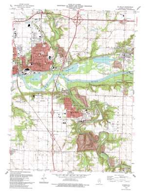
La Salle Topo Map Illinois
To zoom in, hover over the map of La Salle
USGS Topo Quad 41089c1 - 1:24,000 scale
| Topo Map Name: | La Salle |
| USGS Topo Quad ID: | 41089c1 |
| Print Size: | ca. 21 1/4" wide x 27" high |
| Southeast Coordinates: | 41.25° N latitude / 89° W longitude |
| Map Center Coordinates: | 41.3125° N latitude / 89.0625° W longitude |
| U.S. State: | IL |
| Filename: | o41089c1.jpg |
| Download Map JPG Image: | La Salle topo map 1:24,000 scale |
| Map Type: | Topographic |
| Topo Series: | 7.5´ |
| Map Scale: | 1:24,000 |
| Source of Map Images: | United States Geological Survey (USGS) |
| Alternate Map Versions: |
La Salle IL 1966, updated 1968 Download PDF Buy paper map La Salle IL 1966, updated 1979 Download PDF Buy paper map La Salle IL 1966, updated 1980 Download PDF Buy paper map La Salle IL 1993, updated 1993 Download PDF Buy paper map La Salle IL 2012 Download PDF Buy paper map La Salle IL 2015 Download PDF Buy paper map |
1:24,000 Topo Quads surrounding La Salle
> Back to 41089a1 at 1:100,000 scale
> Back to 41088a1 at 1:250,000 scale
> Back to U.S. Topo Maps home
La Salle topo map: Gazetteer
La Salle: Airports
Bassett Airport elevation 204m 669′Illinois Valley Community Hospital Heliport elevation 183m 600′
Trovero Airport elevation 193m 633′
La Salle: Crossings
Interchange 51 elevation 198m 649′Interchange 52 elevation 198m 649′
Interchange 54 elevation 200m 656′
Interchange 57 elevation 164m 538′
Interchange 75 elevation 196m 643′
Interchange 77 elevation 195m 639′
Interchange 79 elevation 204m 669′
Interchange 81 elevation 191m 626′
La Salle: Dams
Deer Park Lake Dam elevation 184m 603′La Salle: Lakes
Huse Lake elevation 137m 449′Split Rock Lake elevation 137m 449′
La Salle: Mines
Utica Pit elevation 133m 436′Vermilion Quarry elevation 160m 524′
La Salle: Parks
Baker Park elevation 189m 620′Carey Memorial Park elevation 146m 479′
Cerri Memorial Park elevation 201m 659′
Hegeler Park elevation 183m 600′
Lehigh Memorial Park elevation 193m 633′
Margery C Carlson Nature Preserve elevation 179m 587′
Market Square elevation 164m 538′
Mary Hegeler Carus Park elevation 159m 521′
Mattheissen Park elevation 179m 587′
Matthiessen Dells Nature Preserve elevation 172m 564′
Matthiessen State Park elevation 191m 626′
McKinley Park elevation 181m 593′
Pecumsaugan Creek - Blackball Mines Nature Preserve elevation 177m 580′
Pulaski Park elevation 174m 570′
Saint Marys Park elevation 190m 623′
Starved Rock Nature Preserve elevation 138m 452′
Washington Park elevation 186m 610′
La Salle: Populated Places
Bailey Falls (historical) elevation 150m 492′Deer Park elevation 168m 551′
Jonesville elevation 153m 501′
La Salle elevation 174m 570′
Little Rock (historical) elevation 140m 459′
Lowell elevation 190m 623′
Oglesby elevation 192m 629′
Utica elevation 146m 479′
La Salle: Post Offices
La Salle Post Office elevation 159m 521′Oblesby Post Office elevation 193m 633′
La Salle: Reservoirs
Deer Park Lake elevation 184m 603′La Salle: Streams
Bailey Creek elevation 141m 462′Clayton Run elevation 140m 459′
Little Vermilion River elevation 137m 449′
Pecumsaugan Creek elevation 144m 472′
Vermilion River elevation 137m 449′
La Salle: Summits
Piety Hill elevation 189m 620′La Salle: Valleys
Saint Louis Canyon elevation 144m 472′La Salle digital topo map on disk
Buy this La Salle topo map showing relief, roads, GPS coordinates and other geographical features, as a high-resolution digital map file on DVD:
Northern Illinois, Northern Indiana & Southwestern Michigan
Buy digital topo maps: Northern Illinois, Northern Indiana & Southwestern Michigan


