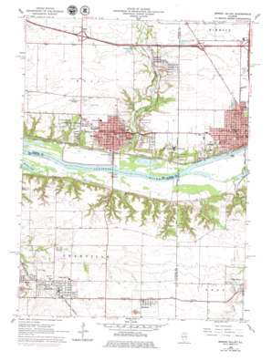
Spring Valley Topo Map Illinois
To zoom in, hover over the map of Spring Valley
USGS Topo Quad 41089c2 - 1:24,000 scale
| Topo Map Name: | Spring Valley |
| USGS Topo Quad ID: | 41089c2 |
| Print Size: | ca. 21 1/4" wide x 27" high |
| Southeast Coordinates: | 41.25° N latitude / 89.125° W longitude |
| Map Center Coordinates: | 41.3125° N latitude / 89.1875° W longitude |
| U.S. State: | IL |
| Filename: | o41089c2.jpg |
| Download Map JPG Image: | Spring Valley topo map 1:24,000 scale |
| Map Type: | Topographic |
| Topo Series: | 7.5´ |
| Map Scale: | 1:24,000 |
| Source of Map Images: | United States Geological Survey (USGS) |
| Alternate Map Versions: |
Spring Valley IL 1966, updated 1968 Download PDF Buy paper map Spring Valley IL 1966, updated 1979 Download PDF Buy paper map Spring Valley IL 2012 Download PDF Buy paper map Spring Valley IL 2015 Download PDF Buy paper map |
1:24,000 Topo Quads surrounding Spring Valley
> Back to 41089a1 at 1:100,000 scale
> Back to 41088a1 at 1:250,000 scale
> Back to U.S. Topo Maps home
Spring Valley topo map: Gazetteer
Spring Valley: Airports
Illinois Valley Regional Airport elevation 198m 649′Saint Margarets Hospital Heliport elevation 180m 590′
Valley Airfield elevation 194m 636′
Spring Valley: Crossings
Interchange 70 elevation 201m 659′Interchange 73 elevation 200m 656′
Spring Valley: Parks
Centennial Park elevation 186m 610′Fox Run State Conservation Area elevation 138m 452′
Kirby Park elevation 168m 551′
Sunset Park elevation 182m 597′
Spring Valley: Populated Places
Cedar Point elevation 201m 659′Dalzell elevation 193m 633′
Granville elevation 210m 688′
Hegeler elevation 193m 633′
Hicks Corners elevation 174m 570′
Peru elevation 183m 600′
Spring Valley elevation 182m 597′
Standard elevation 207m 679′
Webster Park elevation 185m 606′
Spring Valley: Post Offices
Peru Post Office elevation 177m 580′Spring Valley Post Office elevation 184m 603′
Spring Valley: Streams
Cedar Creek elevation 137m 449′Spring Creek elevation 137m 449′
Spring Valley digital topo map on disk
Buy this Spring Valley topo map showing relief, roads, GPS coordinates and other geographical features, as a high-resolution digital map file on DVD:
Northern Illinois, Northern Indiana & Southwestern Michigan
Buy digital topo maps: Northern Illinois, Northern Indiana & Southwestern Michigan


