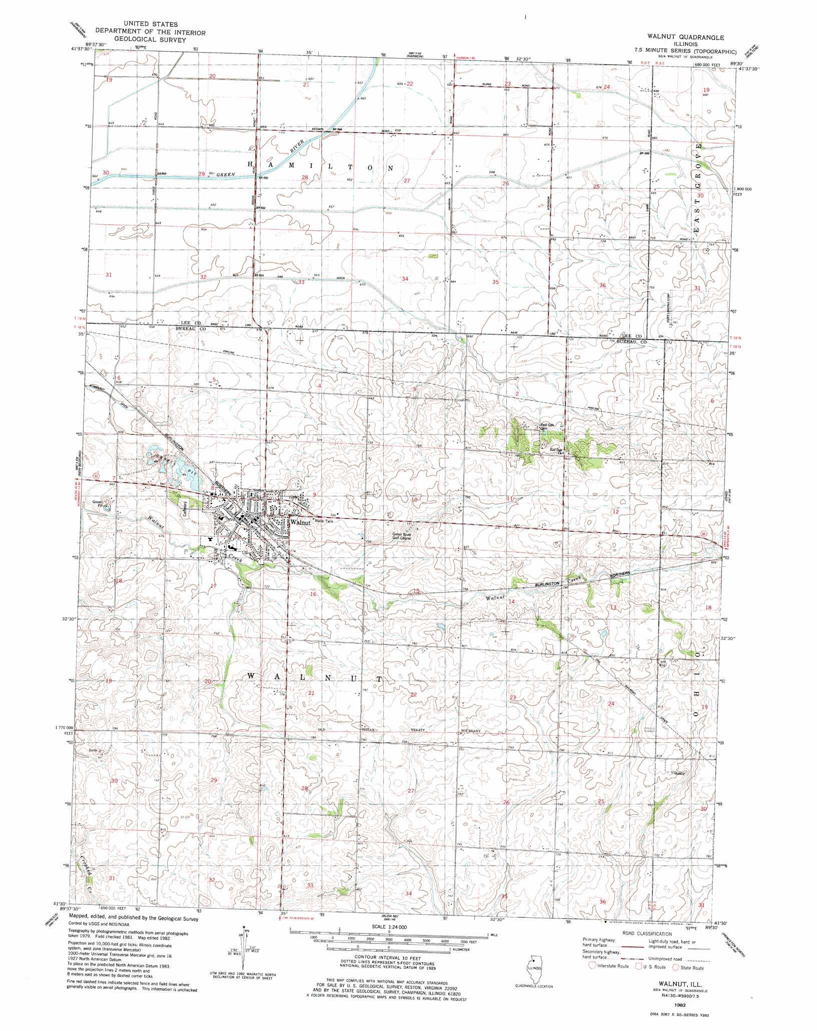
Walnut Topo Map Illinois
To zoom in, hover over the map of Walnut
USGS Topo Quad 41089e5 - 1:24,000 scale
| Topo Map Name: | Walnut |
| USGS Topo Quad ID: | 41089e5 |
| Print Size: | ca. 21 1/4" wide x 27" high |
| Southeast Coordinates: | 41.5° N latitude / 89.5° W longitude |
| Map Center Coordinates: | 41.5625° N latitude / 89.5625° W longitude |
| U.S. State: | IL |
| Filename: | o41089e5.jpg |
| Download Map JPG Image: | Walnut topo map 1:24,000 scale |
| Map Type: | Topographic |
| Topo Series: | 7.5´ |
| Map Scale: | 1:24,000 |
| Source of Map Images: | United States Geological Survey (USGS) |
| Alternate Map Versions: |
Walnut IL 1982, updated 1982 Download PDF Buy paper map Walnut IL 2012 Download PDF Buy paper map Walnut IL 2015 Download PDF Buy paper map |
1:24,000 Topo Quads surrounding Walnut
Como |
Sterling |
Dixon West |
Dixon East |
Franklin Grove |
Tampico |
Hahnaman |
Harmon |
Walton |
Amboy |
Yorktown |
New Bedford |
Walnut |
Ohio |
Lamoille |
Mineral |
Manlius |
Buoane |
Princeton North |
Malden |
Neponset |
Buda |
Wyanet |
Princeton South |
Depue |
> Back to 41089e1 at 1:100,000 scale
> Back to 41088a1 at 1:250,000 scale
> Back to U.S. Topo Maps home
Walnut topo map: Gazetteer
Walnut: Airports
Ioder Landing Strip elevation 232m 761′Walnut: Canals
Red Oak Ditch elevation 198m 649′Walnut: Populated Places
Walnut elevation 215m 705′Walnut digital topo map on disk
Buy this Walnut topo map showing relief, roads, GPS coordinates and other geographical features, as a high-resolution digital map file on DVD:
Northern Illinois, Northern Indiana & Southwestern Michigan
Buy digital topo maps: Northern Illinois, Northern Indiana & Southwestern Michigan