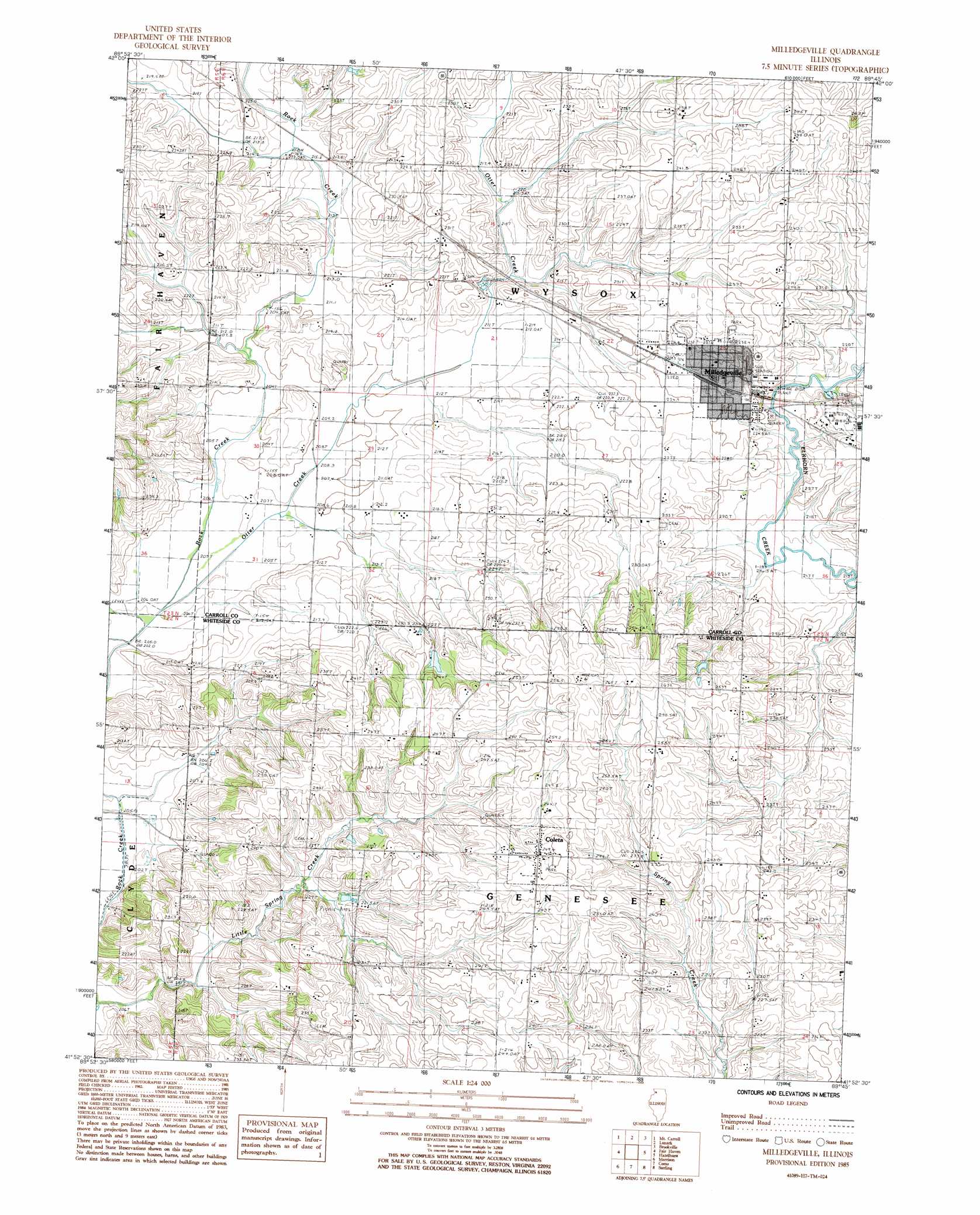
Milledgeville Topo Map Illinois
To zoom in, hover over the map of Milledgeville
USGS Topo Quad 41089h7 - 1:24,000 scale
| Topo Map Name: | Milledgeville |
| USGS Topo Quad ID: | 41089h7 |
| Print Size: | ca. 21 1/4" wide x 27" high |
| Southeast Coordinates: | 41.875° N latitude / 89.75° W longitude |
| Map Center Coordinates: | 41.9375° N latitude / 89.8125° W longitude |
| U.S. State: | IL |
| Filename: | o41089h7.jpg |
| Download Map JPG Image: | Milledgeville topo map 1:24,000 scale |
| Map Type: | Topographic |
| Topo Series: | 7.5´ |
| Map Scale: | 1:24,000 |
| Source of Map Images: | United States Geological Survey (USGS) |
| Alternate Map Versions: |
Milledgeville IL 1985, updated 1986 Download PDF Buy paper map Milledgeville IL 2012 Download PDF Buy paper map Milledgeville IL 2015 Download PDF Buy paper map |
1:24,000 Topo Quads surrounding Milledgeville
Pleasant Valley |
Loran |
Boone Branch |
Shannon |
Forreston North |
Wacker |
Mount Carroll |
Lanark |
Brookville |
Forreston South |
Thomson |
Fairhaven |
Milledgeville |
Hazelhurst |
Polo |
Union Grove |
Morrison |
Como |
Sterling |
Dixon West |
Erie |
Prophetstown |
Tampico |
Hahnaman |
Harmon |
> Back to 41089e1 at 1:100,000 scale
> Back to 41088a1 at 1:250,000 scale
> Back to U.S. Topo Maps home
Milledgeville topo map: Gazetteer
Milledgeville: Populated Places
Coleta elevation 249m 816′Milledgeville elevation 232m 761′
Milledgeville: Post Offices
Milledgeville Post Office elevation 231m 757′Milledgeville: Streams
Little Spring Creek elevation 198m 649′Otter Creek elevation 205m 672′
Milledgeville digital topo map on disk
Buy this Milledgeville topo map showing relief, roads, GPS coordinates and other geographical features, as a high-resolution digital map file on DVD:
Northern Illinois, Northern Indiana & Southwestern Michigan
Buy digital topo maps: Northern Illinois, Northern Indiana & Southwestern Michigan