Nekoma Topo Map Illinois
To zoom in, hover over the map of Nekoma
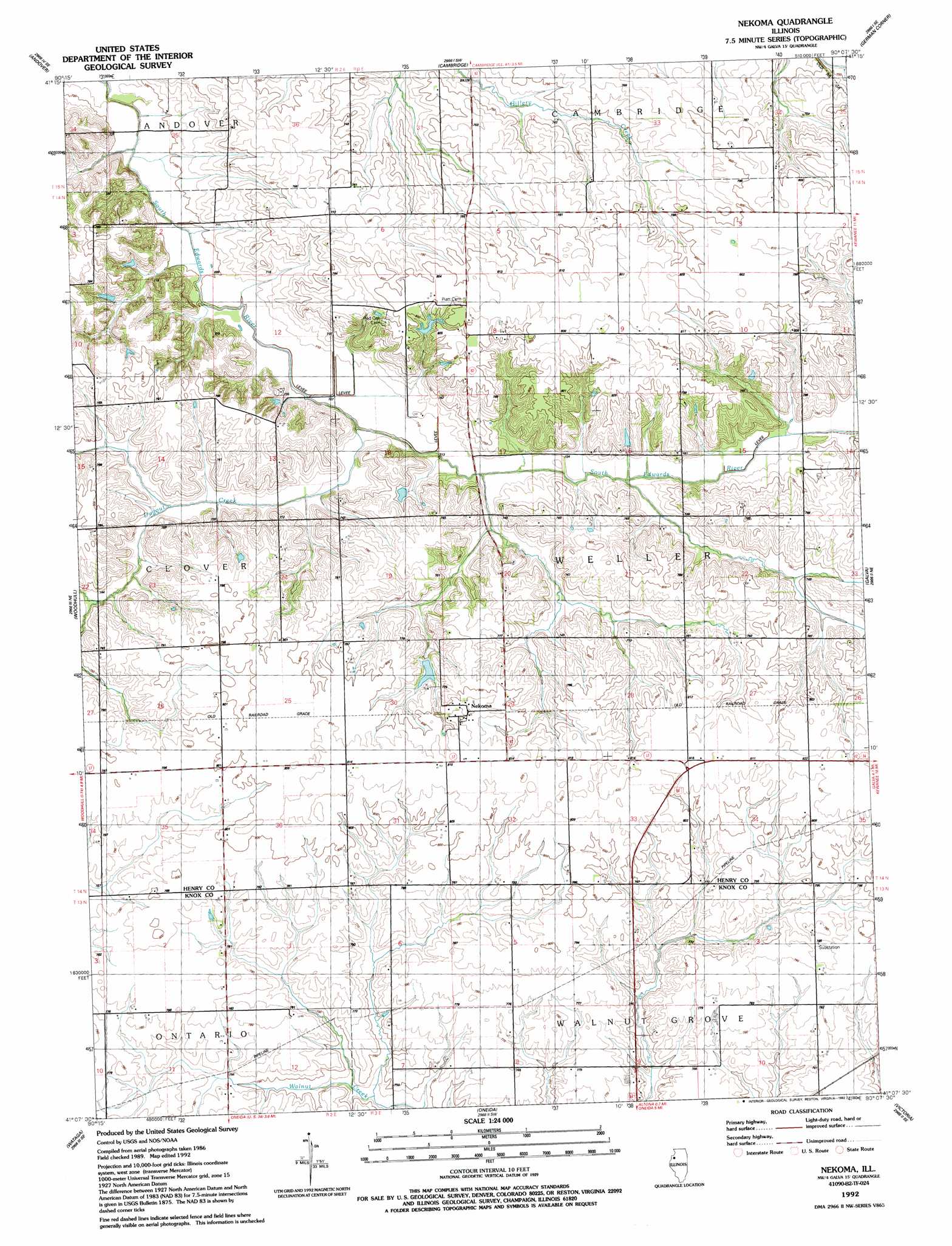
USGS Topo Quad 41090b2 - 1:24,000 scale
| Topo Map Name: | Nekoma |
| USGS Topo Quad ID: | 41090b2 |
| Print Size: | ca. 21 1/4" wide x 27" high |
| Southeast Coordinates: | 41.125° N latitude / 90.125° W longitude |
| Map Center Coordinates: | 41.1875° N latitude / 90.1875° W longitude |
| U.S. State: | IL |
| Filename: | o41090b2.jpg |
| Download Map JPG Image: | Nekoma topo map 1:24,000 scale |
| Map Type: | Topographic |
| Topo Series: | 7.5´ |
| Map Scale: | 1:24,000 |
| Source of Map Images: | United States Geological Survey (USGS) |
| Alternate Map Versions: |
Nekoma IL 1953, updated 1957 Download PDF Buy paper map Nekoma IL 1953, updated 1977 Download PDF Buy paper map Nekoma IL 1992, updated 1992 Download PDF Buy paper map Nekoma IL 2012 Download PDF Buy paper map Nekoma IL 2015 Download PDF Buy paper map |
1:24,000 Topo Quads surrounding Nekoma
Coal Valley |
Green Rock |
Geneseo |
Atkinson |
Annawan |
Orion |
Andover |
Cambridge |
German Corner |
Kewanee North |
New Windsor |
Woodhull |
Nekoma |
Galva |
Kewanee South |
North Henderson |
Wataga |
Oneida |
Victoria |
Lafayette |
Galesburg West |
Galesburg East |
Appleton |
Williamsfield |
Laura |
> Back to 41090a1 at 1:100,000 scale
> Back to 41090a1 at 1:250,000 scale
> Back to U.S. Topo Maps home
Nekoma topo map: Gazetteer
Nekoma: Dams
Nystrom Lake Dam elevation 245m 803′Thompson Pond Dam elevation 238m 780′
Nekoma: Populated Places
Nekoma elevation 247m 810′Nekoma: Reservoirs
Nystrom Lake elevation 245m 803′Thompson Pond elevation 238m 780′
Nekoma: Streams
Dugout Creek elevation 213m 698′Nekoma digital topo map on disk
Buy this Nekoma topo map showing relief, roads, GPS coordinates and other geographical features, as a high-resolution digital map file on DVD: