Cambridge Topo Map Illinois
To zoom in, hover over the map of Cambridge
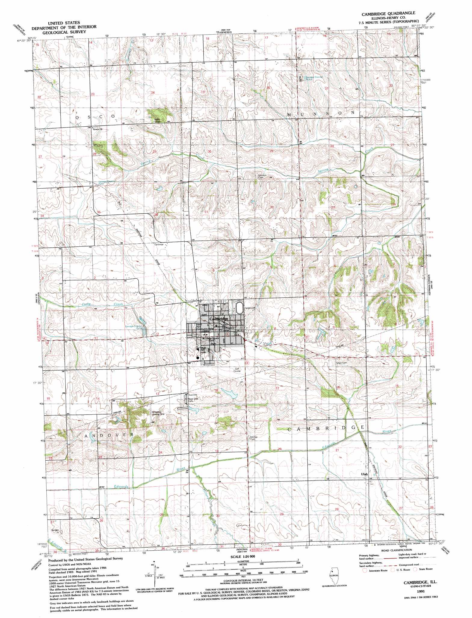
USGS Topo Quad 41090c2 - 1:24,000 scale
| Topo Map Name: | Cambridge |
| USGS Topo Quad ID: | 41090c2 |
| Print Size: | ca. 21 1/4" wide x 27" high |
| Southeast Coordinates: | 41.25° N latitude / 90.125° W longitude |
| Map Center Coordinates: | 41.3125° N latitude / 90.1875° W longitude |
| U.S. State: | IL |
| Filename: | o41090c2.jpg |
| Download Map JPG Image: | Cambridge topo map 1:24,000 scale |
| Map Type: | Topographic |
| Topo Series: | 7.5´ |
| Map Scale: | 1:24,000 |
| Source of Map Images: | United States Geological Survey (USGS) |
| Alternate Map Versions: |
Cambridge IL 1953, updated 1957 Download PDF Buy paper map Cambridge IL 1953, updated 1977 Download PDF Buy paper map Cambridge IL 1991, updated 1992 Download PDF Buy paper map Cambridge IL 2012 Download PDF Buy paper map Cambridge IL 2015 Download PDF Buy paper map |
1:24,000 Topo Quads surrounding Cambridge
Silvis |
Port Byron |
Hillsdale |
Spring Hill |
Hooppole |
Coal Valley |
Green Rock |
Geneseo |
Atkinson |
Annawan |
Orion |
Andover |
Cambridge |
German Corner |
Kewanee North |
New Windsor |
Woodhull |
Nekoma |
Galva |
Kewanee South |
North Henderson |
Wataga |
Oneida |
Victoria |
Lafayette |
> Back to 41090a1 at 1:100,000 scale
> Back to 41090a1 at 1:250,000 scale
> Back to U.S. Topo Maps home
Cambridge topo map: Gazetteer
Cambridge: Airports
Boyd Wheatleys Farm Airport elevation 245m 803′Wheatley Landing Strip elevation 244m 800′
Cambridge: Dams
Valley View Club Lake Dam elevation 227m 744′Cambridge: Parks
College Square Park elevation 247m 810′Hand Park elevation 244m 800′
Munson Township Cemetery Prairie Nature Preserve elevation 221m 725′
Cambridge: Populated Places
Cambridge elevation 247m 810′Ulah elevation 221m 725′
Cambridge: Post Offices
Cambridge Post Office elevation 247m 810′Cambridge: Reservoirs
Valley View Club Lake elevation 227m 744′Cambridge: Streams
Hillery Creek elevation 210m 688′Cambridge digital topo map on disk
Buy this Cambridge topo map showing relief, roads, GPS coordinates and other geographical features, as a high-resolution digital map file on DVD: