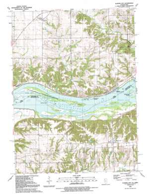
Illinois City Topo Map Illinois
To zoom in, hover over the map of Illinois City
USGS Topo Quad 41090d8 - 1:24,000 scale
| Topo Map Name: | Illinois City |
| USGS Topo Quad ID: | 41090d8 |
| Print Size: | ca. 21 1/4" wide x 27" high |
| Southeast Coordinates: | 41.375° N latitude / 90.875° W longitude |
| Map Center Coordinates: | 41.4375° N latitude / 90.9375° W longitude |
| U.S. States: | IL, IA |
| Filename: | o41090d8.jpg |
| Download Map JPG Image: | Illinois City topo map 1:24,000 scale |
| Map Type: | Topographic |
| Topo Series: | 7.5´ |
| Map Scale: | 1:24,000 |
| Source of Map Images: | United States Geological Survey (USGS) |
| Alternate Map Versions: |
Illinois City IL 1953, updated 1958 Download PDF Buy paper map Illinois City IL 1953, updated 1971 Download PDF Buy paper map Illinois City IL 1991, updated 1992 Download PDF Buy paper map Illinois City IL 1991, updated 1992 Download PDF Buy paper map Illinois City IL 2010 Download PDF Buy paper map Illinois City IL 2012 Download PDF Buy paper map Illinois City IL 2015 Download PDF Buy paper map |
1:24,000 Topo Quads surrounding Illinois City
> Back to 41090a1 at 1:100,000 scale
> Back to 41090a1 at 1:250,000 scale
> Back to U.S. Topo Maps home
Illinois City topo map: Gazetteer
Illinois City: Airports
Thudwhomp Airport elevation 202m 662′Illinois City: Dams
Donnelly Pond Dam elevation 223m 731′McLaughlin Pond Dam elevation 229m 751′
Illinois City: Islands
Geneva Island elevation 168m 551′Goose Island elevation 167m 547′
Hershey Island elevation 167m 547′
Island Number 328 elevation 168m 551′
Island Number 330 elevation 167m 547′
Illinois City: Parks
Fairport Recreation Area elevation 169m 554′Wildcat Den State Park elevation 191m 626′
Illinois City: Populated Places
Fairport elevation 173m 567′Illinois City elevation 233m 764′
New Era elevation 227m 744′
Sweetland Center elevation 229m 751′
Illinois City: Post Offices
Fairport Post Office (historical) elevation 173m 567′Geneva Post Office (historical) elevation 171m 561′
Sweetland Centre Post Office (historical) elevation 230m 754′
Sweetland Post Office (historical) elevation 229m 751′
Illinois City: Reservoirs
Donnelly Pond elevation 223m 731′McLaughlin Pond elevation 229m 751′
Illinois City: Streams
Andalusia Slough elevation 167m 547′Drury Slough elevation 167m 547′
Hershey Slough elevation 167m 547′
Sweetland Creek elevation 167m 547′
Wyoming Slough elevation 167m 547′
Illinois City digital topo map on disk
Buy this Illinois City topo map showing relief, roads, GPS coordinates and other geographical features, as a high-resolution digital map file on DVD:


