Erie Topo Map Illinois
To zoom in, hover over the map of Erie
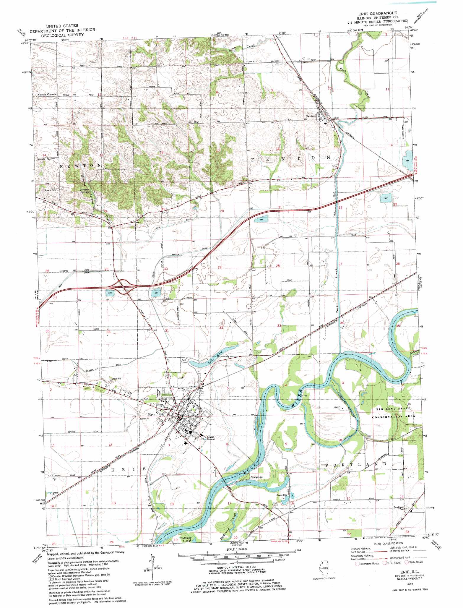
USGS Topo Quad 41090f1 - 1:24,000 scale
| Topo Map Name: | Erie |
| USGS Topo Quad ID: | 41090f1 |
| Print Size: | ca. 21 1/4" wide x 27" high |
| Southeast Coordinates: | 41.625° N latitude / 90° W longitude |
| Map Center Coordinates: | 41.6875° N latitude / 90.0625° W longitude |
| U.S. State: | IL |
| Filename: | o41090f1.jpg |
| Download Map JPG Image: | Erie topo map 1:24,000 scale |
| Map Type: | Topographic |
| Topo Series: | 7.5´ |
| Map Scale: | 1:24,000 |
| Source of Map Images: | United States Geological Survey (USGS) |
| Alternate Map Versions: |
Erie IL 1982, updated 1982 Download PDF Buy paper map Erie IL 2012 Download PDF Buy paper map Erie IL 2015 Download PDF Buy paper map |
1:24,000 Topo Quads surrounding Erie
Andover |
Clinton Nw |
Thomson |
Fairhaven |
Milledgeville |
Camanche |
Clinton |
Union Grove |
Morrison |
Como |
Cordova |
Erie Nw |
Erie |
Prophetstown |
Tampico |
Port Byron |
Hillsdale |
Spring Hill |
Hooppole |
Yorktown |
Green Rock |
Geneseo |
Atkinson |
Annawan |
Mineral |
> Back to 41090e1 at 1:100,000 scale
> Back to 41090a1 at 1:250,000 scale
> Back to U.S. Topo Maps home
Erie topo map: Gazetteer
Erie: Airports
Earls Air Park elevation 180m 590′Trent Aerial Spraying Inc Airport elevation 181m 593′
Erie: Crossings
Interchange 18 elevation 181m 593′Erie: Guts
Faden Slough elevation 176m 577′Erie: Lakes
Lake Erie elevation 176m 577′Erie: Parks
Big Bend State Conservation Area elevation 179m 587′Heritage Park elevation 183m 600′
Erie: Populated Places
Erie elevation 180m 590′Fenton elevation 189m 620′
Mineral Springs (historical) elevation 189m 620′
Newton Corners elevation 222m 728′
Erie: Post Offices
Kingsbury Post Office (historical) elevation 204m 669′Erie: Springs
Mineral Springs elevation 189m 620′Erie: Streams
Carson Slough elevation 174m 570′Hadaway Slough elevation 175m 574′
Lynn Creek elevation 179m 587′
Portland Creek elevation 178m 583′
Rock Creek elevation 176m 577′
Erie digital topo map on disk
Buy this Erie topo map showing relief, roads, GPS coordinates and other geographical features, as a high-resolution digital map file on DVD: