Oakville Topo Map Iowa
To zoom in, hover over the map of Oakville
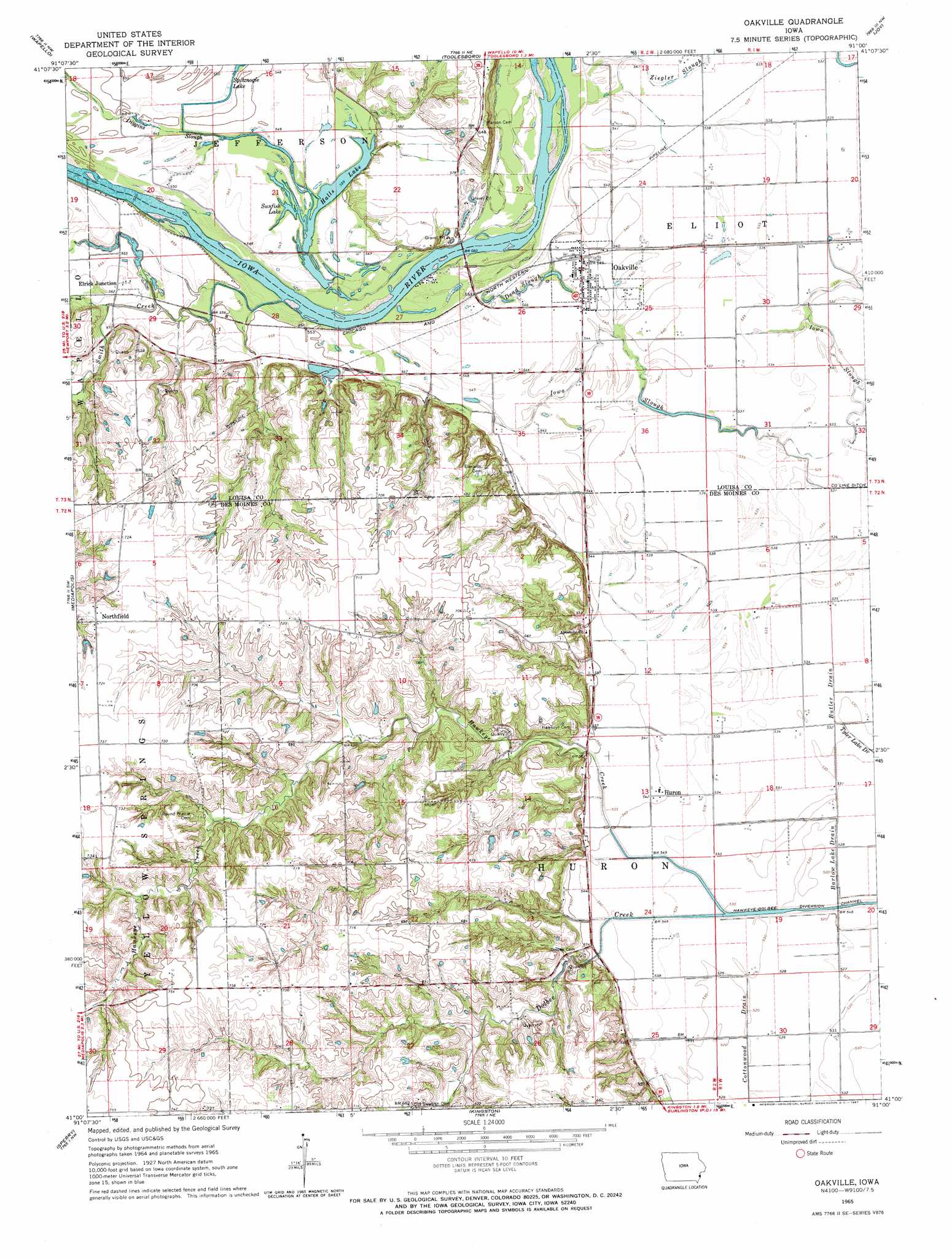
USGS Topo Quad 41091a1 - 1:24,000 scale
| Topo Map Name: | Oakville |
| USGS Topo Quad ID: | 41091a1 |
| Print Size: | ca. 21 1/4" wide x 27" high |
| Southeast Coordinates: | 41° N latitude / 91° W longitude |
| Map Center Coordinates: | 41.0625° N latitude / 91.0625° W longitude |
| U.S. State: | IA |
| Filename: | o41091a1.jpg |
| Download Map JPG Image: | Oakville topo map 1:24,000 scale |
| Map Type: | Topographic |
| Topo Series: | 7.5´ |
| Map Scale: | 1:24,000 |
| Source of Map Images: | United States Geological Survey (USGS) |
| Alternate Map Versions: |
Oakville IA 1965, updated 1967 Download PDF Buy paper map Oakville IA 2012 Download PDF Buy paper map Oakville IA 2013 Download PDF Buy paper map Oakville IA 2015 Download PDF Buy paper map |
1:24,000 Topo Quads surrounding Oakville
Columbus Junction |
Letts |
Blanchard Island |
Eliza |
Buffalo Prairie |
Cairo |
Wapello |
Toolesboro |
Joy |
Aledo West |
Morning Sun |
Mediapolis |
Oakville |
Keithsburg |
Seaton |
Pleasant Grove |
Sperry |
Kingston |
Oquawka |
Rozetta |
Danville |
West Burlington |
Burlington |
Gladstone |
Kirkwood West |
> Back to 41091a1 at 1:100,000 scale
> Back to 41090a1 at 1:250,000 scale
> Back to U.S. Topo Maps home
Oakville topo map: Gazetteer
Oakville: Airports
Sharar Field elevation 194m 636′Oakville: Bridges
Hawkeye Creek Bridge elevation 168m 551′Oakville: Canals
Hawkeye-Dolbee Diversion Channel elevation 163m 534′Oakville: Guts
Dead Slough elevation 164m 538′Oakville: Lakes
Halls Lake elevation 167m 547′Spitznogle Lake elevation 166m 544′
Sunfish Lake elevation 167m 547′
Oakville: Parks
Luckenbill Woods elevation 213m 698′Oakville: Populated Places
Elrick Junction elevation 172m 564′Huron elevation 165m 541′
Northfield elevation 220m 721′
Oakville elevation 165m 541′
Oakville: Post Offices
Elrick Post Office (historical) elevation 170m 557′Florence Post Office (historical) elevation 170m 557′
Huron Post Office (historical) elevation 164m 538′
Limestone Post Office (historical) elevation 169m 554′
Northfield Post Office (historical) elevation 220m 721′
Oakville Post Office elevation 165m 541′
Palo Alto Post Office (historical) elevation 164m 538′
Oakville: Streams
Butler Drain elevation 162m 531′Diggins Slough elevation 167m 547′
Dolbee Creek elevation 164m 538′
Hawkeye Creek elevation 164m 538′
Smith Creek elevation 167m 547′
Oakville digital topo map on disk
Buy this Oakville topo map showing relief, roads, GPS coordinates and other geographical features, as a high-resolution digital map file on DVD: