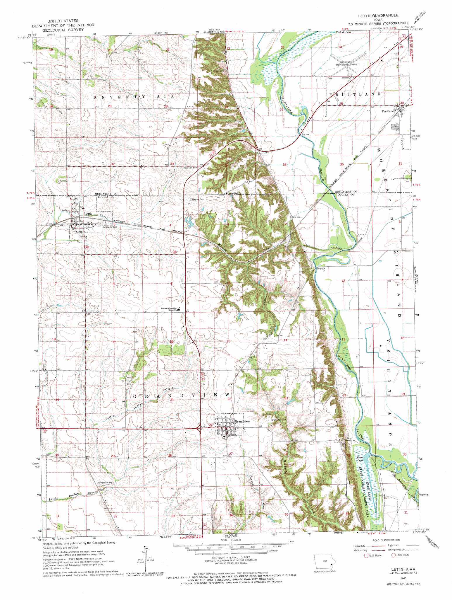
Letts Topo Map Iowa
To zoom in, hover over the map of Letts
USGS Topo Quad 41091c2 - 1:24,000 scale
| Topo Map Name: | Letts |
| USGS Topo Quad ID: | 41091c2 |
| Print Size: | ca. 21 1/4" wide x 27" high |
| Southeast Coordinates: | 41.25° N latitude / 91.125° W longitude |
| Map Center Coordinates: | 41.3125° N latitude / 91.1875° W longitude |
| U.S. State: | IA |
| Filename: | o41091c2.jpg |
| Download Map JPG Image: | Letts topo map 1:24,000 scale |
| Map Type: | Topographic |
| Topo Series: | 7.5´ |
| Map Scale: | 1:24,000 |
| Source of Map Images: | United States Geological Survey (USGS) |
| Alternate Map Versions: |
Letts IA 1965, updated 1966 Download PDF Buy paper map Letts IA 2010 Download PDF Buy paper map Letts IA 2013 Download PDF Buy paper map Letts IA 2015 Download PDF Buy paper map |
1:24,000 Topo Quads surrounding Letts
West Liberty Sw |
West Liberty |
Atalissa |
Wilton Junction |
Durant |
Lone Tree |
Nichols |
Muscatine Nw |
Muscatine |
Illinois City |
Cotter |
Columbus Junction |
Letts |
Blanchard Island |
Eliza |
Winfield North |
Cairo |
Wapello |
Toolesboro |
Joy |
Winfield South |
Morning Sun |
Mediapolis |
Oakville |
Keithsburg |
> Back to 41091a1 at 1:100,000 scale
> Back to 41090a1 at 1:250,000 scale
> Back to U.S. Topo Maps home
Letts topo map: Gazetteer
Letts: Airports
Muscatine Municipal Airport elevation 167m 547′Letts: Parks
Klum Lake State Game Mgt Area elevation 163m 534′Langwood 4-H Reserve elevation 210m 688′
Letts: Populated Places
Fruitland elevation 167m 547′Grandview elevation 217m 711′
Letts elevation 207m 679′
Letts: Post Offices
Fruitland Post Office elevation 167m 547′Grandview Post Office elevation 217m 711′
Letts Post Office elevation 207m 679′
Letts: Reservoirs
Klum Lake elevation 163m 534′Letts: Streams
Whisky Run elevation 163m 534′Letts digital topo map on disk
Buy this Letts topo map showing relief, roads, GPS coordinates and other geographical features, as a high-resolution digital map file on DVD: